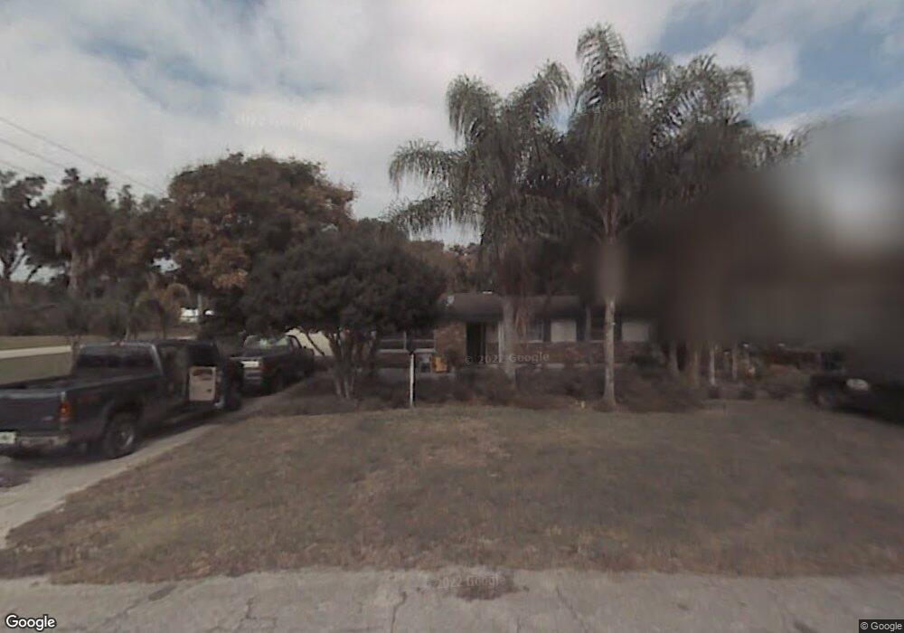
701 E Abel Ave Deland, FL 32724
North DeLand NeighborhoodEstimated Value: $218,000 - $238,000
2
Beds
2
Baths
1,284
Sq Ft
$174/Sq Ft
Est. Value
About This Home
This home is located at 701 E Abel Ave, Deland, FL 32724 and is currently estimated at $223,464, approximately $174 per square foot. 701 E Abel Ave is a home located in Volusia County with nearby schools including Deland High School, George W. Marks Elementary School, and Deland Middle School.
Ownership History
Date
Name
Owned For
Owner Type
Purchase Details
Closed on
Nov 25, 1997
Sold by
Nunn Catherine and Michael W
Bought by
Perez Rigoberto and Perez Anselma
Current Estimated Value
Home Financials for this Owner
Home Financials are based on the most recent Mortgage that was taken out on this home.
Original Mortgage
$58,026
Outstanding Balance
$8,552
Interest Rate
7.35%
Mortgage Type
FHA
Estimated Equity
$214,912
Purchase Details
Closed on
Sep 15, 1985
Bought by
Perez Rigoberto and Perez Anselma
Create a Home Valuation Report for This Property
The Home Valuation Report is an in-depth analysis detailing your home's value as well as a comparison with similar homes in the area
Home Values in the Area
Average Home Value in this Area
Purchase History
| Date | Buyer | Sale Price | Title Company |
|---|---|---|---|
| Perez Rigoberto | $57,500 | -- | |
| Perez Rigoberto | $39,300 | -- |
Source: Public Records
Mortgage History
| Date | Status | Borrower | Loan Amount |
|---|---|---|---|
| Open | Perez Rigoberto | $58,026 |
Source: Public Records
Tax History
| Year | Tax Paid | Tax Assessment Tax Assessment Total Assessment is a certain percentage of the fair market value that is determined by local assessors to be the total taxable value of land and additions on the property. | Land | Improvement |
|---|---|---|---|---|
| 2026 | $2,119 | $146,172 | -- | -- |
| 2025 | $2,119 | $142,330 | -- | -- |
| 2024 | $1,993 | $138,319 | -- | -- |
| 2023 | $1,993 | $134,291 | $0 | $0 |
| 2022 | $1,936 | $130,380 | $0 | $0 |
| 2021 | $1,988 | $126,583 | $0 | $0 |
| 2020 | $1,954 | $124,835 | $20,000 | $104,835 |
| 2019 | $2,291 | $114,323 | $16,000 | $98,323 |
| 2018 | $2,086 | $94,433 | $10,400 | $84,033 |
| 2017 | $1,933 | $81,755 | $10,400 | $71,355 |
| 2016 | $1,722 | $71,765 | $0 | $0 |
| 2015 | $1,641 | $66,758 | $0 | $0 |
| 2014 | $1,499 | $58,550 | $0 | $0 |
Source: Public Records
Map
Nearby Homes
- 14 Sunshine Blvd
- 577 Parkdale Ct
- 1150 Orangewood Ave
- 975 N Boston Ave
- 708 Montreville Ave
- 735 Montreville Ave
- 1004 Hartford Dr
- 905 Northern Oaks Terrace
- 927 Azalea Walk Cir
- 1435 Hensley Dr
- 1403 Island Cove Dr
- 715 Eastover Cir
- 1412 N Garfield Ave
- 516 Grace Ave
- 1 Smith Ct
- 915 Marlboro Dr
- 426 E Plymouth Ave
- 436 E Bennett Ave
- 576 E International Speedway Blvd
- 913 Lake Lindley Dr N
- 1207 N Boston Ave
- 0 Abele St Unit G4651710
- 0 Abele St Unit G4651705
- 6 Sunshine Blvd
- 8 Sunshine Blvd
- 1209 N Boston Ave
- 700 E Abel Ave
- 1208 N Boston Ave
- 579 Compton Ct
- 10 Sunshine Blvd
- 4 Sunshine Blvd
- 578 Parkdale Ct
- 1211 N Boston Ave
- 12 Sunshine Blvd
- 1204 N Boston Ave
- 1201 N Boston Ave
- 576 Parkdale Ct
- 725 Lindley Blvd
- 1213 N Boston Ave
- 5 Sunshine Blvd
Your Personal Tour Guide
Ask me questions while you tour the home.