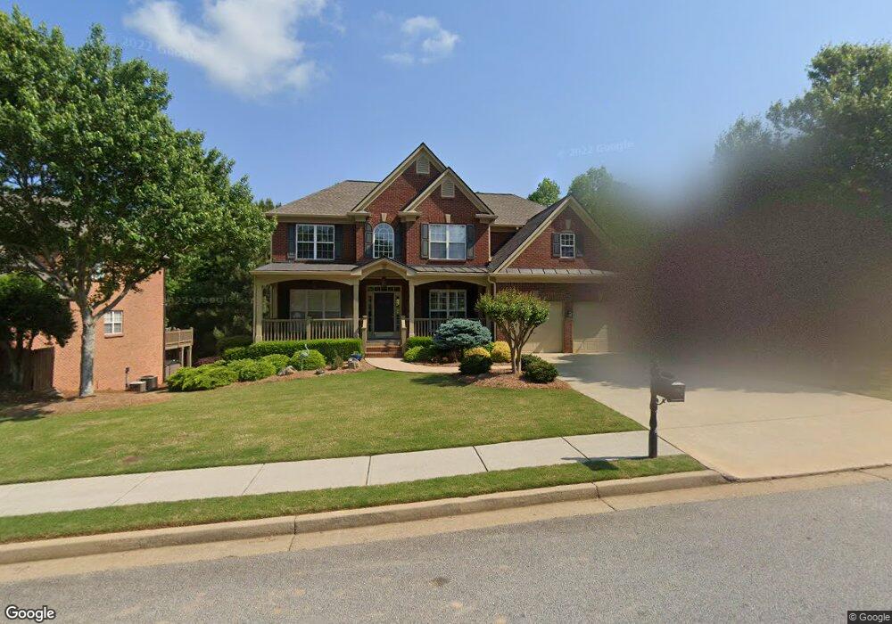
701 Hexham Ct Suwanee, GA 30024
Estimated Value: $667,768 - $752,000
5
Beds
3
Baths
2,901
Sq Ft
$242/Sq Ft
Est. Value
About This Home
This home is located at 701 Hexham Ct, Suwanee, GA 30024 and is currently estimated at $703,192, approximately $242 per square foot. 701 Hexham Ct is a home located in Gwinnett County with nearby schools including Riverside Elementary School, North Gwinnett Middle School, and North Gwinnett High School.
Ownership History
Date
Name
Owned For
Owner Type
Purchase Details
Closed on
Oct 9, 2020
Sold by
Dean Daryl W
Bought by
Hudson Andrew and Hudson Tracy
Current Estimated Value
Home Financials for this Owner
Home Financials are based on the most recent Mortgage that was taken out on this home.
Original Mortgage
$241,900
Outstanding Balance
$165,343
Interest Rate
2.8%
Mortgage Type
New Conventional
Estimated Equity
$537,849
Purchase Details
Closed on
Mar 16, 2004
Sold by
Dean Daryl W
Bought by
Dean Daryl W
Purchase Details
Closed on
Jan 30, 2003
Sold by
Dean Daryl W
Bought by
Dean Daryl W
Home Financials for this Owner
Home Financials are based on the most recent Mortgage that was taken out on this home.
Original Mortgage
$240,000
Interest Rate
5.89%
Mortgage Type
New Conventional
Create a Home Valuation Report for This Property
The Home Valuation Report is an in-depth analysis detailing your home's value as well as a comparison with similar homes in the area
Home Values in the Area
Average Home Value in this Area
Purchase History
| Date | Buyer | Sale Price | Title Company |
|---|---|---|---|
| Hudson Andrew | $483,800 | -- | |
| Dean Daryl W | -- | -- | |
| Dean Daryl W | -- | -- | |
| Dean Daryl W | $300,000 | -- |
Source: Public Records
Mortgage History
| Date | Status | Borrower | Loan Amount |
|---|---|---|---|
| Open | Hudson Andrew | $241,900 | |
| Previous Owner | Dean Daryl W | $240,000 | |
| Previous Owner | Dean Daryl W | $30,000 |
Source: Public Records
Tax History
| Year | Tax Paid | Tax Assessment Tax Assessment Total Assessment is a certain percentage of the fair market value that is determined by local assessors to be the total taxable value of land and additions on the property. | Land | Improvement |
|---|---|---|---|---|
| 2025 | -- | $298,000 | $54,400 | $243,600 |
| 2024 | $8,866 | $316,480 | $54,400 | $262,080 |
| 2023 | $8,866 | $273,120 | $54,400 | $218,720 |
| 2022 | $6,342 | $258,120 | $54,400 | $203,720 |
| 2021 | $6,447 | $176,720 | $33,840 | $142,880 |
| 2020 | $5,613 | $176,720 | $33,840 | $142,880 |
| 2019 | $5,030 | $156,720 | $34,800 | $121,920 |
| 2018 | $5,042 | $156,720 | $34,800 | $121,920 |
| 2016 | $4,634 | $137,440 | $34,800 | $102,640 |
| 2015 | $4,689 | $137,600 | $26,800 | $110,800 |
| 2014 | -- | $137,600 | $26,800 | $110,800 |
Source: Public Records
Map
Nearby Homes
- 731 Hexham Ct
- 5507 Aviemore Ct
- 5566 Aviemore Ct
- 5395 Harbury Ln
- 5224 Brendlynn Dr
- 5683 Brendlynn Dr
- 972 Harvest Park Ln
- 3681 Trevi Ln
- 535 Running Fawn Dr
- 600 Grimsby Ct
- 510 Running Fawn Dr
- 895 Riverhaven Dr
- 2435 Southers Cir
- 570 White Stag Ct
- 4847 Basingstoke Dr
- 0 Johnson Rd Unit 7677593
- 0 Johnson Rd Unit 10638841
- 0 Johnson Rd Unit CL344832
- 5649 Kennedy Rd
- 487 Skiles Ct
- 691 Hexham Ct
- 711 Hexham Ct
- 681 Hexham Ct
- 721 Hexham Ct
- 708 Hexham Ct
- 718 Hexham Ct
- 698 Hexham Ct
- 671 Hexham Ct
- 688 Hexham Ct
- 6010 Hexham Ct
- 728 Hexham Ct
- 738 Hexham Ct
- 668 Hexham Ct
- 661 Hexham Ct
- 695 Birnamwood Dr
- 690 Birnamwood Dr
- 651 Hexham Ct
- 651 Hexham Ct Unit 471
- 658 Hexham Ct
- 665 Birnamwood Dr
Your Personal Tour Guide
Ask me questions while you tour the home.