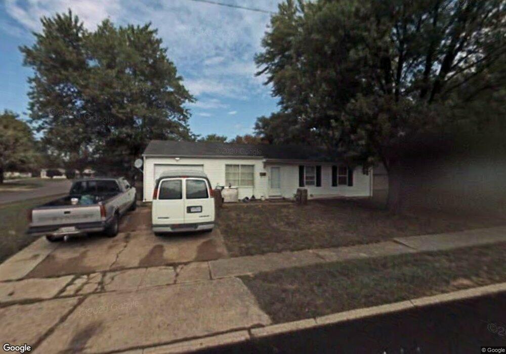
701 Maple Ln Mooresville, IN 46158
Estimated Value: $184,527 - $211,000
3
Beds
1
Bath
925
Sq Ft
$212/Sq Ft
Est. Value
About This Home
This home is located at 701 Maple Ln, Mooresville, IN 46158 and is currently estimated at $195,882, approximately $211 per square foot. 701 Maple Ln is a home located in Morgan County with nearby schools including Mooresville High School and Mooresville Christian Academy.
Ownership History
Date
Name
Owned For
Owner Type
Purchase Details
Closed on
Mar 29, 2022
Sold by
Alumbaugh Juanita E
Bought by
Pomaikai Vespoli Domonic Keoki
Current Estimated Value
Purchase Details
Closed on
Feb 27, 2008
Sold by
Rose Jeffrey A
Bought by
Alumbaugh Juanita E
Home Financials for this Owner
Home Financials are based on the most recent Mortgage that was taken out on this home.
Original Mortgage
$48,000
Interest Rate
5.75%
Mortgage Type
New Conventional
Create a Home Valuation Report for This Property
The Home Valuation Report is an in-depth analysis detailing your home's value as well as a comparison with similar homes in the area
Home Values in the Area
Average Home Value in this Area
Purchase History
| Date | Buyer | Sale Price | Title Company |
|---|---|---|---|
| Pomaikai Vespoli Domonic Keoki | $165,000 | Chicago Title Co | |
| Alumbaugh Juanita E | -- | -- |
Source: Public Records
Mortgage History
| Date | Status | Borrower | Loan Amount |
|---|---|---|---|
| Previous Owner | Alumbaugh Juanita E | $48,000 |
Source: Public Records
Tax History
| Year | Tax Paid | Tax Assessment Tax Assessment Total Assessment is a certain percentage of the fair market value that is determined by local assessors to be the total taxable value of land and additions on the property. | Land | Improvement |
|---|---|---|---|---|
| 2025 | $1,746 | $129,700 | $35,200 | $94,500 |
| 2024 | $1,746 | $125,000 | $35,200 | $89,800 |
| 2023 | $1,699 | $125,000 | $35,200 | $89,800 |
| 2022 | $1,504 | $110,600 | $35,200 | $75,400 |
| 2021 | $818 | $61,600 | $18,900 | $42,700 |
| 2020 | $800 | $59,600 | $16,900 | $42,700 |
| 2019 | $1,422 | $106,900 | $16,900 | $90,000 |
| 2018 | $1,361 | $102,900 | $16,900 | $86,000 |
| 2017 | $1,338 | $101,700 | $16,900 | $84,800 |
| 2016 | $1,313 | $97,700 | $16,900 | $80,800 |
| 2014 | $1,141 | $91,000 | $16,900 | $74,100 |
| 2013 | $1,141 | $91,000 | $16,900 | $74,100 |
Source: Public Records
Map
Nearby Homes
- 91 North Dr
- 671 Maple Ln
- 31 Maryvale Ct
- 205 Locust Ln
- 90 Crestwood Dr
- 649 Nelson Dr
- 617 Nelson Dr
- 698 Indianapolis Rd
- 31 Fairlane Dr
- 306 Bishop St
- 0 E Hadley Rd Unit MBR21956464
- 1056 Delwood Dr
- 520 Denny Dr
- 154 E Washington St
- 109 E Washington St
- 0 E Hendricks County Line Road Lot 2 Unit MBR22075477
- 124 S Indiana St
- 10 Commerce Dr
- 54 W High St
- 320 Lockerbie St
Your Personal Tour Guide
Ask me questions while you tour the home.