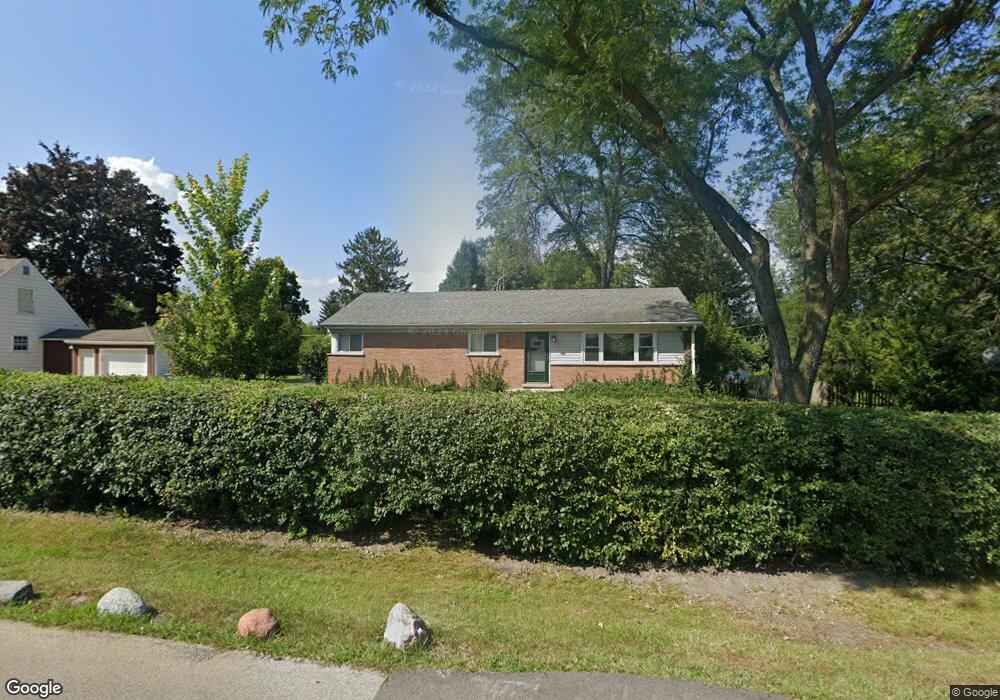
701 Smith Ave Lake Bluff, IL 60044
Estimated Value: $352,265 - $398,000
Studio
--
Bath
1,225
Sq Ft
$312/Sq Ft
Est. Value
About This Home
This home is located at 701 Smith Ave, Lake Bluff, IL 60044 and is currently estimated at $382,316, approximately $312 per square foot. 701 Smith Ave is a home with nearby schools including Lake Bluff Elementary School, Lake Bluff Middle School, and Lake Forest High School.
Ownership History
Date
Name
Owned For
Owner Type
Purchase Details
Closed on
Nov 26, 2024
Sold by
Stein William J and Hickey-Stein Helen
Bought by
Stein Declaration Of Trust and Stein
Current Estimated Value
Purchase Details
Closed on
Aug 20, 2021
Sold by
Stein William J
Bought by
Stein William J and Hickey Stein Helen
Home Financials for this Owner
Home Financials are based on the most recent Mortgage that was taken out on this home.
Original Mortgage
$180,000
Interest Rate
2.98%
Mortgage Type
New Conventional
Create a Home Valuation Report for This Property
The Home Valuation Report is an in-depth analysis detailing your home's value as well as a comparison with similar homes in the area
Home Values in the Area
Average Home Value in this Area
Purchase History
| Date | Buyer | Sale Price | Title Company |
|---|---|---|---|
| Stein Declaration Of Trust | -- | None Listed On Document | |
| Stein Declaration Of Trust | -- | None Listed On Document | |
| Stein William J | -- | Accommodation |
Source: Public Records
Mortgage History
| Date | Status | Borrower | Loan Amount |
|---|---|---|---|
| Previous Owner | Stein William J | $180,000 |
Source: Public Records
Tax History
| Year | Tax Paid | Tax Assessment Tax Assessment Total Assessment is a certain percentage of the fair market value that is determined by local assessors to be the total taxable value of land and additions on the property. | Land | Improvement |
|---|---|---|---|---|
| 2024 | $6,210 | $112,708 | $36,013 | $76,695 |
| 2023 | $5,253 | $103,898 | $33,198 | $70,700 |
| 2022 | $5,253 | $87,246 | $27,877 | $59,369 |
| 2021 | $5,139 | $86,494 | $27,637 | $58,857 |
| 2020 | $5,040 | $86,973 | $27,790 | $59,183 |
| 2019 | $4,859 | $85,377 | $27,280 | $58,097 |
| 2018 | $5,039 | $90,158 | $30,358 | $59,800 |
| 2017 | $5,031 | $88,651 | $29,851 | $58,800 |
| 2016 | $4,785 | $84,381 | $28,413 | $55,968 |
| 2015 | $4,688 | $79,455 | $26,754 | $52,701 |
| 2014 | $4,892 | $82,743 | $36,029 | $46,714 |
| 2012 | $4,663 | $83,461 | $36,342 | $47,119 |
Source: Public Records
Map
Nearby Homes
- 717 Burris Ave
- 11 Shagbark Rd
- 907 W North Ave
- 511 Rockland Rd
- 905 Rockland Rd
- 1107 Quassey Ave
- 2020 Knollwood Rd
- 12790 W Sanctuary Ln
- 1061 Green Bay Rd
- 301 Belle Foret Dr
- 108 Hampton Blvd Unit 11E
- 307 Forest View Dr
- 510 Sunset Terrace
- 440 W Sheridan Place
- 12 Warrington Dr
- 1200 Regency Ln
- 233 Kohl Ave
- 12900 W Heiden Cir Unit 4204
- 505 Pine Ct
- 13000 W Heiden Cir Unit 3105
- 707 Smith Ave
- 706 Smith Ave
- 12537 Quassey Ave
- 629 Smith Ave
- 702 Quassey Ave
- 706 Quassey Ave
- 702 Smith Ave
- 709 Smith Ave
- 627 Smith Ave Unit 627
- 627 Smith Ave
- 630 Smith Ave
- 714 Smith Ave
- 678 Quassey Ave
- 712 Quassey Ave
- 711 Smith Ave
- 701 W Blodgett Ave
- 625 Smith Ave
- 628 Smith Ave
- 628 Smith Ave Unit 1
- 628 Smith Ave Unit 628
Your Personal Tour Guide
Ask me questions while you tour the home.