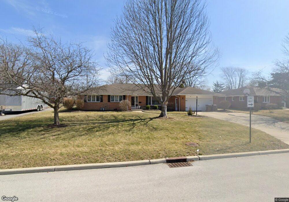
701 W Circle Dr Findlay, OH 45840
Estimated Value: $321,000 - $366,000
4
Beds
3
Baths
2,938
Sq Ft
$115/Sq Ft
Est. Value
About This Home
This home is located at 701 W Circle Dr, Findlay, OH 45840 and is currently estimated at $339,236, approximately $115 per square foot. 701 W Circle Dr is a home located in Hancock County with nearby schools including Wilson Vance Elementary School, Whittier Elementary School, and Donnell Middle School.
Ownership History
Date
Name
Owned For
Owner Type
Purchase Details
Closed on
Sep 8, 2021
Sold by
Buck David Alan and Buck Angel T
Bought by
Trausch Raychael Maree and Trausch Christopher David
Current Estimated Value
Home Financials for this Owner
Home Financials are based on the most recent Mortgage that was taken out on this home.
Original Mortgage
$265,109
Outstanding Balance
$240,703
Interest Rate
2.8%
Mortgage Type
FHA
Estimated Equity
$98,533
Purchase Details
Closed on
Jun 15, 2007
Sold by
Hayes Christopher A and Victoria Hayes M
Bought by
Buck Ii David A and Buck Angel T
Home Financials for this Owner
Home Financials are based on the most recent Mortgage that was taken out on this home.
Original Mortgage
$147,500
Interest Rate
6.2%
Mortgage Type
Purchase Money Mortgage
Purchase Details
Closed on
Oct 31, 1988
Bought by
Hayes Christopher A and Hayes Victoria M
Purchase Details
Closed on
Apr 4, 1986
Bought by
Gayes Steven S and Gayes Patricia
Create a Home Valuation Report for This Property
The Home Valuation Report is an in-depth analysis detailing your home's value as well as a comparison with similar homes in the area
Home Values in the Area
Average Home Value in this Area
Purchase History
| Date | Buyer | Sale Price | Title Company |
|---|---|---|---|
| Trausch Raychael Maree | $270,000 | Beck Title Agency Ltd | |
| Buck Ii David A | $197,500 | Goldey Key Title Agency | |
| Hayes Christopher A | $96,000 | -- | |
| Gayes Steven S | $82,000 | -- |
Source: Public Records
Mortgage History
| Date | Status | Borrower | Loan Amount |
|---|---|---|---|
| Open | Trausch Raychael Maree | $265,109 | |
| Previous Owner | Buck Ii David A | $147,500 |
Source: Public Records
Tax History
| Year | Tax Paid | Tax Assessment Tax Assessment Total Assessment is a certain percentage of the fair market value that is determined by local assessors to be the total taxable value of land and additions on the property. | Land | Improvement |
|---|---|---|---|---|
| 2024 | $3,455 | $97,260 | $11,070 | $86,190 |
| 2023 | $3,460 | $97,260 | $11,070 | $86,190 |
| 2022 | $3,448 | $97,260 | $11,070 | $86,190 |
| 2021 | $3,415 | $83,910 | $11,070 | $72,840 |
| 2020 | $3,415 | $83,910 | $11,070 | $72,840 |
| 2019 | $3,346 | $83,910 | $11,070 | $72,840 |
| 2018 | $2,970 | $68,340 | $10,070 | $58,270 |
| 2017 | $2,971 | $68,340 | $10,070 | $58,270 |
| 2016 | $2,923 | $68,340 | $10,070 | $58,270 |
| 2015 | $3,516 | $80,410 | $11,030 | $69,380 |
| 2014 | $3,516 | $80,410 | $11,030 | $69,380 |
| 2012 | $3,539 | $80,410 | $11,030 | $69,380 |
Source: Public Records
Map
Nearby Homes
- 1308 Greendale Ave
- 630 Winterhaven Dr
- 631 Winterhaven Dr
- 1125 Glen Meadow Dr
- 1209 Heather Dr
- 1450 Fostoria Ave
- 1020 Country Club Dr
- 1108 Glen Meadow Dr
- 1724 Queenswood Dr Unit 10 (2-C)
- 1331 Countryside Dr
- 1828 Queenswood Dr
- 1825 Greendale Ave
- 1642 Cherry Ln
- 439 Carnahan Ave
- 100 Warrington Ave
- 1312 Bernard Ave
- 1142 Concord Ct
- 716 Winfield Ave
- 626 Central Ave
- 300 W Sawmill Rd
- 707 W Circle Dr
- 625 W Circle Dr
- 700 E Circle Dr
- 624 E Circle Dr
- 710 E Circle Dr
- 700 W Circle Dr
- 630 W Circle Dr
- 715 W Circle Dr
- 710 W Circle Dr
- 620 W Circle Dr
- 720 E Circle Dr
- 631 E Circle Dr
- 600 W Circle Dr
- 610 W Circle Dr
- 701 E Circle Dr
- 601 E Circle Dr
- 716 W Circle Dr
- 705 Woodworth Dr
- 625 Woodworth Dr
- 621 E Circle Dr
Your Personal Tour Guide
Ask me questions while you tour the home.