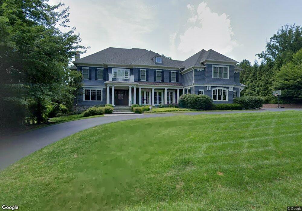
7013 Benjamin St McLean, VA 22101
Estimated Value: $5,029,335 - $5,143,000
5
Beds
8
Baths
8,249
Sq Ft
$619/Sq Ft
Est. Value
About This Home
This home is located at 7013 Benjamin St, McLean, VA 22101 and is currently estimated at $5,102,445, approximately $618 per square foot. 7013 Benjamin St is a home located in Fairfax County with nearby schools including Churchill Road Elementary School, Cooper Middle School, and Langley High School.
Ownership History
Date
Name
Owned For
Owner Type
Purchase Details
Closed on
Jan 8, 2009
Sold by
Katz David
Bought by
Overdeck Daniel
Current Estimated Value
Purchase Details
Closed on
Nov 14, 1995
Sold by
Katz Ruth A
Bought by
Katz David W
Home Financials for this Owner
Home Financials are based on the most recent Mortgage that was taken out on this home.
Original Mortgage
$164,025
Interest Rate
7.62%
Mortgage Type
Purchase Money Mortgage
Create a Home Valuation Report for This Property
The Home Valuation Report is an in-depth analysis detailing your home's value as well as a comparison with similar homes in the area
Home Values in the Area
Average Home Value in this Area
Purchase History
| Date | Buyer | Sale Price | Title Company |
|---|---|---|---|
| Overdeck Daniel | $1,225,000 | -- | |
| Katz Daniel Winfred | -- | -- | |
| Katz David W | $182,250 | -- |
Source: Public Records
Mortgage History
| Date | Status | Borrower | Loan Amount |
|---|---|---|---|
| Previous Owner | Katz David W | $164,025 |
Source: Public Records
Tax History
| Year | Tax Paid | Tax Assessment Tax Assessment Total Assessment is a certain percentage of the fair market value that is determined by local assessors to be the total taxable value of land and additions on the property. | Land | Improvement |
|---|---|---|---|---|
| 2025 | $49,701 | $4,306,950 | $1,155,000 | $3,151,950 |
| 2024 | $49,701 | $4,159,610 | $1,139,000 | $3,020,610 |
| 2023 | $45,190 | $3,881,860 | $1,085,000 | $2,796,860 |
| 2022 | $41,356 | $3,504,610 | $1,085,000 | $2,419,610 |
| 2021 | $41,265 | $3,415,410 | $1,085,000 | $2,330,410 |
| 2020 | $44,198 | $3,632,690 | $1,085,000 | $2,547,690 |
| 2019 | $44,977 | $3,695,990 | $1,085,000 | $2,610,990 |
| 2018 | $41,554 | $3,613,430 | $1,043,000 | $2,570,430 |
| 2017 | $43,931 | $3,681,210 | $1,043,000 | $2,638,210 |
| 2016 | $44,531 | $3,739,840 | $1,043,000 | $2,696,840 |
| 2015 | $42,112 | $3,667,010 | $1,043,000 | $2,624,010 |
| 2014 | $39,313 | $3,428,800 | $993,000 | $2,435,800 |
Source: Public Records
Map
Nearby Homes
- 7009 Benjamin St
- 7008 Arbor Ln
- 6929 River Oaks Dr
- 7002 River Oaks Dr
- 732 Lawton St
- 731 Lawton St
- 6804 Benjamin St
- 725 Lawton St
- 942 Dead Run Dr
- 1044 Carper St
- 825 Whann Ave
- 6707 Lupine Ln
- 6910 Bright Ave
- 6710 Wemberly Way
- 1105 Carper St
- 644 Live Oak Dr
- 913 Whann Ave
- 1104 Sharon Ct
- 7007 Hector Rd
- 904 Mackall Ave
- 7017 Benjamin St
- 7008 Holyrood Dr
- 7006 Holyrood Dr
- 7010 Holyrood Dr
- 7005 Benjamin St
- 7012 Benjamin St
- 7021 Benjamin St
- 7004 Holyrood Dr
- 7008 Benjamin St
- 7016 Benjamin St
- 7002 Holyrood Dr
- 7012 Holyrood Dr
- 7001 Benjamin St
- 7004 Benjamin St
- 7025 Benjamin St
- 904 Lawton St
- 7020 Benjamin St
- 7007 Holyrood Dr
- 7009 Holyrood Dr
- 7001 Arbor Ln
Your Personal Tour Guide
Ask me questions while you tour the home.