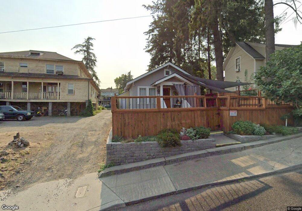
702 Case St the Dalles, OR 97058
Estimated Value: $277,197 - $336,000
2
Beds
1
Bath
1,334
Sq Ft
$230/Sq Ft
Est. Value
About This Home
This home is located at 702 Case St, the Dalles, OR 97058 and is currently estimated at $306,599, approximately $229 per square foot. 702 Case St is a home located in Wasco County with nearby schools including Colonel Wright Elementary School, The Dalles Middle School, and The Dalles High School.
Ownership History
Date
Name
Owned For
Owner Type
Purchase Details
Closed on
Mar 30, 2018
Sold by
Mann Terry L and Mann Eva M
Bought by
Rickert Stephanie D
Current Estimated Value
Home Financials for this Owner
Home Financials are based on the most recent Mortgage that was taken out on this home.
Original Mortgage
$75,000
Outstanding Balance
$63,988
Interest Rate
4.38%
Mortgage Type
New Conventional
Estimated Equity
$242,611
Create a Home Valuation Report for This Property
The Home Valuation Report is an in-depth analysis detailing your home's value as well as a comparison with similar homes in the area
Purchase History
| Date | Buyer | Sale Price | Title Company |
|---|---|---|---|
| Rickert Stephanie D | $203,000 | Columbia Gorge Title |
Source: Public Records
Mortgage History
| Date | Status | Borrower | Loan Amount |
|---|---|---|---|
| Open | Rickert Stephanie D | $75,000 |
Source: Public Records
Tax History
| Year | Tax Paid | Tax Assessment Tax Assessment Total Assessment is a certain percentage of the fair market value that is determined by local assessors to be the total taxable value of land and additions on the property. | Land | Improvement |
|---|---|---|---|---|
| 2025 | $1,643 | $91,467 | -- | -- |
| 2024 | $1,598 | $88,803 | -- | -- |
| 2023 | $1,552 | $86,217 | $0 | $0 |
| 2022 | $1,517 | $96,182 | $0 | $0 |
| 2021 | $1,471 | $93,381 | $0 | $0 |
| 2020 | $1,434 | $90,661 | $0 | $0 |
| 2019 | $1,515 | $88,020 | $0 | $0 |
| 2018 | $1,141 | $57,642 | $0 | $0 |
| 2017 | $1,105 | $55,963 | $0 | $0 |
| 2016 | $1,081 | $54,333 | $0 | $0 |
| 2015 | $1,063 | $52,750 | $0 | $0 |
| 2014 | $1,033 | $51,214 | $0 | $0 |
Source: Public Records
Map
Nearby Homes
Your Personal Tour Guide
Ask me questions while you tour the home.