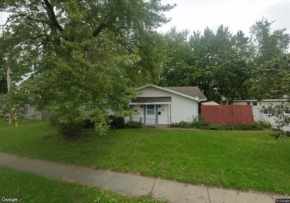
702 Cornell Dr Lima, OH 45805
Westgate NeighborhoodEstimated Value: $116,000 - $140,000
About This Home
This home is located at 702 Cornell Dr, Lima, OH 45805 and is currently estimated at $125,168, approximately $120 per square foot. 702 Cornell Dr is a home located in Allen County with nearby schools including Heritage Elementary School, Lima West Middle School, and Lima North Middle School.
Ownership History
We collect this data history from publicly available records. To have your information removed, we recommend requesting removal directly through your county’s website.
Purchase Details
Purchase Details
Purchase Details
Purchase Details
Purchase Details
Purchase Details
Home Values in the Area
Average Home Value in this Area
Purchase History
We collect this data history from publicly available records. To have your information removed, we recommend requesting removal directly through your county’s website.
| Date | Buyer | Sale Price | Title Company |
|---|---|---|---|
| $56,000 | None Available | ||
| $35,000 | None Available | ||
| $29,800 | -- | ||
| $34,000 | -- | ||
| $27,000 | -- | ||
| -- | -- |
Mortgage History
We collect this data history from publicly available records. To have your information removed, we recommend requesting removal directly through your county’s website.
| Date | Status | Borrower | Loan Amount |
|---|---|---|---|
| Open | $48,500 | ||
| Closed | $49,200 |
Tax History
We collect this data history from publicly available records. To have your information removed, we recommend requesting removal directly through your county’s website.
| Year | Tax Paid | Tax Assessment Tax Assessment Total Assessment is a certain percentage of the fair market value that is determined by local assessors to be the total taxable value of land and additions on the property. | Land | Improvement |
|---|---|---|---|---|
| 2025 | $579 | $24,850 | $6,580 | $18,270 |
| 2024 | $590 | $24,850 | $6,580 | $18,270 |
| 2023 | $426 | $17,990 | $4,760 | $13,230 |
| 2022 | $443 | $17,990 | $4,760 | $13,230 |
| 2021 | $464 | $17,990 | $4,760 | $13,230 |
| 2020 | $758 | $14,490 | $4,830 | $9,660 |
| 2019 | $758 | $14,490 | $4,830 | $9,660 |
| 2018 | $740 | $14,490 | $4,830 | $9,660 |
| 2017 | $737 | $14,000 | $4,830 | $9,170 |
| 2016 | $742 | $14,000 | $4,830 | $9,170 |
| 2015 | $843 | $14,000 | $4,830 | $9,170 |
| 2014 | $843 | $15,960 | $4,830 | $11,130 |
| 2013 | $821 | $15,960 | $4,830 | $11,130 |
Map
- 814 Mackenzie Dr
- 1828 University Blvd
- 1834 Latham Ave
- 1857 Latham Ave
- 1929 W Wayne St
- 926 Crestwood Dr
- 340 N Dale Dr
- 949 N Dale Dr
- 511 N Nixon Ave
- 969 N Dale Dr
- 1811 Mound Rd
- 1687 Rebecca Dr
- 391 N Fernwood Dr
- 1675 Rebecca Dr
- 1517 Allentown Rd
- 1415 Hazel Ave
- 1508 Oakland Pkwy
- 124 N Nixon Ave
- 1817 Hillcrest Dr
- 616 N Rosedale Ave
- 1822 Allentown Rd
- 704 Cornell Dr
- 1818 Allentown Rd
- 1773 Rice Ave
- 1825 Allentown Rd
- 1769 Rice Ave
- 1814 Allentown Rd
- 1801 Rice Ave
- 695 Cornell Dr
- 1821 Allentown Rd
- 1765 Rice Ave
- 1810 Allentown Rd
- 1911 Allentown Rd
- 1817 Allentown Rd
- 1770 Rice Ave
- 1761 Rice Ave
- 644 Cornell Dr
- 1805 Rice Ave
- 1915 Allentown Rd
- 1920 Allentown Rd
Ask me questions while you tour the home.