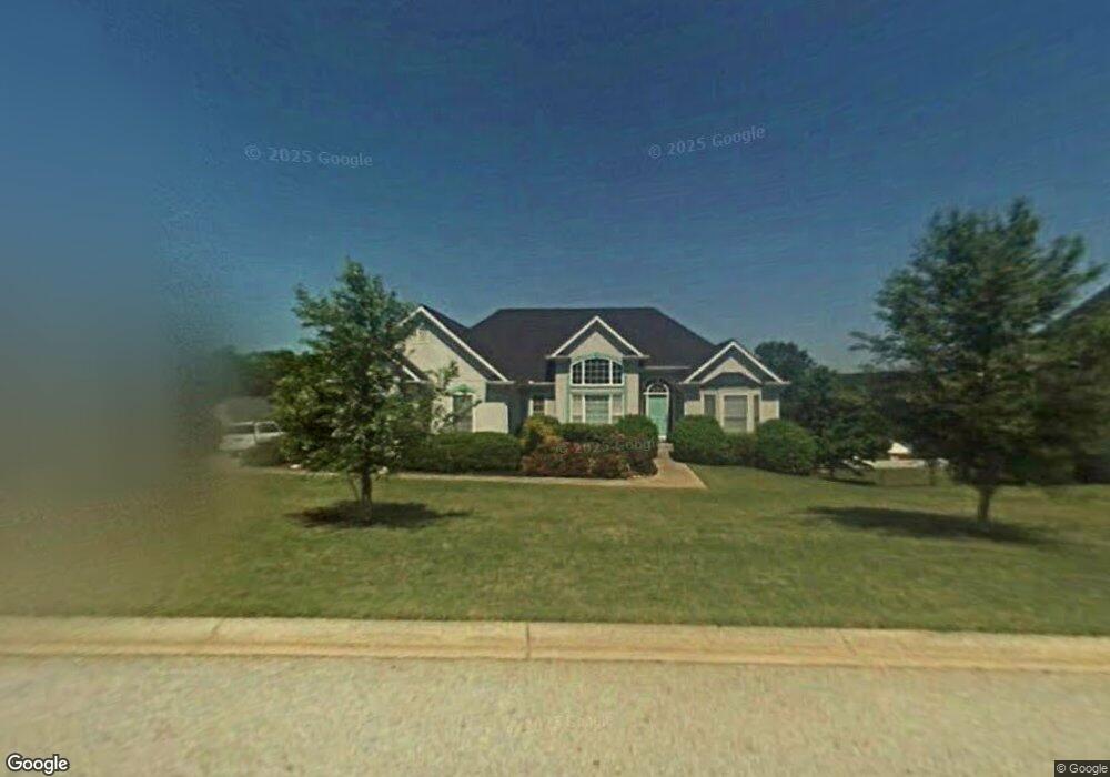
702 High Point Dr Unit 1 Winder, GA 30680
Estimated Value: $346,000 - $401,000
3
Beds
2
Baths
1,798
Sq Ft
$208/Sq Ft
Est. Value
About This Home
This home is located at 702 High Point Dr Unit 1, Winder, GA 30680 and is currently estimated at $374,600, approximately $208 per square foot. 702 High Point Dr Unit 1 is a home located in Barrow County with nearby schools including County Line Elementary School, Russell Middle School, and Winder-Barrow High School.
Ownership History
Date
Name
Owned For
Owner Type
Purchase Details
Closed on
Jan 22, 2002
Sold by
Bleth David R and Bleth Lori L
Bought by
Husk Nancy L and Husk Timothy R
Current Estimated Value
Home Financials for this Owner
Home Financials are based on the most recent Mortgage that was taken out on this home.
Original Mortgage
$127,500
Outstanding Balance
$43,577
Interest Rate
7.08%
Mortgage Type
New Conventional
Estimated Equity
$331,023
Purchase Details
Closed on
Aug 18, 1995
Sold by
Formax Bldrs
Bought by
Bleth David Lori
Create a Home Valuation Report for This Property
The Home Valuation Report is an in-depth analysis detailing your home's value as well as a comparison with similar homes in the area
Home Values in the Area
Average Home Value in this Area
Purchase History
| Date | Buyer | Sale Price | Title Company |
|---|---|---|---|
| Husk Nancy L | $170,000 | -- | |
| Bleth David Lori | $148,000 | -- |
Source: Public Records
Mortgage History
| Date | Status | Borrower | Loan Amount |
|---|---|---|---|
| Open | Husk Nancy L | $127,500 | |
| Closed | Bleth David Lori | $0 |
Source: Public Records
Tax History
| Year | Tax Paid | Tax Assessment Tax Assessment Total Assessment is a certain percentage of the fair market value that is determined by local assessors to be the total taxable value of land and additions on the property. | Land | Improvement |
|---|---|---|---|---|
| 2025 | $2,908 | $120,376 | $28,000 | $92,376 |
| 2024 | $2,913 | $117,924 | $28,000 | $89,924 |
| 2023 | $2,421 | $117,924 | $28,000 | $89,924 |
| 2022 | $2,414 | $76,435 | $16,400 | $60,035 |
| 2021 | $2,485 | $76,435 | $16,400 | $60,035 |
| 2020 | $2,277 | $71,466 | $16,400 | $55,066 |
| 2019 | $2,307 | $71,466 | $16,400 | $55,066 |
| 2018 | $2,199 | $67,440 | $15,200 | $52,240 |
| 2017 | $1,810 | $60,656 | $15,200 | $45,456 |
| 2016 | $1,846 | $58,969 | $15,200 | $43,769 |
| 2015 | $1,866 | $59,504 | $15,200 | $44,304 |
| 2014 | $1,604 | $52,235 | $6,860 | $45,375 |
| 2013 | -- | $49,428 | $6,860 | $42,568 |
Source: Public Records
Map
Nearby Homes
- 719 Mallard Dr
- 617 Teal Dr
- 436 Northcrest Dr
- 460 Flyway Ln
- 469 Plantation Dr
- 171 Bellingrath Dr
- 367 Cedar Wood Trace
- 355 Cedar Wood Trace
- 374 Cedar Wood Trace
- 362 Cedar Wood Trace
- 341 Cedar Wood Trace
- 326 Cedar Wood Trace
- 338 Cedar Wood Trace
- 0 E Northcrest Dr Unit 10648147
- 845 Idlewood Rd
- 314 Cedar Wood Trace
- 276 Cedar Wood Trace
- 264 Cedar Wood Trace
- 240 Cedar Wood Trace
- 704 High Point Dr
- 700 High Point Dr
- 700 Highpoint Dr Unit 9
- 715 Mallard Dr Unit 13B
- 715 Mallard Dr Unit 1
- 717 Mallard Dr Unit 1
- 717 Mallard Dr
- 703 High Point Dr
- 711 Mallard Dr
- 705 High Point Dr
- 719 Mallard Dr Unit 15
- 706 High Point Dr
- 701 High Point Dr
- 721 Mallard Dr
- 721 Mallard Dr Unit 1
- 707 High Point Dr
- 707 Highpoint Dr
- 704 Overlook Dr Unit 1
- 706 Overlook Dr
- 712 Mallard Dr
Your Personal Tour Guide
Ask me questions while you tour the home.