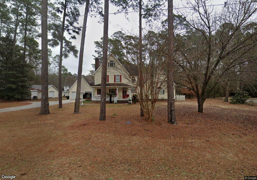
702 Mclean St Metter, GA 30439
Estimated Value: $260,000 - $334,134
4
Beds
3
Baths
2,718
Sq Ft
$115/Sq Ft
Est. Value
About This Home
This home is located at 702 Mclean St, Metter, GA 30439 and is currently estimated at $313,034, approximately $115 per square foot. 702 Mclean St is a home located in Candler County with nearby schools including Metter Elementary School, Metter Middle School, and Metter High School.
Ownership History
Date
Name
Owned For
Owner Type
Purchase Details
Closed on
Feb 4, 2022
Sold by
Bragg Christy Sapp
Bought by
Brannen Martha Ansley Bragg
Current Estimated Value
Purchase Details
Closed on
Dec 31, 2008
Sold by
Bragg Grover
Bought by
Bragg Christy
Purchase Details
Closed on
Oct 1, 1993
Sold by
Deloach James Howar
Bought by
Bragg Grover and Bragg Chri
Purchase Details
Closed on
Mar 1, 1980
Sold by
Franklin Joyce
Bought by
Deloach James Howar
Purchase Details
Closed on
Sep 1, 1979
Bought by
Franklin Joyce
Create a Home Valuation Report for This Property
The Home Valuation Report is an in-depth analysis detailing your home's value as well as a comparison with similar homes in the area
Home Values in the Area
Average Home Value in this Area
Purchase History
| Date | Buyer | Sale Price | Title Company |
|---|---|---|---|
| Brannen Martha Ansley Bragg | -- | -- | |
| Bragg Christy | -- | -- | |
| Bragg Grover | -- | -- | |
| Deloach James Howar | $3,500 | -- | |
| Franklin Joyce | $2,500 | -- |
Source: Public Records
Tax History
| Year | Tax Paid | Tax Assessment Tax Assessment Total Assessment is a certain percentage of the fair market value that is determined by local assessors to be the total taxable value of land and additions on the property. | Land | Improvement |
|---|---|---|---|---|
| 2025 | $4,826 | $111,847 | $9,000 | $102,847 |
| 2024 | $4,826 | $111,847 | $9,000 | $102,847 |
| 2023 | $4,549 | $108,160 | $9,000 | $99,160 |
| 2022 | $4,172 | $102,842 | $9,000 | $93,842 |
| 2021 | $3,682 | $90,618 | $9,000 | $81,618 |
| 2020 | $3,690 | $90,618 | $9,000 | $81,618 |
| 2019 | $3,444 | $83,606 | $9,000 | $74,606 |
| 2018 | $3,286 | $82,476 | $9,000 | $73,476 |
| 2017 | $2,763 | $82,476 | $9,000 | $73,476 |
| 2016 | $3,002 | $82,476 | $9,000 | $73,476 |
| 2015 | $3,013 | $79,798 | $9,000 | $70,798 |
| 2014 | $3,013 | $79,798 | $9,000 | $70,798 |
Source: Public Records
Map
Nearby Homes
- 414 N Terrell St
- 360 N Lewis St
- 170 Foxridge Ct
- 40 Hickory St
- 982 McCranie Dr
- 297 N Rountree St
- 50 Cedar St
- 465 Cedar St
- 150 W Willow Lake Dr
- 221 S College St
- 405 S Leroy St
- 1005 Cedar St
- 200 Ellis St
- 450 S Rountree St
- 410 Preston St
- 46875 Georgia 46
- 1569 Pond View Rd
- 6674 Union Rd
- 1337 Wildflower Cir
- 1230 Rolling Acres Rd
- 0 Mclean St Unit 1.74AC 7496980
- 0 Mclean St Unit 53AC 7496973
- 710 Mclean St
- 410 Franklin Dr
- 408 Franklin Dr
- 705 Mclean St
- 630 Mclean St
- 715 Mclean St
- 720 Mclean St
- 725 Mclean St
- 702 Burton Ave
- 700 Burton Ave
- 720 Burton Ave
- 405 Franklin Dr
- 615 Mclean St
- 407 Franklin Dr
- 403 Franklin Dr
- 302 Franklin Dr
- 730 Burton Ave
- 690 Burton Ave
Your Personal Tour Guide
Ask me questions while you tour the home.