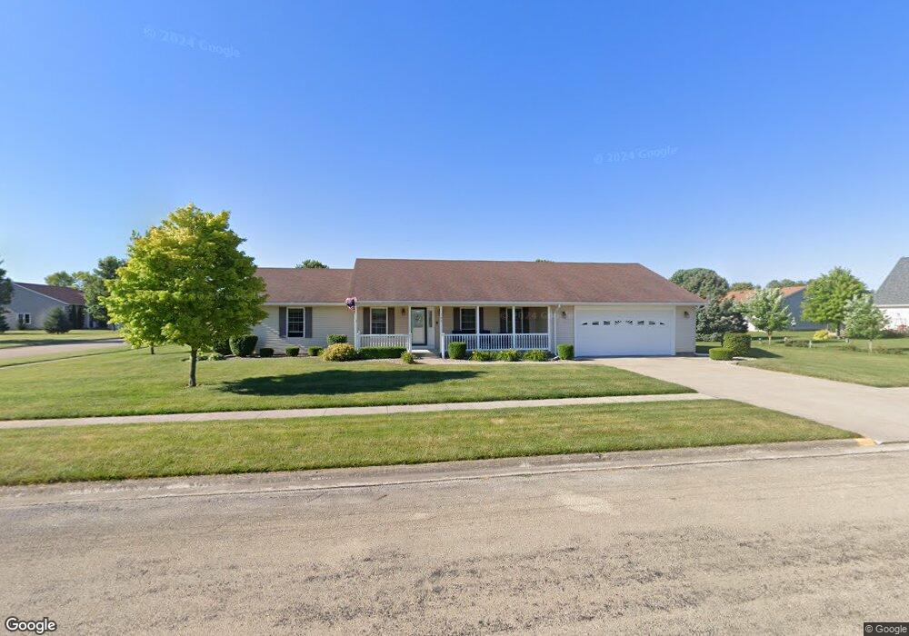
702 Pilot Dr Herscher, IL 60941
Estimated Value: $272,000 - $308,000
About This Home
This home is located at 702 Pilot Dr, Herscher, IL 60941 and is currently estimated at $292,631, approximately $139 per square foot. 702 Pilot Dr is a home located in Kankakee County with nearby schools including Herscher High School.
Ownership History
We collect this data history from publicly available records. To have your information removed, we recommend requesting removal directly through your county’s website.
Purchase Details
Home Financials for this Owner
Home Financials are based on the most recent Mortgage that was taken out on this home.Purchase Details
Purchase History
We collect this data history from publicly available records. To have your information removed, we recommend requesting removal directly through your county’s website.
| Date | Buyer | Sale Price | Title Company |
|---|---|---|---|
| $254,900 | Standard Title | ||
| -- | Homestar Title |
Mortgage History
We collect this data history from publicly available records. To have your information removed, we recommend requesting removal directly through your county’s website.
| Date | Status | Borrower | Loan Amount |
|---|---|---|---|
| Open | $234,900 |
Tax History
We collect this data history from publicly available records. To have your information removed, we recommend requesting removal directly through your county’s website.
| Year | Tax Paid | Tax Assessment Tax Assessment Total Assessment is a certain percentage of the fair market value that is determined by local assessors to be the total taxable value of land and additions on the property. | Land | Improvement |
|---|---|---|---|---|
| 2025 | $4,952 | $87,086 | $16,003 | $71,083 |
| 2024 | $4,952 | $78,901 | $14,499 | $64,402 |
| 2023 | $4,611 | $72,713 | $13,362 | $59,351 |
| 2022 | $4,349 | $67,758 | $12,452 | $55,306 |
| 2021 | $4,217 | $64,384 | $11,832 | $52,552 |
| 2020 | $4,100 | $62,207 | $11,432 | $50,775 |
| 2019 | $3,953 | $60,103 | $11,045 | $49,058 |
| 2018 | $3,905 | $59,361 | $10,909 | $48,452 |
| 2017 | $3,790 | $57,772 | $10,617 | $47,155 |
| 2016 | $3,610 | $55,550 | $10,209 | $45,341 |
| 2015 | $3,278 | $52,754 | $9,695 | $43,059 |
| 2014 | $3,156 | $51,218 | $9,413 | $41,805 |
| 2013 | -- | $52,131 | $9,581 | $42,550 |
Map
- 222 N Maple St
- 597 Jeanette St
- 476 E Kay St
- 473 E Kay St
- 567 Jeanette St
- 431/441 E Myrtle Ave
- 547 Jeanette St
- 203 N Oak St
- 343 E Walnut Ct
- 537 Jeanette St
- 635 N Elm St
- 477 Jeanette St
- 467 Jeanette St
- 457 Jeanette St
- 437 Jeanette St
- 407 Jeanette St
- 515 Tiger Ln
- 525 & N 1/2-535 Tiger Ln
- 4679 S 13000w Rd
- 10438 W 1000s Rd
- 492 Leiser St
- 412 Leiser St
- 0 Bossert St Unit 5475914
- 702 Pilot Dr
- 413 N Willow St
- 413 Willow St
- 441 Leiser St
- 491 Leiser St
- 393 Willow St
- 411 Leiser St
- 362 Leiser St
- 391 Leiser St
- 683 E Spruce St
- 494 N Willow St
- 494 Willow St
- 470 N Mulberry St
- 430 N Mulberry St
- Lot 5 N Leiser St
- 361 Leiser St
- 394 N Willow St
Ask me questions while you tour the home.