Estimated Value: $44,264 - $101,000
Studio
--
Bath
1,680
Sq Ft
$40/Sq Ft
Est. Value
About This Home
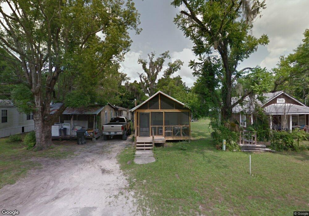
This home is located at 705 12th St, Perry, FL 32347 and is currently estimated at $66,755, approximately $39 per square foot. 705 12th St is a home located in Taylor County with nearby schools including Perry Primary School, Taylor County Elementary School, and Taylor County Middle School.
Ownership History
Date
Name
Owned For
Owner Type
Purchase Details
Closed on
Feb 20, 2025
Sold by
Gray Charlie and Gray Charlie
Bought by
Gray Charlie
Current Estimated Value
Purchase Details
Closed on
Aug 26, 2022
Sold by
Richardson Fred
Bought by
Gray Charlie
Purchase Details
Closed on
May 24, 2002
Sold by
Richardson Beverly
Bought by
Richardson Hazel
Create a Home Valuation Report for This Property
The Home Valuation Report is an in-depth analysis detailing your home's value as well as a comparison with similar homes in the area
Home Values in the Area
Average Home Value in this Area
Purchase History
| Date | Buyer | Sale Price | Title Company |
|---|---|---|---|
| Gray Charlie | $100 | None Listed On Document | |
| Gray Charlie | $100 | None Listed On Document | |
| Gray Charlie | $100 | None Listed On Document | |
| Gray Charlie | $100 | None Listed On Document | |
| Gray Charlie | $100 | None Listed On Document | |
| Gray Charlie | -- | None Listed On Document | |
| Gray Charlie | $100 | None Listed On Document | |
| Gray Charlie | $100 | None Listed On Document | |
| Gray Charlie | $100 | None Listed On Document | |
| Gray Charlie | $100 | None Listed On Document | |
| Richardson Hazel | -- | -- |
Source: Public Records
Tax History
| Year | Tax Paid | Tax Assessment Tax Assessment Total Assessment is a certain percentage of the fair market value that is determined by local assessors to be the total taxable value of land and additions on the property. | Land | Improvement |
|---|---|---|---|---|
| 2025 | $717 | $37,770 | $2,340 | $35,430 |
| 2024 | $110 | $6,120 | $520 | $5,600 |
| 2022 | $110 | $4,880 | $520 | $4,360 |
| 2021 | $72 | $3,950 | $520 | $3,430 |
| 2020 | $63 | $3,070 | $520 | $2,550 |
| 2019 | $63 | $3,070 | $520 | $2,550 |
| 2018 | $61 | $3,000 | $520 | $2,480 |
| 2017 | $62 | $3,000 | $520 | $2,480 |
| 2016 | $61 | $3,000 | $520 | $2,480 |
| 2015 | $62 | $3,007 | $527 | $2,480 |
| 2014 | -- | $2,754 | $0 | $0 |
Source: Public Records
Map
Nearby Homes
- 1011 Richard Bell Ave
- 914 W Malloy Ave
- Lot 000 U S Highway 19
- 804 W Green St Unit n/a
- 804 W Green St
- 611 W Green St
- 808 W Main St Unit n/a
- 808 W Main St
- 1100 S Wilder St
- 302 W Spring Place
- 602 W Bay St
- 415 W Main St
- 315 W Green St
- 00 Landry Rd
- 603 N Faulkner St
- TBD N Veterans Dr
- 205 Susan St
- 708 W Julia St
- 1012 S Orange St
- 210 S Center St
Your Personal Tour Guide
Ask me questions while you tour the home.