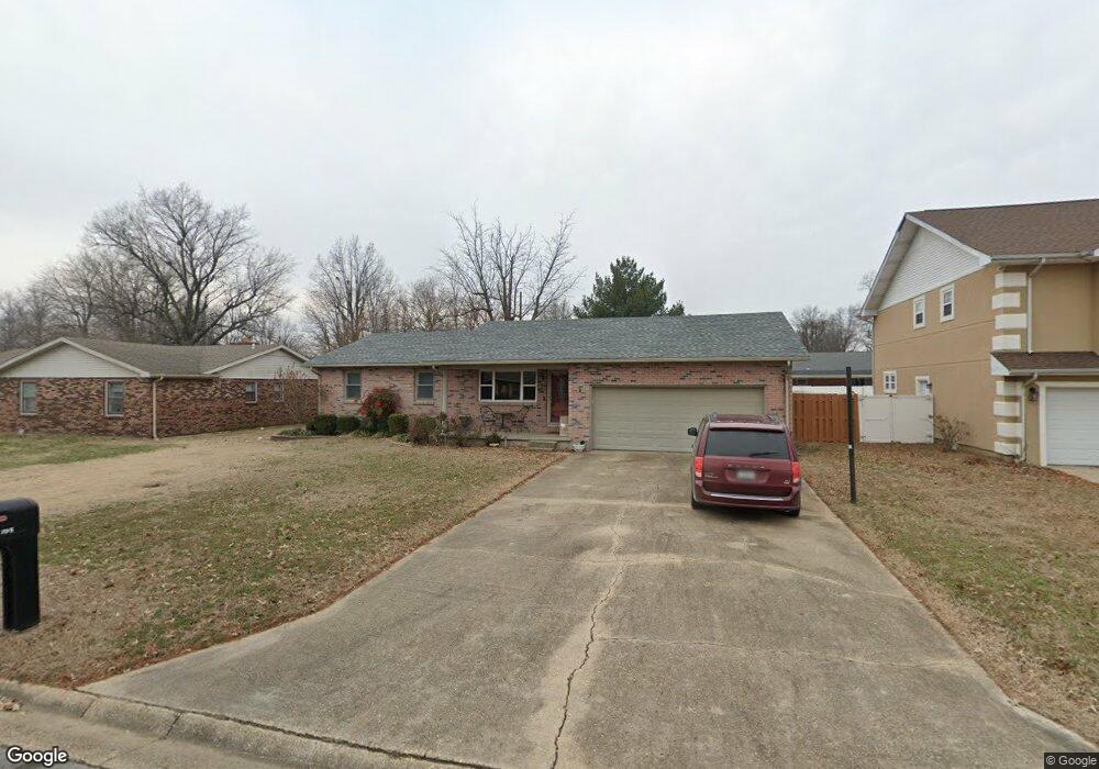
705 Aspen Trace Sikeston, MO 63801
Estimated Value: $162,447 - $204,000
3
Beds
2
Baths
1,630
Sq Ft
$118/Sq Ft
Est. Value
About This Home
This home is located at 705 Aspen Trace, Sikeston, MO 63801 and is currently estimated at $192,112, approximately $117 per square foot. 705 Aspen Trace is a home located in Scott County with nearby schools including Sikeston Senior High School, Southeast Missouri Christian Academy, and The Christian Academy.
Ownership History
Date
Name
Owned For
Owner Type
Purchase Details
Closed on
Nov 5, 2012
Sold by
Secretary Of Housing And Urban Developme
Bought by
Whitman Richard D and Whitman Mellony S
Current Estimated Value
Home Financials for this Owner
Home Financials are based on the most recent Mortgage that was taken out on this home.
Original Mortgage
$65,594
Interest Rate
3.37%
Purchase Details
Closed on
Jun 28, 2012
Sold by
Wells Fargo Bank National Association
Bought by
Secretary Of Housing & Urban Development
Create a Home Valuation Report for This Property
The Home Valuation Report is an in-depth analysis detailing your home's value as well as a comparison with similar homes in the area
Home Values in the Area
Average Home Value in this Area
Purchase History
| Date | Buyer | Sale Price | Title Company |
|---|---|---|---|
| Whitman Richard D | -- | -- | |
| Secretary Of Housing & Urban Development | -- | -- |
Source: Public Records
Mortgage History
| Date | Status | Borrower | Loan Amount |
|---|---|---|---|
| Closed | Secretary Of Housing & Urban Development | $65,594 |
Source: Public Records
Tax History
| Year | Tax Paid | Tax Assessment Tax Assessment Total Assessment is a certain percentage of the fair market value that is determined by local assessors to be the total taxable value of land and additions on the property. | Land | Improvement |
|---|---|---|---|---|
| 2025 | $800 | $18,630 | $0 | $0 |
| 2024 | $8 | $16,830 | $0 | $0 |
| 2023 | $798 | $16,830 | $0 | $0 |
| 2022 | $802 | $16,240 | $0 | $0 |
| 2021 | $802 | $16,240 | $0 | $0 |
| 2020 | $715 | $15,640 | $0 | $0 |
| 2019 | -- | $15,640 | $0 | $0 |
| 2018 | -- | $15,640 | $0 | $0 |
| 2017 | -- | $15,640 | $0 | $0 |
| 2014 | -- | $15,540 | $0 | $0 |
| 2011 | -- | $15,540 | $0 | $0 |
Source: Public Records
Map
Nearby Homes
- 904 Crescent Dr
- 705 Linden Ln
- 926 Crescent Dr
- 838 E Gladys St
- 904 Pine St
- 733 Matthews Ave
- 720 Matthews Ave
- 829 Plantation Blvd
- 814 Auburn Dr Unit 1
- 415 E Gladys St
- 322 Helen St
- 321 Benton St
- 319 Benton St
- 338 E Gladys St
- 309 Benton St
- 312 Hardin St
- 414 Matthews Ave
- 1510 E Kathleen St
- 911 S Prairie St
- 303 Greer Ave
Your Personal Tour Guide
Ask me questions while you tour the home.