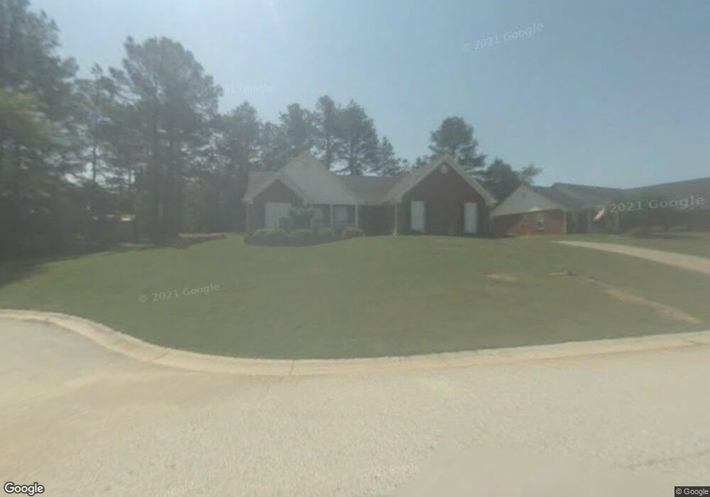
707 Highpoint Dr Winder, GA 30680
Estimated Value: $337,000 - $354,000
3
Beds
2
Baths
1,746
Sq Ft
$199/Sq Ft
Est. Value
About This Home
This home is located at 707 Highpoint Dr, Winder, GA 30680 and is currently estimated at $347,094, approximately $198 per square foot. 707 Highpoint Dr is a home located in Barrow County with nearby schools including County Line Elementary School, Russell Middle School, and Winder-Barrow High School.
Ownership History
Date
Name
Owned For
Owner Type
Purchase Details
Closed on
Feb 20, 2025
Sold by
Gyldholm Joseph Michael
Bought by
Gyldholm Rachel Carole
Current Estimated Value
Purchase Details
Closed on
Feb 2, 2017
Sold by
Ellison Jodie Mcdonald
Bought by
Gyldholm Joseph Michael and Gyldholm Rachel Carole
Home Financials for this Owner
Home Financials are based on the most recent Mortgage that was taken out on this home.
Original Mortgage
$124,236
Interest Rate
4.4%
Mortgage Type
FHA
Purchase Details
Closed on
Sep 23, 2011
Sold by
Federal Home Loan Mortgage Corporation
Bought by
Mcdonald Jodie R and Mcdonald Elizabeth
Home Financials for this Owner
Home Financials are based on the most recent Mortgage that was taken out on this home.
Original Mortgage
$107,941
Interest Rate
4.25%
Mortgage Type
FHA
Purchase Details
Closed on
May 3, 2011
Sold by
Wells Fargo Bk Na
Bought by
Federal Home Loan Mortgage Corporation
Purchase Details
Closed on
Aug 14, 2006
Sold by
Sanders Kenneth R
Bought by
Nix Lynda J and Nix David A
Home Financials for this Owner
Home Financials are based on the most recent Mortgage that was taken out on this home.
Original Mortgage
$150,850
Interest Rate
6.71%
Mortgage Type
New Conventional
Purchase Details
Closed on
Jul 25, 2005
Sold by
Jones Michael G and Jones Shannon
Bought by
Sanders Kenneth R
Home Financials for this Owner
Home Financials are based on the most recent Mortgage that was taken out on this home.
Original Mortgage
$145,220
Interest Rate
5.59%
Purchase Details
Closed on
Nov 26, 2003
Sold by
Holley Timothy J and Holley Melody D
Bought by
Jones Michael G and Jones Shannon
Home Financials for this Owner
Home Financials are based on the most recent Mortgage that was taken out on this home.
Original Mortgage
$143,825
Interest Rate
6.04%
Mortgage Type
FHA
Purchase Details
Closed on
Oct 20, 2000
Sold by
Star Home Builders
Bought by
Holley Timothy J and Holley Melody D
Home Financials for this Owner
Home Financials are based on the most recent Mortgage that was taken out on this home.
Original Mortgage
$128,835
Interest Rate
7.94%
Mortgage Type
New Conventional
Create a Home Valuation Report for This Property
The Home Valuation Report is an in-depth analysis detailing your home's value as well as a comparison with similar homes in the area
Home Values in the Area
Average Home Value in this Area
Purchase History
| Date | Buyer | Sale Price | Title Company |
|---|---|---|---|
| Gyldholm Rachel Carole | -- | -- | |
| Gyldholm Joseph Michael | $149,000 | -- | |
| Mcdonald Jodie R | $110,750 | -- | |
| Federal Home Loan Mortgage Corporation | -- | -- | |
| Wells Fargo Bk Na | $88,396 | -- | |
| Nix Lynda J | $155,600 | -- | |
| Sanders Kenneth R | $145,000 | -- | |
| Jones Michael G | $146,200 | -- | |
| Holley Timothy J | $129,900 | -- |
Source: Public Records
Mortgage History
| Date | Status | Borrower | Loan Amount |
|---|---|---|---|
| Previous Owner | Gyldholm Joseph Michael | $124,236 | |
| Previous Owner | Mcdonald Jodie R | $107,941 | |
| Previous Owner | Nix Lynda J | $150,850 | |
| Previous Owner | Sanders Kenneth R | $145,220 | |
| Previous Owner | Jones Michael G | $143,825 | |
| Previous Owner | Holley Timothy J | $128,835 |
Source: Public Records
Tax History
| Year | Tax Paid | Tax Assessment Tax Assessment Total Assessment is a certain percentage of the fair market value that is determined by local assessors to be the total taxable value of land and additions on the property. | Land | Improvement |
|---|---|---|---|---|
| 2025 | $3,361 | $121,140 | $28,000 | $93,140 |
| 2024 | $3,343 | $118,378 | $28,000 | $90,378 |
| 2023 | $3,333 | $118,378 | $28,000 | $90,378 |
| 2022 | $2,444 | $71,248 | $16,400 | $54,848 |
| 2021 | $2,594 | $71,248 | $16,400 | $54,848 |
| 2020 | $2,317 | $66,711 | $16,400 | $50,311 |
| 2019 | $2,349 | $66,711 | $16,400 | $50,311 |
| 2018 | $2,090 | $59,013 | $15,200 | $43,813 |
| 2017 | $1,548 | $51,892 | $15,200 | $36,692 |
| 2016 | $1,565 | $50,478 | $15,200 | $35,278 |
| 2015 | $1,580 | $50,879 | $15,200 | $35,679 |
| 2014 | $1,281 | $42,539 | $6,860 | $35,679 |
| 2013 | -- | $40,302 | $6,860 | $33,442 |
Source: Public Records
Map
Nearby Homes
- 719 Mallard Dr
- 436 Northcrest Dr
- 617 Teal Dr
- 469 Plantation Dr
- 0 E Northcrest Dr Unit 10648147
- 460 Flyway Ln
- 845 Idlewood Rd
- 171 Bellingrath Dr
- 367 Cedar Wood Trace
- 355 Cedar Wood Trace
- 374 Cedar Wood Trace
- 362 Cedar Wood Trace
- 341 Cedar Wood Trace
- 326 Cedar Wood Trace
- 338 Cedar Wood Trace
- 2050 Whispering Way
- 314 Cedar Wood Trace
- 273 Partridge Trail
- 276 Cedar Wood Trace
- 707 High Point Dr
- 705 High Point Dr
- 706 High Point Dr
- 703 High Point Dr
- 708 High Point Dr
- 704 High Point Dr
- 701 High Point Dr
- 723 Mallard Dr Unit 24
- 723 Mallard Dr
- 721 Mallard Dr
- 721 Mallard Dr Unit 1
- 702 High Point Dr Unit 1
- 725 Mallard Dr
- 719 Mallard Dr Unit 15
- 700 High Point Dr
- 700 Highpoint Dr Unit 9
- 727 Mallard Dr Unit 1
- 717 Mallard Dr Unit 1
- 717 Mallard Dr
- 715 Mallard Dr Unit 13B
Your Personal Tour Guide
Ask me questions while you tour the home.