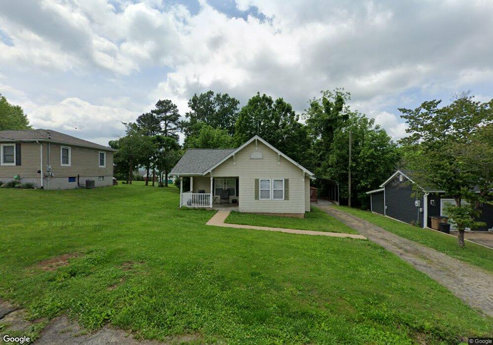
708 Oak St Fredericktown, MO 63645
Estimated Value: $90,791 - $113,000
2
Beds
--
Bath
812
Sq Ft
$123/Sq Ft
Est. Value
About This Home
This home is located at 708 Oak St, Fredericktown, MO 63645 and is currently estimated at $100,198, approximately $123 per square foot. 708 Oak St is a home with nearby schools including Fredericktown Elementary School, Fredericktown Intermediate School, and Kelly A. Burlison Middle School.
Ownership History
Date
Name
Owned For
Owner Type
Purchase Details
Closed on
Jan 17, 2017
Sold by
Thomas Harold Lloyd and Thomas Carolyn Diane
Bought by
Highland Park Investments Llc
Current Estimated Value
Home Financials for this Owner
Home Financials are based on the most recent Mortgage that was taken out on this home.
Original Mortgage
$43,304
Outstanding Balance
$35,610
Interest Rate
4.3%
Mortgage Type
New Conventional
Estimated Equity
$64,588
Create a Home Valuation Report for This Property
The Home Valuation Report is an in-depth analysis detailing your home's value as well as a comparison with similar homes in the area
Home Values in the Area
Average Home Value in this Area
Purchase History
We collect this data history from publicly available records. To have your information removed, we recommend requesting removal directly through your county’s website.
| Date | Buyer | Sale Price | Title Company |
|---|---|---|---|
| Highland Park Investments Llc | -- | None Available |
Source: Public Records
Mortgage History
We collect this data history from publicly available records. To have your information removed, we recommend requesting removal directly through your county’s website.
| Date | Status | Borrower | Loan Amount |
|---|---|---|---|
| Open | Highland Park Investments Llc | $43,304 |
Source: Public Records
Tax History
| Year | Tax Paid | Tax Assessment Tax Assessment Total Assessment is a certain percentage of the fair market value that is determined by local assessors to be the total taxable value of land and additions on the property. | Land | Improvement |
|---|---|---|---|---|
| 2025 | $465 | $7,400 | $0 | $0 |
| 2024 | $468 | $7,400 | $0 | $0 |
| 2023 | $465 | $7,400 | $0 | $0 |
| 2022 | $451 | $7,110 | $0 | $0 |
| 2021 | $450 | $7,110 | $0 | $0 |
| 2020 | $467 | $6,980 | $0 | $0 |
| 2019 | $464 | $7,000 | $0 | $0 |
| 2018 | $467 | $7,000 | $0 | $0 |
| 2017 | $417 | $6,400 | $0 | $0 |
| 2016 | $408 | $6,400 | $0 | $0 |
| 2015 | -- | $6,400 | $0 | $0 |
| 2014 | -- | $6,400 | $0 | $0 |
| 2013 | -- | $6,400 | $0 | $0 |
| 2012 | -- | $6,460 | $0 | $0 |
Source: Public Records
Map
Nearby Homes
- 706 Oak St
- 710 Oak St
- 804 Oak St
- 711 Oak St
- 709 Oak St
- 0 45+ - Acres Unit 17094393
- 461 Route 2 B
- 0 Turkey Run Rd Unit 80055150
- 20 County Road 303 Acres
- 120 County Road 303 Acres
- 0 County Road 278 Unit 90045191
- 0 Thomas Road (Off Of) Unit 10002597
- 0 Turkey Run Rd Unit 10008022
- 0 Turkey Run Rd Unit 10028788
- 0 County Road 9242 Rd Unit 10028972
- 0 Lost Valley Lake Unit 10043258
- 48 Lost Valley Lake Rd
- 13 Eagle Ln
- 14 Eagle Ln
- 15 Eagle Ln
Your Personal Tour Guide
Ask me questions while you tour the home.