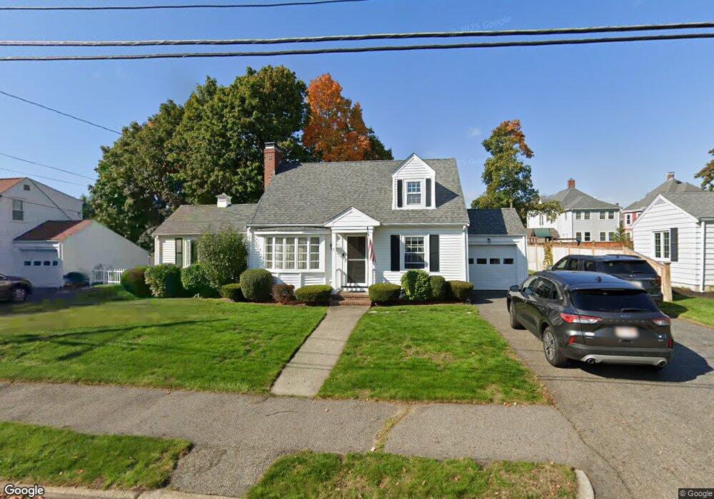
71 Colonial Ave Waltham, MA 02453
Bleachery NeighborhoodEstimated Value: $885,000 - $998,000
2
Beds
2
Baths
1,723
Sq Ft
$533/Sq Ft
Est. Value
About This Home
This home is located at 71 Colonial Ave, Waltham, MA 02453 and is currently estimated at $918,711, approximately $533 per square foot. 71 Colonial Ave is a home located in Middlesex County with nearby schools including James Fitzgerald Elementary School, John W. Mcdevitt Middle School, and Waltham Sr High School.
Ownership History
Date
Name
Owned For
Owner Type
Purchase Details
Closed on
Mar 22, 2010
Sold by
Glidden Marcia A
Bought by
Glidden Ft
Current Estimated Value
Purchase Details
Closed on
Aug 24, 1994
Sold by
Keirce Joseph L Est
Bought by
Glidden Marcia A
Home Financials for this Owner
Home Financials are based on the most recent Mortgage that was taken out on this home.
Original Mortgage
$131,500
Interest Rate
8.65%
Mortgage Type
Purchase Money Mortgage
Create a Home Valuation Report for This Property
The Home Valuation Report is an in-depth analysis detailing your home's value as well as a comparison with similar homes in the area
Home Values in the Area
Average Home Value in this Area
Purchase History
We collect this data history from publicly available records. To have your information removed, we recommend requesting removal directly through your county’s website.
| Date | Buyer | Sale Price | Title Company |
|---|---|---|---|
| Glidden Ft | -- | -- | |
| Glidden Marcia A | $180,000 | -- |
Source: Public Records
Mortgage History
We collect this data history from publicly available records. To have your information removed, we recommend requesting removal directly through your county’s website.
| Date | Status | Borrower | Loan Amount |
|---|---|---|---|
| Previous Owner | Glidden Marcia A | $132,000 | |
| Previous Owner | Glidden Marcia A | $131,500 |
Source: Public Records
Tax History
| Year | Tax Paid | Tax Assessment Tax Assessment Total Assessment is a certain percentage of the fair market value that is determined by local assessors to be the total taxable value of land and additions on the property. | Land | Improvement |
|---|---|---|---|---|
| 2025 | $6,999 | $712,700 | $451,200 | $261,500 |
| 2024 | $6,621 | $686,800 | $429,300 | $257,500 |
| 2023 | $6,737 | $652,800 | $407,500 | $245,300 |
| 2022 | $6,771 | $607,800 | $378,400 | $229,400 |
| 2021 | $6,703 | $592,100 | $378,400 | $213,700 |
| 2020 | $6,624 | $554,300 | $349,300 | $205,000 |
| 2019 | $6,630 | $523,700 | $341,900 | $181,800 |
| 2018 | $6,115 | $484,900 | $316,500 | $168,400 |
| 2017 | $5,725 | $455,800 | $287,400 | $168,400 |
| 2016 | $5,089 | $415,800 | $247,400 | $168,400 |
| 2015 | $4,756 | $362,200 | $218,300 | $143,900 |
Source: Public Records
Map
Nearby Homes
- 148 Main St
- 220 Grove St Unit 1
- 78 Barbara Rd Unit 1
- 165 River St Unit 2
- 172 Bright St Unit 3
- 4 Repton Cir Unit 4105
- 266-274 River St
- 58 Madison Rd
- 601 Main St
- 28-32 Calvary St
- 4 Jensen Rd Unit 6
- 11 Hersom St Unit 2
- 26 Cross St
- 49 Waltham St Unit 49
- 49 Hollace St
- 227-229 Newton St
- 200 Church St Unit 200-202
- 210 Church St
- 128 Carey Ave Unit 1
- 128 Church St Unit 2
- 77 Colonial Ave
- 65 Colonial Ave
- 36 Lafayette St
- 24 Lafayette St
- 70 Colonial Ave
- 83 Colonial Ave
- 40 Lafayette St
- 61 Colonial Ave
- 28 Lafayette St
- 80 Colonial Ave
- 62 Colonial Ave
- 20 Lafayette St
- 44 Lafayette St
- 63 Richgrain Ave
- 86 Colonial Ave
- 89 Colonial Ave
- 66 Richgrain Ave
- 57 Colonial Ave
- 46 Colonial Ave
- 14 Lafayette St
Your Personal Tour Guide
Ask me questions while you tour the home.