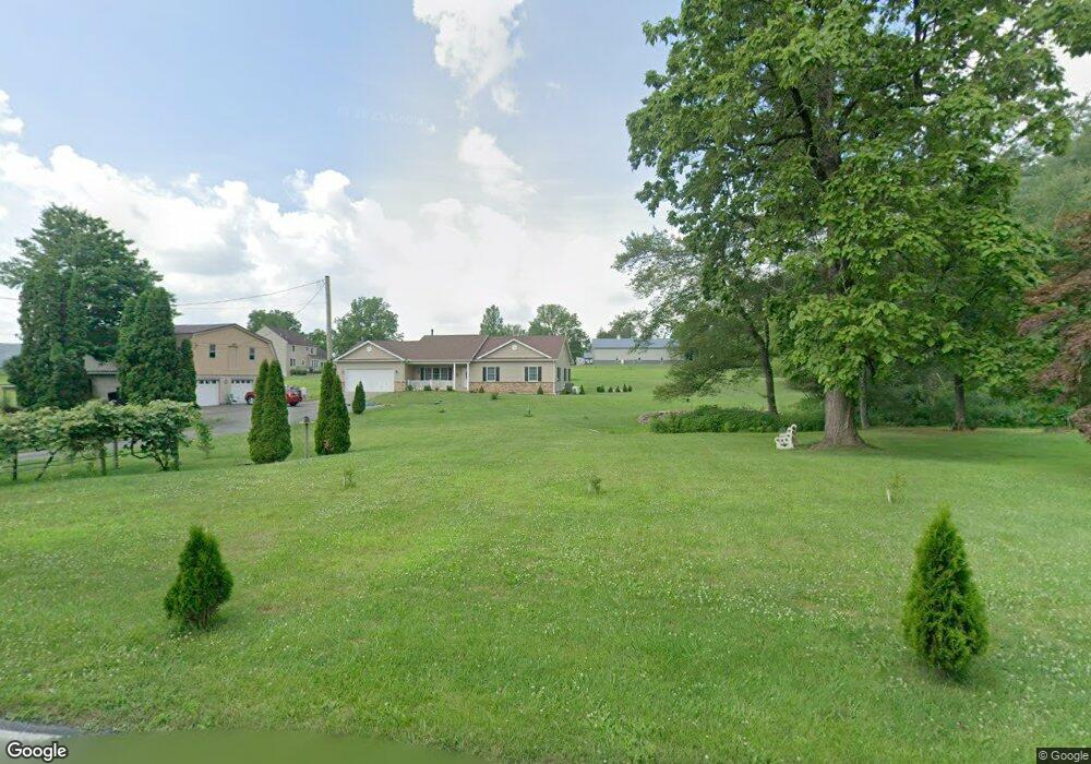
71 Hemlock Dr Lehighton, PA 18235
Estimated Value: $311,000 - $432,000
3
Beds
2
Baths
1,822
Sq Ft
$215/Sq Ft
Est. Value
About This Home
This home is located at 71 Hemlock Dr, Lehighton, PA 18235 and is currently estimated at $391,547, approximately $214 per square foot. 71 Hemlock Dr is a home located in Carbon County with nearby schools including Lehighton Area High School, Sts. Peter & Paul School, and Valley Ridge Academy.
Ownership History
Date
Name
Owned For
Owner Type
Purchase Details
Closed on
Dec 27, 2016
Sold by
Schneider John J and Schneider Susan L
Bought by
Schneider John J and Schneider Susan L
Current Estimated Value
Purchase Details
Closed on
Sep 22, 1976
Bought by
Schneider John J and Schneider Susan
Create a Home Valuation Report for This Property
The Home Valuation Report is an in-depth analysis detailing your home's value as well as a comparison with similar homes in the area
Home Values in the Area
Average Home Value in this Area
Purchase History
We collect this data history from publicly available records. To have your information removed, we recommend requesting removal directly through your county’s website.
| Date | Buyer | Sale Price | Title Company |
|---|---|---|---|
| Schneider John J | -- | None Available | |
| Schneider John J | $8,600 | -- |
Source: Public Records
Tax History
| Year | Tax Paid | Tax Assessment Tax Assessment Total Assessment is a certain percentage of the fair market value that is determined by local assessors to be the total taxable value of land and additions on the property. | Land | Improvement |
|---|---|---|---|---|
| 2026 | $6,824 | $89,189 | $9,650 | $79,539 |
| 2025 | $6,824 | $89,189 | $9,650 | $79,539 |
| 2024 | $6,557 | $89,189 | $9,650 | $79,539 |
| 2023 | $6,490 | $89,189 | $9,650 | $79,539 |
| 2022 | $6,401 | $89,189 | $9,650 | $79,539 |
| 2021 | $3,200 | $45,950 | $9,650 | $36,300 |
| 2020 | $3,119 | $45,950 | $9,650 | $36,300 |
| 2019 | $2,958 | $45,950 | $9,650 | $36,300 |
| 2018 | $2,924 | $45,950 | $9,650 | $36,300 |
| 2017 | $2,924 | $45,950 | $9,650 | $36,300 |
| 2016 | -- | $46,050 | $9,750 | $36,300 |
| 2015 | -- | $46,050 | $9,750 | $36,300 |
| 2014 | -- | $46,050 | $9,750 | $36,300 |
Source: Public Records
Map
Nearby Homes
- 2093 Mahoning Dr E
- 0 Sage Ct Unit Lot 7
- 0 Sage Ct Unit Lot 6
- 0 Sage Ct Unit Lot 5
- 0 Sage Ct Unit 749012
- Lot 7 Sage Ct
- Lot 5 Sage Ct
- 87 Sage Ct Unit Lot 2
- 98 Sage Ct
- 7 Sage Ct
- 2 Sage Ct
- 10 Sage Ct
- 0 Airport Rd Unit Lot 4
- 0 Airport Rd Unit Lot 3
- 558 Mahoning Dr E
- 0 Pine Hollow Dr Unit PACC2006714
- 7 Robert Henry Cir
- 8 Taylor Nicole Cir
- 107 Teliha Dr
- 635 Coal St
- 97 Hemlock Dr
- 1668 Mahoning Dr E
- 1 Hemlock Dr
- 1800 Mahoning Dr E
- 1614 Mahoning Dr E
- 1820 Mahoning Dr E
- 1842 Mahoning Dr E
- 179 Hemlock Dr
- 1490 Mahoning Dr E
- 130 Fredericks Grove Rd
- 181 Hemlock Dr
- 1934 Mahoning Dr E
- 1923 Mahoning Dr E
- 151 Fredericks Grove Rd
- 183 Hemlock Dr
- 172 Fredericks Grove Rd
- 1943 Mahoning Dr E
- 1426 Mahoning Dr E
- 1984 Mahoning Dr E
- 1953 Mahoning Dr E
Your Personal Tour Guide
Ask me questions while you tour the home.