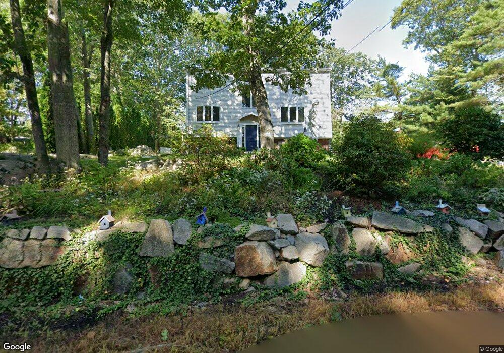
71 Hesperus Ave Unit 1 Gloucester, MA 01930
West Gloucester NeighborhoodEstimated Value: $849,000 - $1,348,000
4
Beds
3
Baths
2,150
Sq Ft
$468/Sq Ft
Est. Value
About This Home
This home is located at 71 Hesperus Ave Unit 1, Gloucester, MA 01930 and is currently estimated at $1,006,549, approximately $468 per square foot. 71 Hesperus Ave Unit 1 is a home located in Essex County with nearby schools including West Parish, Ralph B O'maley Middle School, and Gloucester High School.
Ownership History
Date
Name
Owned For
Owner Type
Purchase Details
Closed on
Dec 15, 2023
Sold by
Oneill Francis and Oneill Stefanie
Bought by
Souza Derric and Souza Melissa
Current Estimated Value
Home Financials for this Owner
Home Financials are based on the most recent Mortgage that was taken out on this home.
Original Mortgage
$540,000
Outstanding Balance
$528,819
Interest Rate
7.76%
Mortgage Type
Purchase Money Mortgage
Estimated Equity
$477,730
Purchase Details
Closed on
Jan 31, 2017
Sold by
Aiello Brian
Bought by
Oneill Francis and Oneill Stefanie
Home Financials for this Owner
Home Financials are based on the most recent Mortgage that was taken out on this home.
Original Mortgage
$387,000
Interest Rate
4.16%
Mortgage Type
New Conventional
Purchase Details
Closed on
Dec 13, 2013
Sold by
Bank Of America Na
Bought by
Aiello Brian
Purchase Details
Closed on
May 30, 2013
Sold by
Blazewicz Robert and Bank Of America Na
Bought by
Bank Of America Na
Purchase Details
Closed on
Apr 28, 2005
Sold by
Kaplan Kimberly
Bought by
Blazewicz Robert
Create a Home Valuation Report for This Property
The Home Valuation Report is an in-depth analysis detailing your home's value as well as a comparison with similar homes in the area
Home Values in the Area
Average Home Value in this Area
Purchase History
| Date | Buyer | Sale Price | Title Company |
|---|---|---|---|
| Souza Derric | $740,000 | None Available | |
| Souza Derric | $740,000 | None Available | |
| Oneill Francis | $430,000 | -- | |
| Oneill Francis | $430,000 | -- | |
| Aiello Brian | $300,000 | -- | |
| Aiello Brian | $300,000 | -- | |
| Bank Of America Na | $325,000 | -- | |
| Bank Of America Na | $325,000 | -- | |
| Blazewicz Robert | $450,000 | -- | |
| Blazewicz Robert | $450,000 | -- |
Source: Public Records
Mortgage History
| Date | Status | Borrower | Loan Amount |
|---|---|---|---|
| Open | Souza Derric | $540,000 | |
| Previous Owner | Oneill Francis | $387,000 |
Source: Public Records
Tax History
| Year | Tax Paid | Tax Assessment Tax Assessment Total Assessment is a certain percentage of the fair market value that is determined by local assessors to be the total taxable value of land and additions on the property. | Land | Improvement |
|---|---|---|---|---|
| 2025 | $7,035 | $723,800 | $245,000 | $478,800 |
| 2024 | $6,924 | $711,600 | $233,300 | $478,300 |
| 2023 | $6,634 | $626,400 | $208,300 | $418,100 |
| 2022 | $6,375 | $543,500 | $177,100 | $366,400 |
| 2021 | $6,153 | $494,600 | $161,000 | $333,600 |
| 2020 | $6,143 | $498,200 | $161,000 | $337,200 |
| 2019 | $5,901 | $465,000 | $161,000 | $304,000 |
| 2018 | $5,706 | $441,300 | $161,000 | $280,300 |
| 2017 | $5,586 | $423,500 | $153,300 | $270,200 |
| 2016 | $5,413 | $397,700 | $153,800 | $243,900 |
| 2015 | $5,173 | $379,000 | $153,800 | $225,200 |
Source: Public Records
Map
Nearby Homes
- 24 Flume Rd
- 2 Ocean Ave Unit 1M
- 53 Raymond St
- 100 Eastern Point Blvd
- 5 Marshfield St
- 18 Lyndale Ave
- 5 Lepage Ln
- 24 Cobblestone Ln Unit 603
- 145 Essex Ave Unit 512
- 145 Essex Ave Unit 402
- 13 Leslie o Johnson Rd
- 468 Summer St
- 15 Raven Ln Unit 15
- 18 Hampden St
- 5 Samoset Rd Unit B
- 1 Wonson St
- 33 Middle St
- 28 Eastern Point Rd
- 20 Beacon St
- 20 Beacon St Unit 2
- 71 Hesperus Ave
- 69 Hesperus Ave
- 73 Hesperus Ave
- 6 Castle Hill Rd
- 4 Castle Hill Rd
- 75 Hesperus Ave
- 8 Castle Hill Rd
- 67 Hesperus Ave
- 9 Castle Hill Rd
- 77 Hesperus Ave
- 1 Tower Rd
- 10 Castle Hill Rd
- 3 Castle Hill Rd
- 65 Hesperus Ave
- 66 Hesperus Ave
- 5 Castle Hill Rd
- 7 Castle Hill Rd
- 3 Tower Rd
- 13 Castle Hill Rd
- 63 Hesperus Ave
Your Personal Tour Guide
Ask me questions while you tour the home.