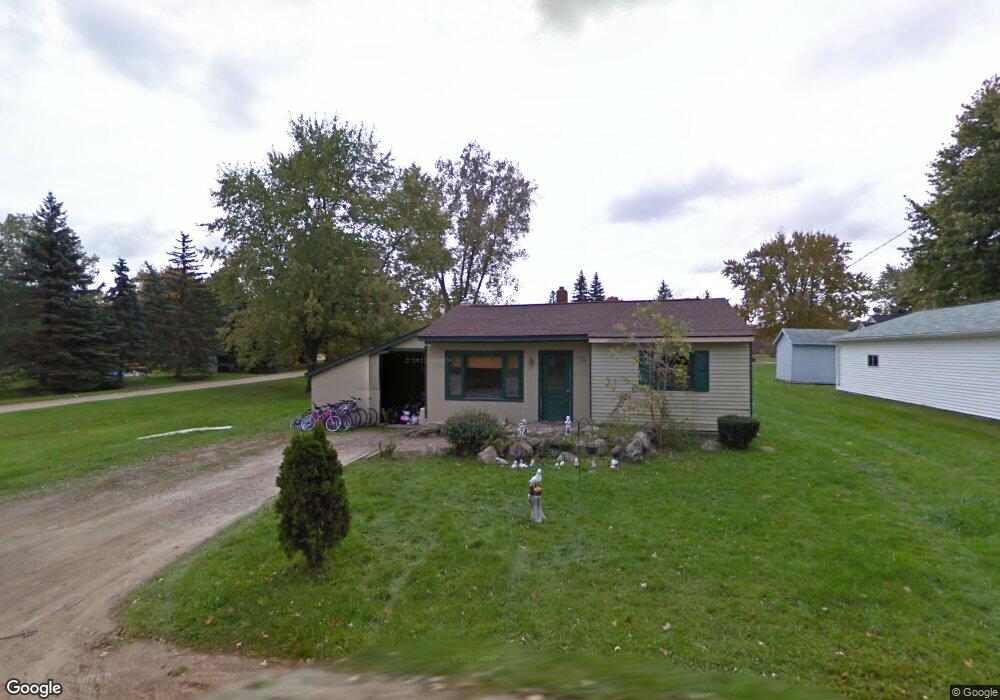
71 W Division St Leonard, MI 48367
Estimated Value: $142,000 - $265,000
3
Beds
1
Bath
1,084
Sq Ft
$183/Sq Ft
Est. Value
About This Home
This home is located at 71 W Division St, Leonard, MI 48367 and is currently estimated at $198,505, approximately $183 per square foot. 71 W Division St is a home located in Oakland County with nearby schools including Leonard Elementary School, Oxford Middle School, and Oxford High School.
Ownership History
Date
Name
Owned For
Owner Type
Purchase Details
Closed on
Feb 5, 2024
Sold by
Shamoun Sanan
Bought by
71 Division Llc
Current Estimated Value
Purchase Details
Closed on
May 13, 2016
Sold by
Justindunaskiss Llc
Bought by
Shamoun Sanan
Home Financials for this Owner
Home Financials are based on the most recent Mortgage that was taken out on this home.
Original Mortgage
$56,000
Interest Rate
4.25%
Mortgage Type
Adjustable Rate Mortgage/ARM
Purchase Details
Closed on
Apr 8, 2011
Sold by
Dunaskiss Mathew and Dunaskiss Diane
Bought by
Justindunaskiss L L C
Create a Home Valuation Report for This Property
The Home Valuation Report is an in-depth analysis detailing your home's value as well as a comparison with similar homes in the area
Home Values in the Area
Average Home Value in this Area
Purchase History
| Date | Buyer | Sale Price | Title Company |
|---|---|---|---|
| 71 Division Llc | -- | None Listed On Document | |
| 71 Division Llc | -- | None Listed On Document | |
| Shamoun Sanan | $70,000 | First American Title Ins Co | |
| Justindunaskiss L L C | -- | None Available |
Source: Public Records
Mortgage History
| Date | Status | Borrower | Loan Amount |
|---|---|---|---|
| Previous Owner | Shamoun Sanan | $56,000 |
Source: Public Records
Tax History
| Year | Tax Paid | Tax Assessment Tax Assessment Total Assessment is a certain percentage of the fair market value that is determined by local assessors to be the total taxable value of land and additions on the property. | Land | Improvement |
|---|---|---|---|---|
| 2025 | $1,870 | $49,410 | $0 | $0 |
| 2024 | $1,701 | $46,480 | $0 | $0 |
| 2023 | $1,621 | $42,370 | $0 | $0 |
| 2022 | $1,946 | $38,830 | $0 | $0 |
| 2021 | $1,823 | $37,140 | $0 | $0 |
| 2020 | $1,510 | $36,680 | $0 | $0 |
| 2019 | $1,560 | $35,060 | $0 | $0 |
| 2018 | $1,734 | $29,710 | $0 | $0 |
| 2017 | $1,689 | $29,710 | $0 | $0 |
| 2016 | $1,315 | $27,540 | $0 | $0 |
| 2015 | -- | $27,330 | $0 | $0 |
| 2014 | -- | $24,780 | $0 | $0 |
| 2011 | -- | $23,850 | $0 | $0 |
Source: Public Records
Map
Nearby Homes
- 99 E Elmwood
- 4633 Rosy Dr
- 4664 Rosy Dr
- 4742 Rosy Dr
- 205 Gerst Rd
- 0000 Beech Forest Ct
- 0000 Hagerman Parcel 4 Rd
- 00 Hagerman Parcel 2 Rd
- 0 Hagerman Parcel 1 Rd Unit 50182156
- 00000 Hagerman Parcel 5 Rd
- 000 Hagerman Parcel 3 Rd
- 0 Pond Unit 20251014765
- 00 West St
- 433 Rochester Rd
- 0 Secord Lake Rd
- 2755 Curtis Rd
- 0000 Hagerman Rd
- VL Lake George Rd
- 9 Annandale
- 1721 Moffat
Your Personal Tour Guide
Ask me questions while you tour the home.