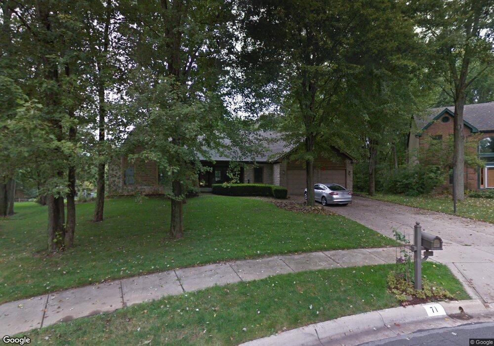
71 Westridge Ct Westerville, OH 43081
Estimated Value: $672,000 - $820,000
5
Beds
6
Baths
3,576
Sq Ft
$214/Sq Ft
Est. Value
About This Home
This home is located at 71 Westridge Ct, Westerville, OH 43081 and is currently estimated at $766,924, approximately $214 per square foot. 71 Westridge Ct is a home located in Franklin County with nearby schools including Robert Frost Elementary School, Heritage Middle School, and Westerville-North High School.
Ownership History
Date
Name
Owned For
Owner Type
Purchase Details
Closed on
Jan 28, 1999
Sold by
Dunn Steven M and Dunn Arlene S
Bought by
Edson Mark S and Edson Pamela M A
Current Estimated Value
Home Financials for this Owner
Home Financials are based on the most recent Mortgage that was taken out on this home.
Original Mortgage
$322,905
Interest Rate
6.5%
Purchase Details
Closed on
Sep 24, 1992
Bought by
Dunn Steven M and Dunn Arlene S
Purchase Details
Closed on
Jan 22, 1992
Create a Home Valuation Report for This Property
The Home Valuation Report is an in-depth analysis detailing your home's value as well as a comparison with similar homes in the area
Home Values in the Area
Average Home Value in this Area
Purchase History
We collect this data history from publicly available records. To have your information removed, we recommend requesting removal directly through your county’s website.
| Date | Buyer | Sale Price | Title Company |
|---|---|---|---|
| Edson Mark S | $339,900 | Chicago Title West | |
| Dunn Steven M | $200,000 | -- | |
| -- | $19,000 | -- |
Source: Public Records
Mortgage History
We collect this data history from publicly available records. To have your information removed, we recommend requesting removal directly through your county’s website.
| Date | Status | Borrower | Loan Amount |
|---|---|---|---|
| Previous Owner | Edson Mark S | $322,905 |
Source: Public Records
Tax History
| Year | Tax Paid | Tax Assessment Tax Assessment Total Assessment is a certain percentage of the fair market value that is determined by local assessors to be the total taxable value of land and additions on the property. | Land | Improvement |
|---|---|---|---|---|
| 2025 | $13,624 | $239,720 | $31,260 | $208,460 |
| 2024 | $13,624 | $239,720 | $31,260 | $208,460 |
| 2023 | $13,335 | $239,720 | $31,260 | $208,460 |
| 2022 | $12,610 | $173,080 | $15,750 | $157,330 |
| 2021 | $12,716 | $173,080 | $15,750 | $157,330 |
| 2020 | $12,679 | $173,080 | $15,750 | $157,330 |
| 2019 | $10,169 | $131,040 | $15,750 | $115,290 |
| 2018 | $11,138 | $131,040 | $15,750 | $115,290 |
| 2017 | $11,354 | $131,040 | $15,750 | $115,290 |
| 2016 | $12,707 | $151,560 | $37,210 | $114,350 |
| 2015 | $12,307 | $151,560 | $37,210 | $114,350 |
| 2014 | $12,316 | $151,560 | $37,210 | $114,350 |
| 2013 | $5,855 | $144,305 | $35,420 | $108,885 |
Source: Public Records
Map
Nearby Homes
- 344 Eastwood Ave
- 80 Ash Ct
- 622 Michael Ave
- 328 Myrtle Dr Unit Lot 5
- 348 Myrtle Dr Unit Lot 10
- 337 Myrtle Dr Unit Lot 2
- 334 Myrtle Dr Unit Lot 7
- 342 Myrtle Dr Unit Lot 8
- 344 Myrtle Dr Unit Lot 9
- 172 Orchard Ln
- 252 E Broadway Ave
- 370 Potomac Ave
- 393 Canterbury Ct
- 240 E Walnut St
- 565 Peach St
- 391 Burns Dr N
- 192 Buckeye Ct
- 419 Wyndham Park S
- 375 Potawatomi Dr
- 340 Buck Run Trail Unit 340
- 65 Westridge Ct
- 77 Westridge Ct
- 487 Susan Ave
- 433 Michael Ave
- 425 Michael Ave
- 441 Michael Ave
- 417 Michael Ave
- 449 Michael Ave
- 74 Juniper Ave
- 56 Juniper Ave
- 82 Juniper Ave
- 511 Susan Ave
- 66 Juniper Ave
- 90 Juniper Ave
- 0 Susan Ave
- 123 Matthew Ave
- 48 Juniper Ave
- 96 Juniper Ave
- 457 Michael Ave
- 45 Green Acres Dr
Your Personal Tour Guide
Ask me questions while you tour the home.