Estimated Value: $217,000 - $295,000
Studio
--
Bath
1,904
Sq Ft
$132/Sq Ft
Est. Value
About This Home
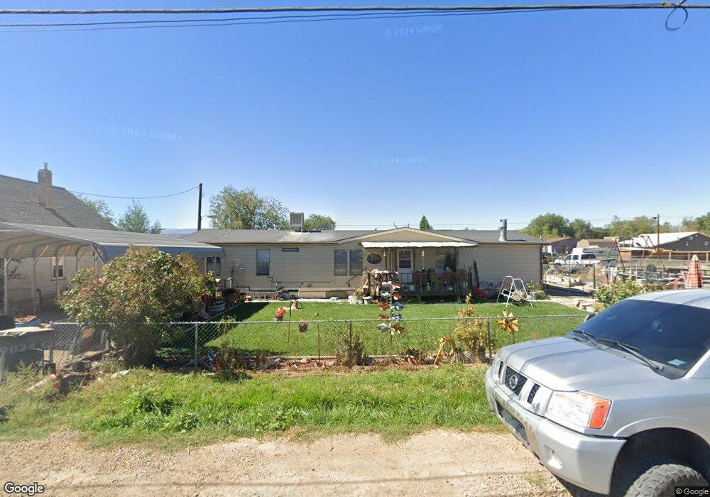
This home is located at 710 S 400 E, Price, UT 84501 and is currently estimated at $251,615, approximately $132 per square foot. 710 S 400 E is a home located in Carbon County with nearby schools including Creekview School, Mont Harmon Junior High School, and Carbon High School.
Ownership History
Date
Name
Owned For
Owner Type
Purchase Details
Closed on
Dec 17, 2021
Sold by
Ajb Holdings Llc
Bought by
Ruden Brandi and Ruden Jimmy
Current Estimated Value
Home Financials for this Owner
Home Financials are based on the most recent Mortgage that was taken out on this home.
Original Mortgage
$100,152
Outstanding Balance
$91,708
Interest Rate
3.09%
Mortgage Type
FHA
Estimated Equity
$159,907
Purchase Details
Closed on
Oct 28, 2010
Sold by
Craven Louis
Bought by
Ajb Holdings Llc
Create a Home Valuation Report for This Property
The Home Valuation Report is an in-depth analysis detailing your home's value as well as a comparison with similar homes in the area
Purchase History
| Date | Buyer | Sale Price | Title Company |
|---|---|---|---|
| Ruden Brandi | $1,226 | South Eastern Utah Title | |
| Ajb Holdings Llc | -- | South Eastern Utah Title Co |
Source: Public Records
Mortgage History
| Date | Status | Borrower | Loan Amount |
|---|---|---|---|
| Open | Ruden Brandi | $100,152 | |
| Closed | Ruden Brandi | $5,800 |
Source: Public Records
Tax History
| Year | Tax Paid | Tax Assessment Tax Assessment Total Assessment is a certain percentage of the fair market value that is determined by local assessors to be the total taxable value of land and additions on the property. | Land | Improvement |
|---|---|---|---|---|
| 2025 | $1,457 | $112,778 | $20,913 | $91,865 |
| 2024 | $1,154 | $90,886 | $16,005 | $74,881 |
| 2023 | $769 | $65,429 | $13,750 | $51,679 |
| 2022 | $511 | $38,476 | $12,986 | $25,490 |
| 2021 | $472 | $56,416 | $19,040 | $37,376 |
| 2020 | $425 | $25,473 | $0 | $0 |
| 2019 | $320 | $23,434 | $0 | $0 |
| 2018 | $311 | $23,434 | $0 | $0 |
| 2017 | $323 | $24,663 | $0 | $0 |
| 2016 | $289 | $24,663 | $0 | $0 |
| 2015 | $289 | $24,663 | $0 | $0 |
| 2014 | $284 | $24,663 | $0 | $0 |
| 2013 | $497 | $42,778 | $0 | $0 |
Source: Public Records
Map
Nearby Homes
- 8095 US Highway 6
- 513 Rose Ave
- 351 S 400 E
- 1300 S Carbon Ave Unit B
- 318 S 600 E
- 1101 S Carbon Ave Unit 24
- 1101 S Carbon Ave Unit 87
- 1101 S Carbon Ave Unit 20
- 1101 S Carbon Ave Unit 70
- 1101 S Carbon Ave Unit 93
- 1101 S Carbon Ave Unit 68
- 425 E 300 S
- 449 E 300 S
- 251 S 300 E
- 315 Giraud Ave
- 298 S 5th E
- 785 S Fairgrounds Rd
- 211 S 700 E
- 144 S 300 E
- 558 E 200 S
Your Personal Tour Guide
Ask me questions while you tour the home.