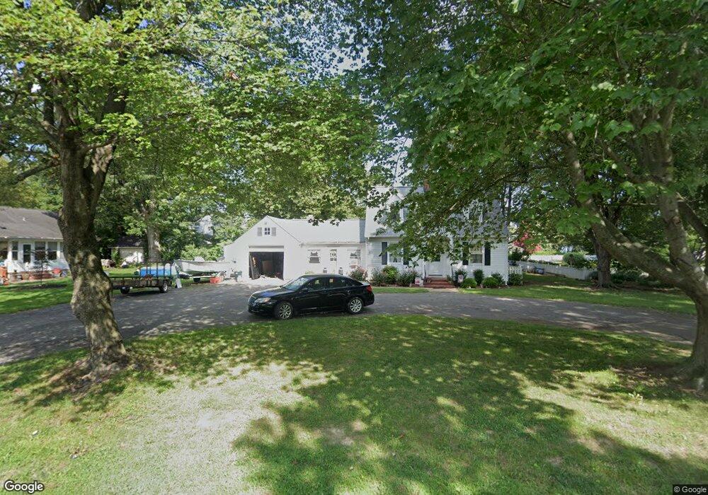
7105S Second Ave Queenstown, MD 21658
Estimated Value: $390,488 - $446,000
Studio
2
Baths
1,560
Sq Ft
$269/Sq Ft
Est. Value
About This Home
This home is located at 7105S Second Ave, Queenstown, MD 21658 and is currently estimated at $418,872, approximately $268 per square foot. 7105S Second Ave is a home located in Queen Anne's County with nearby schools including Centreville Elementary School, Kennard Elementary School, and Centreville Middle School.
Ownership History
Date
Name
Owned For
Owner Type
Purchase Details
Closed on
Jan 15, 2022
Sold by
Willis Thomas B and Willis Nola N
Bought by
Moore Amy E and Parkerson Kimberly A
Current Estimated Value
Purchase Details
Closed on
Feb 23, 2011
Sold by
Willis Dorothy W
Bought by
Willis Thomas B and Willis Nola N
Purchase Details
Closed on
Oct 23, 2000
Sold by
Willis Thomas B
Bought by
Willis Dorothy W
Create a Home Valuation Report for This Property
The Home Valuation Report is an in-depth analysis detailing your home's value as well as a comparison with similar homes in the area
Home Values in the Area
Average Home Value in this Area
Purchase History
| Date | Buyer | Sale Price | Title Company |
|---|---|---|---|
| Moore Amy E | -- | None Listed On Document | |
| Willis Thomas B | $190,000 | -- | |
| Willis Dorothy W | -- | -- |
Source: Public Records
Mortgage History
| Date | Status | Borrower | Loan Amount |
|---|---|---|---|
| Closed | Willis Thomas B | -- |
Source: Public Records
Tax History
| Year | Tax Paid | Tax Assessment Tax Assessment Total Assessment is a certain percentage of the fair market value that is determined by local assessors to be the total taxable value of land and additions on the property. | Land | Improvement |
|---|---|---|---|---|
| 2025 | $3,353 | $285,767 | $0 | $0 |
| 2024 | $3,145 | $268,100 | $131,400 | $136,700 |
| 2023 | $3,031 | $258,333 | $0 | $0 |
| 2022 | $2,640 | $248,567 | $0 | $0 |
| 2021 | $5,548 | $238,800 | $106,600 | $132,200 |
| 2020 | $5,405 | $235,867 | $0 | $0 |
| 2019 | $2,640 | $232,933 | $0 | $0 |
| 2018 | $2,603 | $230,000 | $106,600 | $123,400 |
| 2017 | $2,541 | $226,433 | $0 | $0 |
| 2016 | -- | $222,867 | $0 | $0 |
| 2015 | $2,861 | $219,300 | $0 | $0 |
| 2014 | $2,861 | $219,300 | $0 | $0 |
Source: Public Records
Map
Nearby Homes
- 100 Wall St
- 0 U S 301
- 248 Harbor Ln
- 252 Harbor Ln
- 325 Greenspring Rd
- 915 Sportsman Neck Rd
- 201 Sawmill Ln
- 141 Sawmill Ln
- 105 Port Ct
- 149 Sawmill Ln
- 155 Sawmill Ln
- 0 Forest Rd
- 816 Chester River Dr
- 107 Chestnut Ln
- 119 Watkins Rd
- 4926 Main St
- 0 Vfw Ave Unit MDQA2014970
- 0 Vfw Ave Unit MDQA2014774
- 105 Gravel Run Rd
- 959 Chester River Dr
- 7105 Second Ave
- 100 Davidson Ave
- 7100 First Ave
- 7109 Second Ave
- 7109S 2nd Ave
- 7109S Second Ave
- 7102 Second Ave
- 7119 First Ave
- 7113 Second Ave
- 7113S Second Ave
- 7024 Second Ave
- 7109 2nd Ave
- 7102S Second Ave
- 7024S Second Ave
- 7024S 2nd Ave
- 7024 S S 2nd Ave
- 7024 S 2nd Ave S
- 7112 2nd Ave
- 7112 Second Ave
- 7112 Second Ave
Your Personal Tour Guide
Ask me questions while you tour the home.