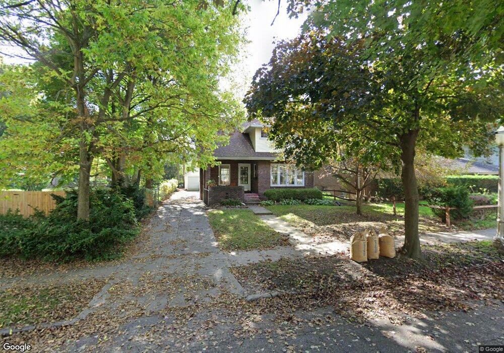
711 Britten Ave Lansing, MI 48910
Moores Park NeighborhoodEstimated Value: $166,320 - $189,000
3
Beds
1
Bath
1,559
Sq Ft
$115/Sq Ft
Est. Value
About This Home
This home is located at 711 Britten Ave, Lansing, MI 48910 and is currently estimated at $179,830, approximately $115 per square foot. 711 Britten Ave is a home located in Ingham County with nearby schools including Averill Elementary School, Pattengill Academy, and J.W. Sexton High School.
Ownership History
Date
Name
Owned For
Owner Type
Purchase Details
Closed on
Jun 8, 2006
Sold by
Samsel Patrick C and Samsel Martha A
Bought by
James Jeremy
Current Estimated Value
Home Financials for this Owner
Home Financials are based on the most recent Mortgage that was taken out on this home.
Original Mortgage
$102,150
Outstanding Balance
$60,425
Interest Rate
6.68%
Mortgage Type
Purchase Money Mortgage
Estimated Equity
$119,405
Create a Home Valuation Report for This Property
The Home Valuation Report is an in-depth analysis detailing your home's value as well as a comparison with similar homes in the area
Home Values in the Area
Average Home Value in this Area
Purchase History
We collect this data history from publicly available records. To have your information removed, we recommend requesting removal directly through your county’s website.
| Date | Buyer | Sale Price | Title Company |
|---|---|---|---|
| James Jeremy | $113,500 | Fatic |
Source: Public Records
Mortgage History
We collect this data history from publicly available records. To have your information removed, we recommend requesting removal directly through your county’s website.
| Date | Status | Borrower | Loan Amount |
|---|---|---|---|
| Open | James Jeremy | $102,150 |
Source: Public Records
Tax History
| Year | Tax Paid | Tax Assessment Tax Assessment Total Assessment is a certain percentage of the fair market value that is determined by local assessors to be the total taxable value of land and additions on the property. | Land | Improvement |
|---|---|---|---|---|
| 2025 | $2,843 | $76,100 | $8,800 | $67,300 |
| 2024 | $23 | $69,800 | $8,800 | $61,000 |
| 2023 | $2,675 | $63,100 | $8,800 | $54,300 |
| 2022 | $2,443 | $59,400 | $9,000 | $50,400 |
| 2021 | $2,386 | $34,600 | $7,800 | $26,800 |
| 2020 | $2,370 | $32,700 | $7,800 | $24,900 |
| 2019 | $2,289 | $31,100 | $7,800 | $23,300 |
| 2018 | $2,171 | $30,500 | $7,800 | $22,700 |
| 2017 | $2,089 | $30,500 | $7,800 | $22,700 |
| 2016 | $2,023 | $27,900 | $7,800 | $20,100 |
| 2015 | $2,023 | $27,000 | $15,690 | $11,310 |
| 2014 | $2,023 | $26,800 | $18,921 | $7,879 |
Source: Public Records
Map
Nearby Homes
- 915 Braman St
- 1027 Britten Ave
- 1120 Alsdorf St
- 516 Smith Ave
- 1823 Delevan Ave
- 1824 S Rundle Ave
- 612 W Mount Hope Ave
- 1116 George St
- 1309 Hammond St
- 712 Lenore Ave
- 216 Reo Ave Unit 1,2,3
- 139 Woodlawn Ave
- 1633 Park Ave
- 1408 Reo Ave
- 1406 Reo Ave
- 1816 Todd Ave
- 211 W Barnes Ave
- 1601 Coleman Ave
- 1209 W Mount Hope Ave
- 1612 S Washington Ave
- 707 Moores River Dr
- 705 Moores River Dr
- 717 Moores River Dr
- 706 Britten Ave
- 1415 Hess Ave
- 1423 Hess Ave
- 721 Moores River Dr
- 716 Britten Ave
- 718 Britten Ave
- 725 Moores River Dr
- 722 Britten Ave
- 701 Britten Ave
- 1416 Hess Ave
- 1412 Hess Ave
- 1420 Hess Ave
- 1410 Hess Ave
- 717 Britten Ave
- 1428 Hess Ave
- 1434 Hess Ave
- 723 Britten Ave
Your Personal Tour Guide
Ask me questions while you tour the home.