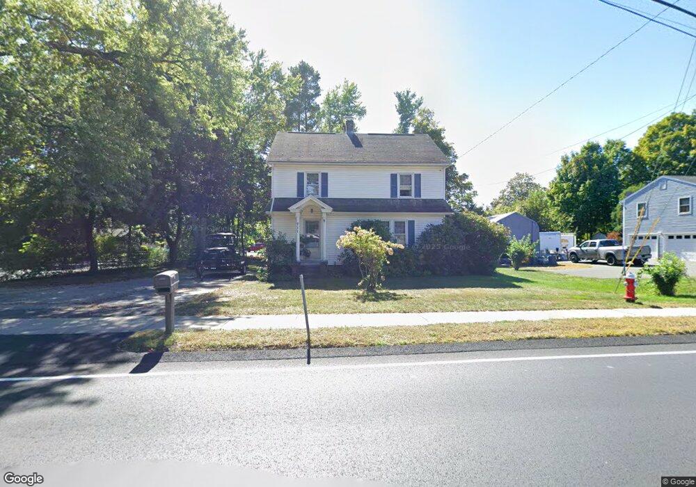
711 Morgan Rd West Springfield, MA 01089
Estimated Value: $359,341 - $408,000
3
Beds
1
Bath
1,742
Sq Ft
$225/Sq Ft
Est. Value
About This Home
This home is located at 711 Morgan Rd, West Springfield, MA 01089 and is currently estimated at $391,335, approximately $224 per square foot. 711 Morgan Rd is a home located in Hampden County with nearby schools including West Springfield High School, Hampden Charter School of Science West, and St Thomas The Apostle School.
Ownership History
Date
Name
Owned For
Owner Type
Purchase Details
Closed on
Jul 30, 2015
Sold by
Krawczynski Gail L and Cotton Lorrie P
Bought by
Cotton Lorrie P
Current Estimated Value
Purchase Details
Closed on
Dec 27, 2011
Sold by
Whitaker Harold W
Bought by
Krawczynski Gail L and Cotton Lorrie P
Create a Home Valuation Report for This Property
The Home Valuation Report is an in-depth analysis detailing your home's value as well as a comparison with similar homes in the area
Home Values in the Area
Average Home Value in this Area
Purchase History
We collect this data history from publicly available records. To have your information removed, we recommend requesting removal directly through your county’s website.
| Date | Buyer | Sale Price | Title Company |
|---|---|---|---|
| Cotton Lorrie P | -- | -- | |
| Krawczynski Gail L | -- | -- |
Source: Public Records
Tax History
| Year | Tax Paid | Tax Assessment Tax Assessment Total Assessment is a certain percentage of the fair market value that is determined by local assessors to be the total taxable value of land and additions on the property. | Land | Improvement |
|---|---|---|---|---|
| 2025 | $4,297 | $289,000 | $114,000 | $175,000 |
| 2024 | $4,051 | $273,500 | $114,000 | $159,500 |
| 2023 | $3,857 | $248,200 | $114,000 | $134,200 |
| 2022 | $3,478 | $220,700 | $103,500 | $117,200 |
| 2021 | $3,179 | $188,100 | $82,300 | $105,800 |
| 2020 | $3,196 | $188,100 | $82,300 | $105,800 |
| 2019 | $3,190 | $188,100 | $82,300 | $105,800 |
| 2018 | $3,207 | $188,100 | $82,300 | $105,800 |
| 2017 | $3,207 | $188,100 | $82,300 | $105,800 |
| 2016 | $3,114 | $183,300 | $77,500 | $105,800 |
| 2015 | $3,055 | $179,800 | $76,000 | $103,800 |
| 2014 | $741 | $179,800 | $76,000 | $103,800 |
Source: Public Records
Map
Nearby Homes
- 300 Circle Dr
- 0 Ahiska Rd Unit 73477754
- 1193 Amostown Rd
- 72 Paulson Dr
- 51 Lantern Ln
- 1211 Piper Rd
- 71 Jennifer Dr
- 125 Lennys Way
- 25 Piper Cross Rd
- 291 Forest Glen
- 543 Amostown Rd
- 1318 Piper Rd
- 36 Shady Brook
- 38 Shady Brook
- 2 Windpath E
- 256 Morton St
- 13 Parkwood Dr
- 514 Dewey St
- 65 Verdugo St
- 3 John Dr
Your Personal Tour Guide
Ask me questions while you tour the home.