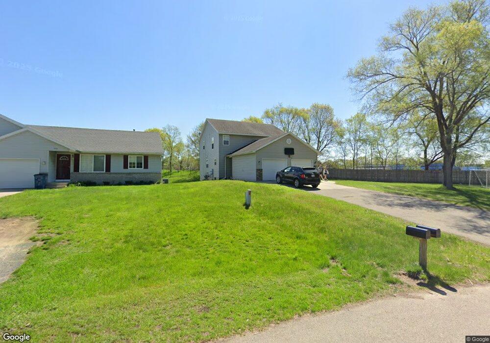
7110 10th Ave Unit 7112 Jenison, MI 49428
Jenison AreaEstimated Value: $450,009
About This Home
This home is located at 7110 10th Ave Unit 7112, Jenison, MI 49428 and is currently priced at $450,009, approximately $219 per square foot. 7110 10th Ave Unit 7112 is a home located in Ottawa County.
Ownership History
We collect this data history from publicly available records. To have your information removed, we recommend requesting removal directly through your county’s website.
Purchase Details
Purchase Details
Home Financials for this Owner
Home Financials are based on the most recent Mortgage that was taken out on this home.Purchase Details
Home Values in the Area
Average Home Value in this Area
Purchase History
We collect this data history from publicly available records. To have your information removed, we recommend requesting removal directly through your county’s website.
| Date | Buyer | Sale Price | Title Company |
|---|---|---|---|
| -- | None Listed On Document | ||
| $196,000 | Lighthouse Title Inc | ||
| -- | -- |
Mortgage History
We collect this data history from publicly available records. To have your information removed, we recommend requesting removal directly through your county’s website.
| Date | Status | Borrower | Loan Amount |
|---|---|---|---|
| Previous Owner | $110,000 | ||
| Previous Owner | $147,000 |
Tax History
We collect this data history from publicly available records. To have your information removed, we recommend requesting removal directly through your county’s website.
| Year | Tax Paid | Tax Assessment Tax Assessment Total Assessment is a certain percentage of the fair market value that is determined by local assessors to be the total taxable value of land and additions on the property. | Land | Improvement |
|---|---|---|---|---|
| 2026 | $5,353 | $196,200 | $0 | $0 |
| 2025 | $4,924 | $185,400 | $0 | $0 |
| 2024 | $48 | $162,600 | $0 | $0 |
| 2023 | $4,532 | $133,000 | $0 | $0 |
| 2022 | $4,696 | $132,200 | $0 | $0 |
| 2021 | $4,475 | $122,700 | $0 | $0 |
| 2020 | $4,434 | $118,600 | $0 | $0 |
| 2019 | $4,453 | $108,900 | $0 | $0 |
| 2018 | $4,229 | $106,500 | $0 | $0 |
| 2017 | $4,145 | $104,000 | $0 | $0 |
| 2016 | $4,134 | $97,500 | $0 | $0 |
| 2015 | $3,989 | $92,100 | $0 | $0 |
| 2014 | $3,989 | $91,300 | $0 | $0 |
Map
- 1095 Vos St
- 7367 Terrace Ln
- 6873 11th Ave
- 7543 Walnut Ave
- 7470 Louise Ave
- 775 Port Sheldon St Unit 13
- 6736 Waterview Dr SW Unit 69
- 7530 Boulder Bluff Dr Unit 47
- 7695 Thomas Ave
- 7105 Southwood Dr
- 7439 Eastlane Ave
- 689 Carriage Ln Unit 79
- 6543 W Meadowlark Dr
- 1041 Village Ln Unit 225
- 1009 Village Ln Unit 210
- 905 Village Ln
- 171 Sunnybrook Dr SW
- 1011 Fairfield Dr
- 7467 Pinegrove Dr
- 6274 Derek Dr
- 1010 Koster St
- 1020 Koster St
- 1034 Koster St
- 1034 Koster St Unit 1036
- 7110 10th Ave
- 7125 10th Ave
- 7126 10th Ave
- 7126 10th Ave Unit 7128
- 1023 Koster St
- 1023 Koster St Unit 1025
- 1044 Koster St
- 7128 10th Ave
- 1035 Koster St
- 1056 Koster St
- 1047 Koster St
- 7144 10th Ave
- 1010 Vos St
- 1057 Koster St
- 1024 Vos St
- 1070 Koster St
Ask me questions while you tour the home.