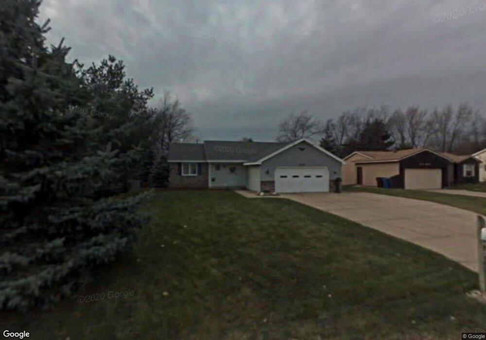
7117 Olde Farm Dr Jenison, MI 49428
Estimated Value: $338,152 - $372,000
3
Beds
2
Baths
1,060
Sq Ft
$337/Sq Ft
Est. Value
About This Home
This home is located at 7117 Olde Farm Dr, Jenison, MI 49428 and is currently estimated at $357,538, approximately $337 per square foot. 7117 Olde Farm Dr is a home located in Ottawa County with nearby schools including Rosewood Elementary School, Jenison Junior High School, and Jenison High School.
Ownership History
Date
Name
Owned For
Owner Type
Purchase Details
Closed on
Mar 18, 2023
Sold by
Wohlford Connie L
Bought by
Wohlford Connie L and Johnson Debra L
Current Estimated Value
Purchase Details
Closed on
Aug 11, 2015
Sold by
Johnson Debra L
Bought by
Wohlford Connie L and Johnson Debra L
Purchase Details
Closed on
Jun 25, 2015
Sold by
Wohlford Connie L
Bought by
Johnson Debra L
Create a Home Valuation Report for This Property
The Home Valuation Report is an in-depth analysis detailing your home's value as well as a comparison with similar homes in the area
Home Values in the Area
Average Home Value in this Area
Purchase History
We collect this data history from publicly available records. To have your information removed, we recommend requesting removal directly through your county’s website.
| Date | Buyer | Sale Price | Title Company |
|---|---|---|---|
| Wohlford Connie L | -- | None Listed On Document | |
| Wohlford Connie L | -- | None Listed On Document | |
| Wohlford Connie L | -- | None Available | |
| Johnson Debra L | -- | None Available |
Source: Public Records
Tax History
| Year | Tax Paid | Tax Assessment Tax Assessment Total Assessment is a certain percentage of the fair market value that is determined by local assessors to be the total taxable value of land and additions on the property. | Land | Improvement |
|---|---|---|---|---|
| 2025 | $1,985 | $155,900 | $0 | $0 |
| 2024 | $19 | $138,000 | $0 | $0 |
| 2023 | $1,821 | $128,100 | $0 | $0 |
| 2022 | $1,999 | $111,800 | $0 | $0 |
| 2021 | $1,941 | $99,700 | $0 | $0 |
| 2020 | $1,920 | $91,500 | $0 | $0 |
| 2019 | $1,922 | $84,500 | $0 | $0 |
| 2018 | $1,792 | $81,100 | $0 | $0 |
| 2017 | $1,761 | $79,100 | $0 | $0 |
| 2016 | $2,879 | $72,100 | $0 | $0 |
| 2015 | $1,670 | $67,600 | $0 | $0 |
| 2014 | $1,670 | $64,600 | $0 | $0 |
Source: Public Records
Map
Nearby Homes
- 2556 Windcrest St
- 1908 Elizabeth Ln Unit 123
- 2595 Rosewood St
- 1852 Elizabeth Ln Unit 77
- 7384 Pinegrove Dr
- 2225 Baldwin St
- 7249 Heatherwood Dr
- 7130 28th Ave
- 1745 Westwood Ct
- 2754 Fairbrook Dr
- 7041 28th Ave
- 7486 Pinegrove Dr
- 2739 Cedar Grove N
- 7702 Park Lane Ave
- 1750 Jason Ct
- 7439 Eastlane Ave
- 6748 28th Ave
- 6724 28th Ave
- 7117 Sunset Ave
- 9067 Hollace Ct
- 7125 Olde Farm Dr
- 7109 Olde Farm Dr
- 7118 23rd Ave
- 7139 Olde Farm Dr
- 7095 Olde Farm Dr
- 7134 23rd Ave
- 7104 23rd Ave
- 2228 Sandstone Dr
- 7147 Olde Farm Dr
- 7087 Olde Farm Dr
- 2227 Oak Hollow Dr
- 2231 Sandstone Dr
- 7150 23rd Ave
- 7092 23rd Ave
- 2216 Sandstone Dr
- 7079 Olde Farm Dr
- 2215 Oak Hollow Dr
- 7155 Olde Farm Dr
- 2219 Sandstone Dr
- 7154 Olde Farm Dr
Your Personal Tour Guide
Ask me questions while you tour the home.