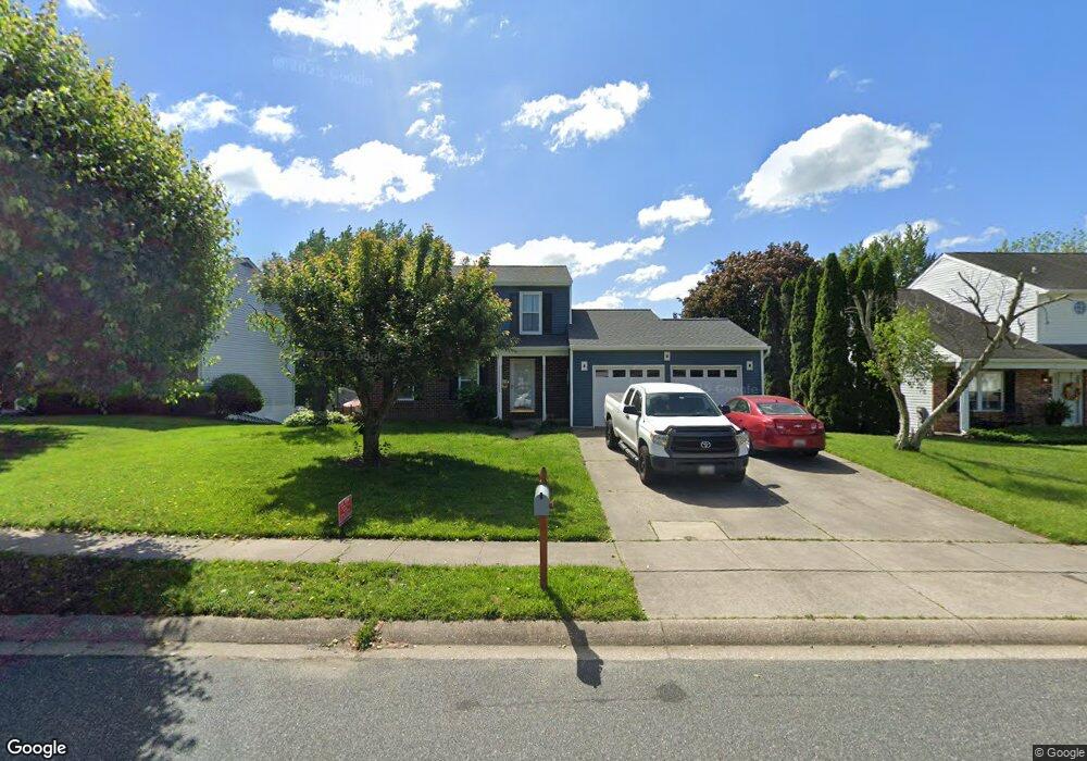
713 High Plain Dr Bel Air, MD 21014
Estimated Value: $459,000 - $515,000
Studio
3
Baths
1,738
Sq Ft
$283/Sq Ft
Est. Value
About This Home
This home is located at 713 High Plain Dr, Bel Air, MD 21014 and is currently estimated at $491,288, approximately $282 per square foot. 713 High Plain Dr is a home located in Harford County with nearby schools including Homestead-Wakefield Elementary School, Bel Air Middle School, and Bel Air High School.
Ownership History
Date
Name
Owned For
Owner Type
Purchase Details
Closed on
Feb 19, 2021
Sold by
Dodson James and Dodson Anne Haggerty
Bought by
Dodson James
Current Estimated Value
Home Financials for this Owner
Home Financials are based on the most recent Mortgage that was taken out on this home.
Original Mortgage
$272,000
Outstanding Balance
$243,274
Interest Rate
2.7%
Mortgage Type
New Conventional
Estimated Equity
$248,014
Purchase Details
Closed on
Jan 14, 2004
Sold by
Lawer Lewis E
Bought by
Dodson James and Haggerty Anne
Purchase Details
Closed on
Sep 8, 1983
Sold by
Universal Management Corp
Bought by
Lawer Lewis E
Home Financials for this Owner
Home Financials are based on the most recent Mortgage that was taken out on this home.
Original Mortgage
$67,000
Interest Rate
13.77%
Create a Home Valuation Report for This Property
The Home Valuation Report is an in-depth analysis detailing your home's value as well as a comparison with similar homes in the area
Home Values in the Area
Average Home Value in this Area
Purchase History
| Date | Buyer | Sale Price | Title Company |
|---|---|---|---|
| Dodson James | -- | Accommodation | |
| Dodson James | $259,900 | -- | |
| Lawer Lewis E | $84,700 | -- |
Source: Public Records
Mortgage History
| Date | Status | Borrower | Loan Amount |
|---|---|---|---|
| Open | Dodson James | $272,000 | |
| Previous Owner | Lawer Lewis E | $67,000 | |
| Closed | Dodson James | -- |
Source: Public Records
Tax History
| Year | Tax Paid | Tax Assessment Tax Assessment Total Assessment is a certain percentage of the fair market value that is determined by local assessors to be the total taxable value of land and additions on the property. | Land | Improvement |
|---|---|---|---|---|
| 2025 | $4,020 | $408,700 | $93,700 | $315,000 |
| 2024 | $4,020 | $383,467 | $0 | $0 |
| 2023 | $3,820 | $358,233 | $0 | $0 |
| 2022 | $3,629 | $333,000 | $93,700 | $239,300 |
| 2021 | $3,668 | $325,433 | $0 | $0 |
| 2020 | $3,668 | $317,867 | $0 | $0 |
| 2019 | $3,581 | $310,300 | $112,300 | $198,000 |
| 2018 | $3,511 | $307,033 | $0 | $0 |
| 2017 | $3,474 | $310,300 | $0 | $0 |
| 2016 | -- | $300,500 | $0 | $0 |
| 2015 | $3,332 | $299,000 | $0 | $0 |
| 2014 | $3,332 | $297,500 | $0 | $0 |
Source: Public Records
Map
Nearby Homes
- 604 Fox Bow Dr
- 1049 Sansa Ct
- 619 Ponderosa Dr
- 637 Iron Gate Rd
- 722 Iron Gate Rd
- 699 Iron Gate Rd
- 116 Hibiscus Ct
- 707 Shady Creek Ct
- 1264 Colonnade Ln
- 731 Shady Creek Ct
- 614 Camelot Dr
- 207 Hillendale Rd
- 537 Park Manor Cir
- 1500 S Tollgate Rd
- 9 E Ring Factory Rd
- 606 Squire Ln Unit G
- 606 Squire Ln Unit 606-A
- 601 Thames Way Unit E
- 724 Montravel Ct
- 298 Canterbury Rd Unit 298-M
- 711 High Plain Dr
- 715 High Plain Dr
- 700 Mayton Ct
- 701 Mayton Ct
- 709 High Plain Dr
- 717 High Plain Dr
- 703 Foot Hill Rd
- 716 High Plain Dr
- 703 Mayton Ct
- 702 Mayton Ct
- 707 High Plain Dr
- 714 High Plain Dr
- 705 Foot Hill Rd
- 720 High Plain Dr
- 705 Mayton Ct
- 704 Mayton Ct
- 702 Mustang Ct
- 712 High Plain Dr
- 707 Foot Hill Rd
- 722 High Plain Dr
Your Personal Tour Guide
Ask me questions while you tour the home.