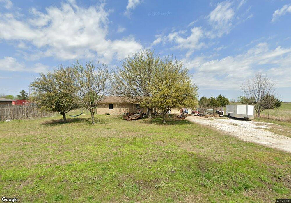
7136 Michael Rd Sanger, TX 76266
Estimated Value: $318,423 - $415,000
About This Home
This home is located at 7136 Michael Rd, Sanger, TX 76266 and is currently estimated at $367,856, approximately $288 per square foot. 7136 Michael Rd is a home located in Denton County with nearby schools including Chisholm Trail Elementary School, Clear Creek Intermediate School, and Sanger Sixth Grade Campus.
Ownership History
We collect this data history from publicly available records. To have your information removed, we recommend requesting removal directly through your county’s website.
Purchase Details
Purchase Details
Home Financials for this Owner
Home Financials are based on the most recent Mortgage that was taken out on this home.Home Values in the Area
Average Home Value in this Area
Purchase History
We collect this data history from publicly available records. To have your information removed, we recommend requesting removal directly through your county’s website.
| Date | Buyer | Sale Price | Title Company |
|---|---|---|---|
| $70,214 | -- | ||
| -- | -- |
Tax History
We collect this data history from publicly available records. To have your information removed, we recommend requesting removal directly through your county’s website.
| Year | Tax Paid | Tax Assessment Tax Assessment Total Assessment is a certain percentage of the fair market value that is determined by local assessors to be the total taxable value of land and additions on the property. | Land | Improvement |
|---|---|---|---|---|
| 2025 | $3,746 | $236,453 | $122,000 | $114,453 |
| 2024 | $3,746 | $276,000 | $122,000 | $154,000 |
| 2023 | $3,832 | $280,764 | $122,000 | $158,764 |
| 2022 | $2,930 | $176,649 | $54,500 | $122,149 |
| 2021 | $2,326 | $159,409 | $50,000 | $109,409 |
| 2020 | $2,334 | $148,544 | $50,000 | $98,544 |
| 2019 | $2,324 | $142,000 | $50,000 | $92,000 |
| 2018 | $2,061 | $125,000 | $40,000 | $85,000 |
| 2017 | $2,026 | $122,000 | $40,000 | $82,000 |
| 2016 | $1,577 | $95,000 | $26,000 | $69,000 |
| 2015 | $1,425 | $89,000 | $26,000 | $63,000 |
| 2013 | -- | $79,351 | $26,000 | $53,351 |
Map
- 1958 Crockett St
- 7014 Davidson Rd
- 7140 Davidson Rd
- 9238 Indian Trail
- 7429 Stonehenge Dr
- 7425 Stonehenge Dr
- 7421 Stonehenge Dr
- 7417 Stonehenge Dr
- 7413 Stonehenge Dr
- 7405 Stonehenge Dr
- 6044 Mango Dr
- 6501 Indian Trail
- 8875 Fm 2450
- 9517 Indian Trail
- 7404 Stonehenge Dr
- TBD Michael Rd
- 6037 Amber Dr
- 6025 Mango Dr
- 6552 Private Rd 6601
- 8572 Houston Rd
- 7059 Michael Rd
- 7135 Michael Rd
- 7193 Michael Rd
- 7111 Michael Rd
- 7200 Michael Rd
- 7077 Michael Rd
- 6811 Michael Rd
- 7024 Michael Rd
- 7166 Michael Rd
- 7308 Michael Rd
- 6979 Michael Rd
- 2122 Crockett St
- 7319 Michael Rd
- 2151 Crockett St
- 6943 Michael Rd
- 7368 Michael Rd
- 2191 Crockett Rd
- 7373 Michael Rd
- 6898 Michael Rd
- 7111 Davidson Rd
Ask me questions while you tour the home.