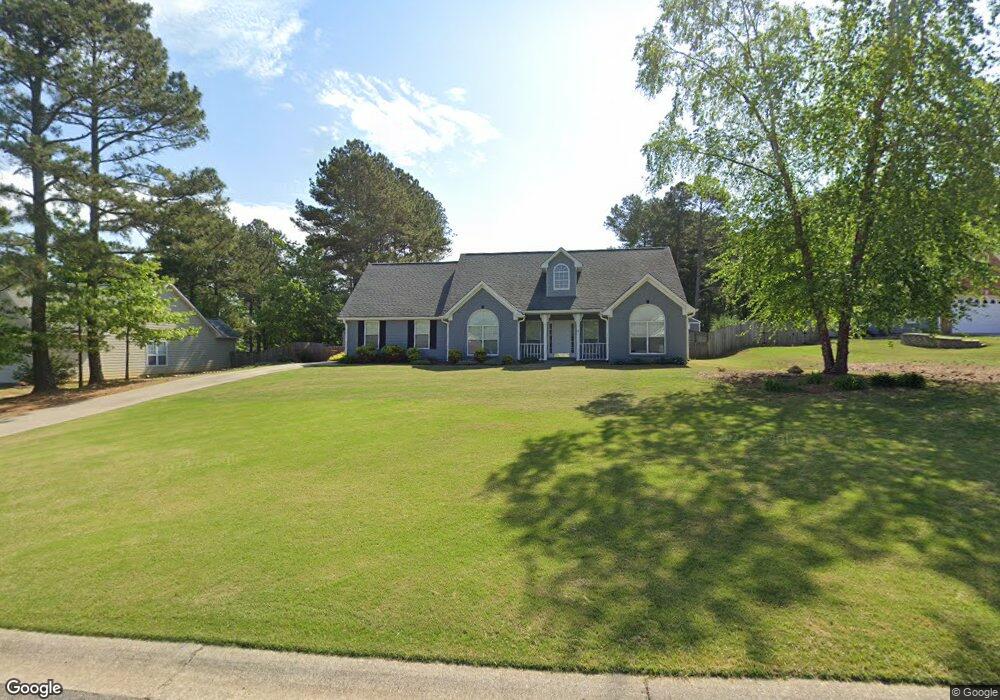
715 Michael Dr Unit 1 Winder, GA 30680
Estimated Value: $317,963 - $368,000
Studio
2
Baths
1,664
Sq Ft
$205/Sq Ft
Est. Value
About This Home
This home is located at 715 Michael Dr Unit 1, Winder, GA 30680 and is currently estimated at $341,241, approximately $205 per square foot. 715 Michael Dr Unit 1 is a home located in Barrow County with nearby schools including County Line Elementary School, Russell Middle School, and Winder-Barrow High School.
Ownership History
Date
Name
Owned For
Owner Type
Purchase Details
Closed on
Oct 2, 1998
Sold by
Loran Homes Inc
Bought by
Mutchler Steven J and Mutchler Kathleen
Current Estimated Value
Home Financials for this Owner
Home Financials are based on the most recent Mortgage that was taken out on this home.
Original Mortgage
$60,000
Interest Rate
6.96%
Mortgage Type
New Conventional
Purchase Details
Closed on
Aug 1, 1997
Sold by
D & R Devel
Bought by
Loran Homes
Home Financials for this Owner
Home Financials are based on the most recent Mortgage that was taken out on this home.
Original Mortgage
$92,036
Interest Rate
10.5%
Mortgage Type
New Conventional
Purchase Details
Closed on
Jul 16, 1996
Bought by
D & R Development In
Create a Home Valuation Report for This Property
The Home Valuation Report is an in-depth analysis detailing your home's value as well as a comparison with similar homes in the area
Home Values in the Area
Average Home Value in this Area
Purchase History
| Date | Buyer | Sale Price | Title Company |
|---|---|---|---|
| Mutchler Steven J | $125,000 | -- | |
| Loran Homes | $20,000 | -- | |
| Loran Homes Inc | $20,000 | -- | |
| D & R Development In | -- | -- |
Source: Public Records
Mortgage History
| Date | Status | Borrower | Loan Amount |
|---|---|---|---|
| Closed | Mutchler Steven J | $60,000 | |
| Previous Owner | Loran Homes Inc | $92,036 |
Source: Public Records
Tax History
| Year | Tax Paid | Tax Assessment Tax Assessment Total Assessment is a certain percentage of the fair market value that is determined by local assessors to be the total taxable value of land and additions on the property. | Land | Improvement |
|---|---|---|---|---|
| 2025 | $684 | $110,928 | $27,200 | $83,728 |
| 2024 | $2,409 | $108,480 | $27,200 | $81,280 |
| 2023 | $1,998 | $108,880 | $27,200 | $81,680 |
| 2022 | $2,200 | $84,256 | $20,000 | $64,256 |
| 2021 | $1,892 | $66,788 | $16,400 | $50,388 |
| 2020 | $1,778 | $62,007 | $13,600 | $48,407 |
| 2019 | $1,758 | $60,026 | $13,600 | $46,426 |
| 2018 | $1,641 | $56,064 | $13,600 | $42,464 |
| 2017 | $1,398 | $48,004 | $13,600 | $34,404 |
| 2016 | $1,370 | $47,186 | $13,600 | $33,586 |
| 2015 | $1,388 | $47,576 | $13,600 | $33,976 |
| 2014 | $1,225 | $41,814 | $7,448 | $34,366 |
| 2013 | -- | $40,192 | $7,448 | $32,744 |
Source: Public Records
Map
Nearby Homes
- 716 Michael Dr
- 615 Wellington Dr
- 311 Rockwell Church Rd NW
- 879 Hawk Creek Trail
- 569 Maddox Rd
- 932 Century Oak Dr
- 128 Northridge Dr
- 909 Century Oak Dr Unit 2
- 139 Ashwood Ct
- 536 Valley View Dr
- 857 Laurel Ln
- 403 Ryan Cir
- 2050 Whispering Way
- 845 Idlewood Rd
- 27 Creekside Dr
- 0 Gainesville Hwy Unit 10712053
- 0 E Northcrest Dr Unit 10648147
- 469 Plantation Dr
- 236 Hidden Ct
- 553 Rockwell Church Rd NW
- 719 Michael Dr
- 711 Michael Dr
- 721 Michael Dr Unit 1
- 709 Michael Dr
- 810 Carmon Ct Unit 2
- 807 Carmon Ct
- 714 Michael Dr
- 725 Michael Dr Unit 1
- 707 Michael Dr
- 710 Michael Dr
- 720 Michael Dr
- 708 Michael Dr Unit 1
- 708 Michael Dr
- 708 Michael Dr Unit 5
- 722 Michael Dr
- 724 Michael Dr
- 724 Michael Dr
- 729 Michael Dr Unit 1
- 705 Michael Dr Unit 1
- 706 Michael Dr
Your Personal Tour Guide
Ask me questions while you tour the home.