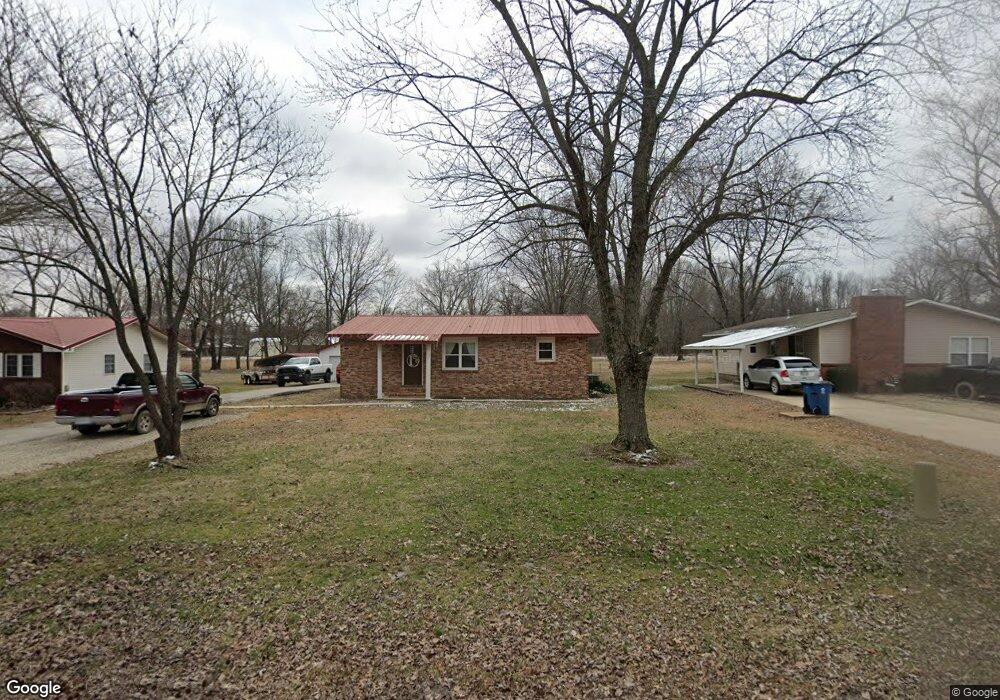
715 Northwest St Bloomfield, MO 63825
Estimated Value: $122,000 - $147,000
About This Home
This home is located at 715 Northwest St, Bloomfield, MO 63825 and is currently estimated at $136,785, approximately $101 per square foot. 715 Northwest St is a home located in Stoddard County with nearby schools including Bloomfield Elementary School, Bloomfield Middle School, and Bloomfield High School.
Ownership History
We collect this data history from publicly available records. To have your information removed, we recommend requesting removal directly through your county’s website.
Purchase Details
Home Financials for this Owner
Home Financials are based on the most recent Mortgage that was taken out on this home.Purchase Details
Home Financials for this Owner
Home Financials are based on the most recent Mortgage that was taken out on this home.Purchase History
We collect this data history from publicly available records. To have your information removed, we recommend requesting removal directly through your county’s website.
| Date | Buyer | Sale Price | Title Company |
|---|---|---|---|
| $119,996 | National Title & Escrow Inc | ||
| $102,109 | National Title & Escrow Inc |
Mortgage History
We collect this data history from publicly available records. To have your information removed, we recommend requesting removal directly through your county’s website.
| Date | Status | Borrower | Loan Amount |
|---|---|---|---|
| Open | $118,808 | ||
| Previous Owner | $104,193 |
Tax History
We collect this data history from publicly available records. To have your information removed, we recommend requesting removal directly through your county’s website.
| Year | Tax Paid | Tax Assessment Tax Assessment Total Assessment is a certain percentage of the fair market value that is determined by local assessors to be the total taxable value of land and additions on the property. | Land | Improvement |
|---|---|---|---|---|
| 2025 | $706 | $13,167 | $0 | $0 |
| 2024 | $7 | $12,179 | $0 | $0 |
| 2023 | $655 | $12,179 | $0 | $0 |
| 2022 | $618 | $11,476 | $0 | $0 |
| 2021 | $617 | $11,476 | $0 | $0 |
| 2020 | $527 | $11,001 | $0 | $0 |
| 2019 | $527 | $11,191 | $0 | $0 |
| 2018 | $518 | $11,001 | $0 | $0 |
| 2016 | $503 | $10,697 | $0 | $0 |
| 2015 | -- | $10,697 | $0 | $0 |
| 2014 | -- | $10,621 | $0 | $0 |
| 2013 | -- | $0 | $0 | $0 |
Map
- 203 Depot Rd
- 301 Cape Rd
- 301 W Shawnee St
- 707 S Prairie St
- 16501 County Road 420
- 16763 County Road 511
- 0 E Hwy Unit MIS26003606
- 15723 County Road 533a
- 0 County Road 237
- 14089 County Road 405
- 14038 County Road 405
- 16987 County Road 470
- 16911 Christian Dr
- 17173 E Cedar Hills Dr
- 0 E Kenton Rd Unit MAR25009938
- 18328 Lake Circle Dr
- 25097 State Highway 25
- 130 Hunt St
- Lot 4 Breezeway Dr
- 1008 N Mulberry St
- 705 Cate Dr
- 717 Northwest St
- 718 Northwest St
- 723 Northwest St
- 701 Cate Dr
- 713 Northwest St
- 711 Northwest St
- 700 Cate Dr
- 18501 Northwest St
- 708 Northwest St
- 709 Northwest St
- 803 Northwest St
- 707 Northwest St
- 715 Depot Rd
- 705 Northwest St
- 713 Depot Rd
- 601 Guiling St
- 711 Depot Rd
- 607 Guiling St
- 605 Guiling St
Ask me questions while you tour the home.