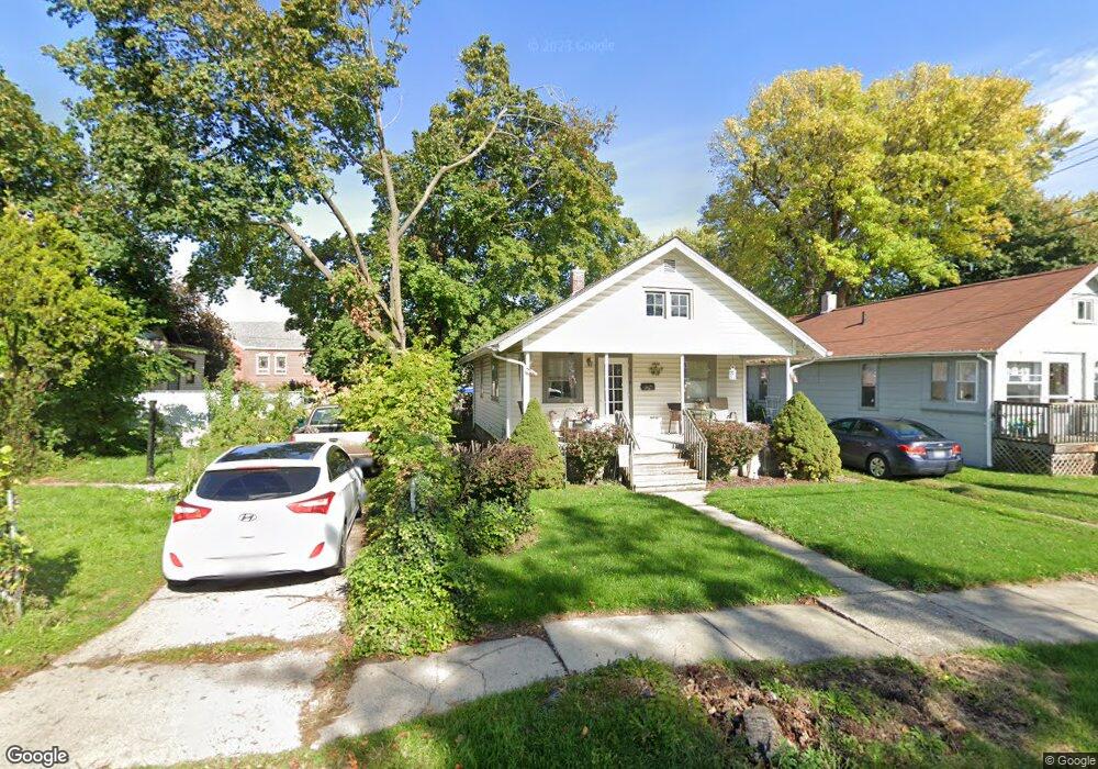
716 Lenore Ave Lansing, MI 48910
Greencroft Park NeighborhoodEstimated Value: $76,412 - $94,000
Studio
--
Bath
616
Sq Ft
$138/Sq Ft
Est. Value
About This Home
This home is located at 716 Lenore Ave, Lansing, MI 48910 and is currently estimated at $85,103, approximately $138 per square foot. 716 Lenore Ave is a home located in Ingham County with nearby schools including Averill Elementary School, Attwood School, and J.W. Sexton High School.
Ownership History
Date
Name
Owned For
Owner Type
Purchase Details
Closed on
Dec 8, 2004
Sold by
Busch Claire A and Busch Lisa K
Bought by
Busch Development Llc
Current Estimated Value
Purchase Details
Closed on
Feb 11, 2000
Sold by
Busch Claire
Bought by
Busch Claire and Busch Lisa K
Purchase Details
Closed on
Dec 9, 1999
Sold by
Strouse Stacey and Tarver Stacey
Bought by
Busch Claire
Home Financials for this Owner
Home Financials are based on the most recent Mortgage that was taken out on this home.
Original Mortgage
$30,600
Interest Rate
7.87%
Mortgage Type
Purchase Money Mortgage
Purchase Details
Closed on
Oct 28, 1996
Sold by
Holland Betty B
Bought by
Tarver Stacey
Create a Home Valuation Report for This Property
The Home Valuation Report is an in-depth analysis detailing your home's value as well as a comparison with similar homes in the area
Home Values in the Area
Average Home Value in this Area
Purchase History
| Date | Buyer | Sale Price | Title Company |
|---|---|---|---|
| Busch Development Llc | -- | -- | |
| Busch Claire | -- | Midstate Title Company | |
| Busch Claire | $34,000 | Midstate Title Company | |
| Tarver Stacey | $41,500 | -- |
Source: Public Records
Mortgage History
| Date | Status | Borrower | Loan Amount |
|---|---|---|---|
| Previous Owner | Busch Claire | $30,600 |
Source: Public Records
Tax History
| Year | Tax Paid | Tax Assessment Tax Assessment Total Assessment is a certain percentage of the fair market value that is determined by local assessors to be the total taxable value of land and additions on the property. | Land | Improvement |
|---|---|---|---|---|
| 2025 | $2,170 | $38,200 | $5,100 | $33,100 |
| 2024 | $18 | $35,200 | $5,100 | $30,100 |
| 2023 | $2,043 | $31,000 | $5,100 | $25,900 |
| 2022 | $1,868 | $29,300 | $6,500 | $22,800 |
| 2021 | $1,825 | $26,800 | $5,500 | $21,300 |
| 2020 | $1,812 | $24,100 | $5,500 | $18,600 |
| 2019 | $1,749 | $22,600 | $5,500 | $17,100 |
| 2018 | $1,660 | $21,700 | $5,500 | $16,200 |
| 2017 | $1,597 | $21,700 | $5,500 | $16,200 |
| 2016 | $1,533 | $21,400 | $5,500 | $15,900 |
| 2015 | $1,533 | $20,600 | $11,004 | $9,596 |
| 2014 | $1,533 | $20,000 | $11,004 | $8,996 |
Source: Public Records
Map
Nearby Homes
- 712 Lenore Ave
- 612 W Mount Hope Ave
- 1917 Osband Ave
- 717 Smith Ave
- 1723 Osband Ave
- 815 Woodbine Ave
- 1824 Davis Ave
- 1116 George St
- 1033 Kelsey Ave
- 1312 W Mount Hope Ave
- 1315 Goodrich St
- 1027 Britten Ave
- 1319 Pico Ave
- 211 W Barnes Ave
- 1414 Cooper Ave
- 0 Rickle
- 1309 Hammond St
- 1120 Alsdorf St
- 1722 S Washington Ave
- 111 W Barnes Ave
- 710 Lenore Ave
- 1917 S Rundle Ave
- 1921 S Rundle Ave
- 1916 Beal Ave
- 2001 S Rundle Ave
- 1918 Beal Ave
- 1912 Beal Ave
- 713 Lenore Ave
- 709 W Mount Hope Ave
- 725 W Mount Hope Ave
- 713 W Mount Hope Ave
- 2005 S Rundle Ave
- 711 Lenore Ave
- 2000 Beal Ave
- 701 W Mount Hope Ave
- 2004 Beal Ave
- 2009 S Rundle Ave
- 1916 S Rundle Ave
- 1920 S Rundle Ave
- 2008 Beal Ave
Your Personal Tour Guide
Ask me questions while you tour the home.