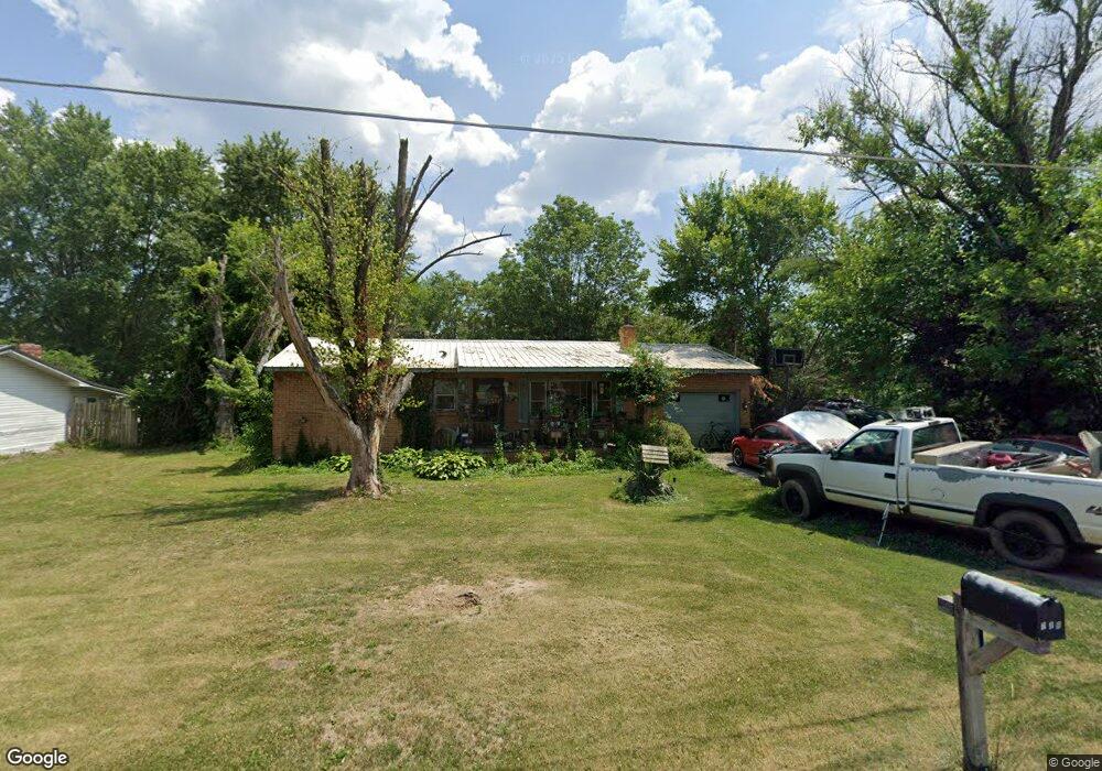
719 E Main St Richland, MO 65556
Estimated Value: $84,000 - $151,000
3
Beds
2
Baths
912
Sq Ft
$135/Sq Ft
Est. Value
About This Home
This home is located at 719 E Main St, Richland, MO 65556 and is currently estimated at $123,163, approximately $135 per square foot. 719 E Main St is a home with nearby schools including Richland Elementary School, Richland Jr. High School, and Richland High School.
Create a Home Valuation Report for This Property
The Home Valuation Report is an in-depth analysis detailing your home's value as well as a comparison with similar homes in the area
Tax History
We collect this data history from publicly available records. To have your information removed, we recommend requesting removal directly through your county’s website.
| Year | Tax Paid | Tax Assessment Tax Assessment Total Assessment is a certain percentage of the fair market value that is determined by local assessors to be the total taxable value of land and additions on the property. | Land | Improvement |
|---|---|---|---|---|
| 2025 | $441 | $10,582 | $1,870 | $8,712 |
| 2024 | $4 | $9,478 | $1,558 | $7,920 |
| 2023 | $407 | $9,478 | $1,558 | $7,920 |
| 2022 | $398 | $9,478 | $1,558 | $7,920 |
| 2021 | $402 | $9,478 | $1,558 | $7,920 |
| 2020 | $389 | $11,086 | $0 | $0 |
| 2019 | $388 | $9,101 | $0 | $0 |
| 2018 | $388 | $9,101 | $0 | $0 |
| 2017 | $387 | $11,086 | $0 | $0 |
| 2016 | $387 | $9,100 | $0 | $0 |
| 2015 | -- | $9,100 | $0 | $0 |
| 2014 | $298 | $9,100 | $0 | $0 |
Source: Public Records
Map
Nearby Homes
- 514 O Dell Ave
- TBD Route 7
- 204 E Mcclurg St
- 23013 Rock Bluff Dr
- 220 Warren St
- 24939 Storm Break Dr
- 26287 Radcliff Dr
- 810 Mildred St
- 11 Flora Dr
- 20955 Rye Ln
- 34555 Highway Ff
- 337 Cottonwood Branch
- 23400 Range Ln
- TBD Ranch Ln
- TBD Range Ln Tract 5
- TBD Roam Dr
- TBD Range Ln Tract 7
- TBD Range Ln Tract 8
- 271 Pleasant Knoll Rd
- 27 Pleasant Knoll Rd
Your Personal Tour Guide
Ask me questions while you tour the home.