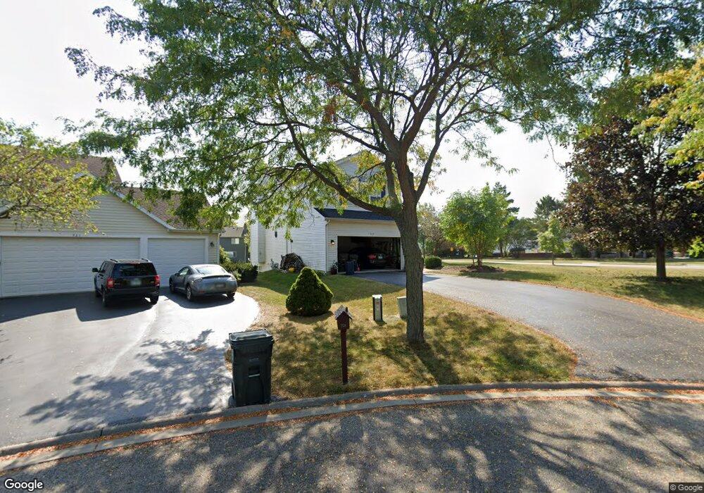
719 N Summit Ct Lindenhurst, IL 60046
Estimated Value: $403,000 - $417,000
About This Home
This home is located at 719 N Summit Ct, Lindenhurst, IL 60046 and is currently estimated at $409,312, approximately $204 per square foot. 719 N Summit Ct is a home located in Lake County with nearby schools including Lakes Community High School.
Ownership History
We collect this data history from publicly available records. To have your information removed, we recommend requesting removal directly through your county’s website.
Purchase Details
Home Financials for this Owner
Home Financials are based on the most recent Mortgage that was taken out on this home.Purchase Details
Home Financials for this Owner
Home Financials are based on the most recent Mortgage that was taken out on this home.Purchase Details
Home Financials for this Owner
Home Financials are based on the most recent Mortgage that was taken out on this home.Purchase Details
Home Financials for this Owner
Home Financials are based on the most recent Mortgage that was taken out on this home.Home Values in the Area
Average Home Value in this Area
Purchase History
We collect this data history from publicly available records. To have your information removed, we recommend requesting removal directly through your county’s website.
| Date | Buyer | Sale Price | Title Company |
|---|---|---|---|
| -- | Old Republic Title | ||
| $232,000 | -- | ||
| $185,000 | Mid America Title Company | ||
| $44,000 | Chicago Title Insurance Co |
Mortgage History
We collect this data history from publicly available records. To have your information removed, we recommend requesting removal directly through your county’s website.
| Date | Status | Borrower | Loan Amount |
|---|---|---|---|
| Open | $166,700 | ||
| Previous Owner | $211,932 | ||
| Previous Owner | $148,000 | ||
| Previous Owner | $133,200 |
Tax History
We collect this data history from publicly available records. To have your information removed, we recommend requesting removal directly through your county’s website.
| Year | Tax Paid | Tax Assessment Tax Assessment Total Assessment is a certain percentage of the fair market value that is determined by local assessors to be the total taxable value of land and additions on the property. | Land | Improvement |
|---|---|---|---|---|
| 2025 | $10,817 | $121,691 | $23,216 | $98,475 |
| 2024 | $10,282 | $113,444 | $21,643 | $91,801 |
| 2023 | $10,282 | $100,234 | $19,123 | $81,111 |
| 2022 | $9,305 | $87,279 | $13,161 | $74,118 |
| 2021 | $8,852 | $81,077 | $12,226 | $68,851 |
| 2020 | $8,654 | $78,479 | $11,834 | $66,645 |
| 2019 | $10,229 | $80,210 | $12,095 | $68,115 |
| 2018 | $10,026 | $84,417 | $17,557 | $66,860 |
| 2017 | $9,393 | $82,166 | $17,089 | $65,077 |
| 2016 | $9,593 | $78,839 | $16,397 | $62,442 |
| 2015 | $9,154 | $73,633 | $15,314 | $58,319 |
| 2014 | $8,772 | $67,161 | $15,384 | $51,777 |
| 2012 | $8,157 | $76,842 | $18,651 | $58,191 |
Map
- 1896 E Vista Terrace
- 1575 Mcclellan Dr
- 533 N Beck Rd Unit 28
- 38740 N Anderle Ave
- 534 Whispering Pines Rd Unit 2
- 1228 Meade Ct
- 2494 Forest View Rd
- 433 Woodland Trail
- 420 Woodland Trail
- 428 Woodland Trail
- 434 Woodland Trail
- 405 Woodland Trail
- 829 Colony Ct Unit 1
- 20215 W Miller Rd
- 38895 N Maple Ave
- 1911 Hazelwood Dr
- 1900 S Shore Cove
- 1891 S Shore Cove
- 1903 S Shore Cove
- 1775 S Port Dr
- 1865 E Ivy Cir
- 1871 E Ivy Cir
- 1861 E Ivy Cir
- 730 N Horizon Ct
- 732 N Horizon Ct
- 1879 E Ivy Cir
- 1851 E Ivy Cir
- 734 N Horizon Ct
- 1889 E Ivy Cir
- 720 N Summit Ct
- 1852 E Ivy Cir
- 736 N Horizon Ct
- 1860 E Ivy Cir
- 721 N Summit Ct
- 716 N Clover Ct
- 722 N Summit Ct
- 738 N Horizon Ct
- 735 N Auburn Ln
- 1890 E Ivy Cir
- 720 N Clover Ct
Ask me questions while you tour the home.