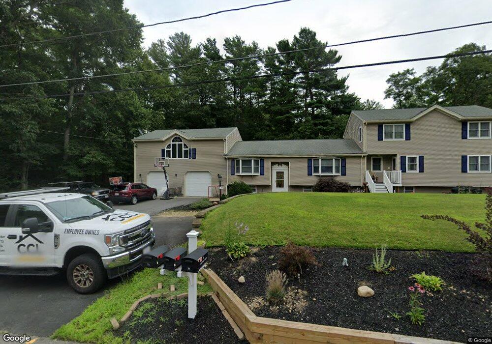
72 Andrew Ln Hanson, MA 02341
Estimated Value: $798,000 - $1,014,000
6
Beds
5
Baths
3,420
Sq Ft
$264/Sq Ft
Est. Value
About This Home
This home is located at 72 Andrew Ln, Hanson, MA 02341 and is currently estimated at $904,019, approximately $264 per square foot. 72 Andrew Ln is a home located in Plymouth County.
Ownership History
Date
Name
Owned For
Owner Type
Purchase Details
Closed on
Oct 30, 2025
Sold by
Haggerty James and Haggerty Sandra L
Bought by
Davis Nicole
Current Estimated Value
Purchase Details
Closed on
Mar 15, 2012
Sold by
Haggerty James and Haggerty Sandra L
Bought by
Haggerty James and Davis Nicole M
Create a Home Valuation Report for This Property
The Home Valuation Report is an in-depth analysis detailing your home's value as well as a comparison with similar homes in the area
Home Values in the Area
Average Home Value in this Area
Purchase History
We collect this data history from publicly available records. To have your information removed, we recommend requesting removal directly through your county’s website.
| Date | Buyer | Sale Price | Title Company |
|---|---|---|---|
| Davis Nicole | -- | -- | |
| Haggerty James | -- | -- | |
| Haggerty James R | -- | -- |
Source: Public Records
Mortgage History
We collect this data history from publicly available records. To have your information removed, we recommend requesting removal directly through your county’s website.
| Date | Status | Borrower | Loan Amount |
|---|---|---|---|
| Previous Owner | Haggerty James | $170,000 |
Source: Public Records
Tax History
| Year | Tax Paid | Tax Assessment Tax Assessment Total Assessment is a certain percentage of the fair market value that is determined by local assessors to be the total taxable value of land and additions on the property. | Land | Improvement |
|---|---|---|---|---|
| 2025 | $10,897 | $814,400 | $181,600 | $632,800 |
| 2024 | $10,693 | $799,200 | $176,300 | $622,900 |
| 2023 | $10,181 | $718,000 | $176,300 | $541,700 |
| 2022 | $9,956 | $659,800 | $160,300 | $499,500 |
| 2021 | $9,220 | $610,600 | $154,100 | $456,500 |
| 2020 | $9,014 | $590,300 | $148,900 | $441,400 |
| 2019 | $8,591 | $553,200 | $146,000 | $407,200 |
| 2018 | $8,231 | $526,200 | $140,400 | $385,800 |
| 2017 | $8,091 | $506,300 | $133,700 | $372,600 |
| 2016 | $8,191 | $494,900 | $133,700 | $361,200 |
| 2015 | $7,732 | $485,700 | $133,700 | $352,000 |
Source: Public Records
Map
Nearby Homes
- 113 Andrew Ln
- 102 Ransom Rd
- Lot 6 Way
- Lot 2 Harvard Rd
- 241 Indian Head St
- 700 High St
- 42 Taylor Point Rd
- 361 County Rd
- 361A County Rd
- Lot 5 Princeton Way
- 0 Monponsett St
- 24 Bowker Ave
- 56 Wildwood Rd
- 158 Bay State Cir
- 724 Whitman St
- 90 W Elm St
- 17 E Boundary Rd
- 50 Sawmill Ln Unit 5
- 29 Andrew Dr
- 10 Beach Rd
Your Personal Tour Guide
Ask me questions while you tour the home.