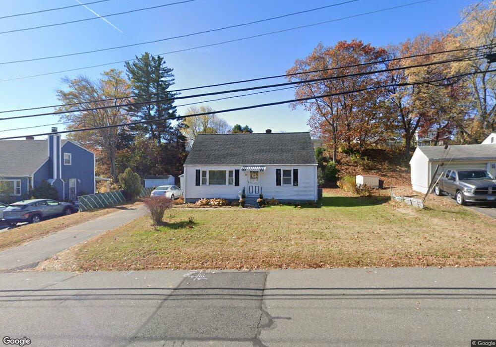
72 Lewis Rd New Britain, CT 06053
Estimated Value: $308,228 - $340,000
4
Beds
2
Baths
1,306
Sq Ft
$246/Sq Ft
Est. Value
About This Home
This home is located at 72 Lewis Rd, New Britain, CT 06053 and is currently estimated at $321,307, approximately $246 per square foot. 72 Lewis Rd is a home located in Hartford County with nearby schools including Holmes School, Pulaski Middle School, and St. Francis of Assisi Middle School.
Ownership History
Date
Name
Owned For
Owner Type
Purchase Details
Closed on
Sep 10, 2010
Sold by
Stjohn Donald
Bought by
Krajewska Sylvia
Current Estimated Value
Home Financials for this Owner
Home Financials are based on the most recent Mortgage that was taken out on this home.
Original Mortgage
$50,000
Outstanding Balance
$33,200
Interest Rate
4.55%
Estimated Equity
$288,107
Create a Home Valuation Report for This Property
The Home Valuation Report is an in-depth analysis detailing your home's value as well as a comparison with similar homes in the area
Home Values in the Area
Average Home Value in this Area
Purchase History
| Date | Buyer | Sale Price | Title Company |
|---|---|---|---|
| Krajewska Sylvia | $140,000 | -- |
Source: Public Records
Mortgage History
| Date | Status | Borrower | Loan Amount |
|---|---|---|---|
| Open | Krajewska Sylvia | $50,000 | |
| Previous Owner | Krajewska Sylvia | $25,000 | |
| Previous Owner | Krajewska Sylvia | $55,000 |
Source: Public Records
Tax History
| Year | Tax Paid | Tax Assessment Tax Assessment Total Assessment is a certain percentage of the fair market value that is determined by local assessors to be the total taxable value of land and additions on the property. | Land | Improvement |
|---|---|---|---|---|
| 2025 | $6,302 | $160,860 | $63,630 | $97,230 |
| 2024 | $6,368 | $160,860 | $63,630 | $97,230 |
| 2023 | $6,158 | $160,860 | $63,630 | $97,230 |
| 2022 | $5,253 | $106,120 | $29,330 | $76,790 |
| 2021 | $5,253 | $106,120 | $29,330 | $76,790 |
| 2020 | $5,359 | $106,120 | $29,330 | $76,790 |
| 2019 | $5,359 | $106,120 | $29,330 | $76,790 |
| 2018 | $5,359 | $106,120 | $29,330 | $76,790 |
| 2017 | $4,818 | $95,410 | $26,740 | $68,670 |
| 2016 | $4,765 | $94,360 | $26,740 | $67,620 |
| 2015 | $4,624 | $94,360 | $26,740 | $67,620 |
| 2014 | $4,624 | $94,360 | $26,740 | $67,620 |
Source: Public Records
Map
Nearby Homes
- 23 Lewis Rd
- 40 Hutchinson St
- 678 Farmington Ave
- 346 Lewis Rd
- 21 Skipper St
- 244 Alexander Rd
- 186 Alexander Rd
- 178 Alexander Rd
- 169 Country Club Rd
- 14 Bonnie Dr
- 30 Wendy Ln
- 2180 Stanley St
- 900 Slater Rd
- 54 Overlook Ave
- 2391 Stanley St
- 234 Pierremount Ave
- 160 Brittany Farms Rd Unit F
- 51 Two Mile Rd
- 8128 Colt Hwy
- 190 Brittany Farms Rd Unit F
- 66 Lewis Rd
- 78 Lewis Rd
- 58 Lewis Rd Unit 60
- 909 Farmington Ave
- 903 Farmington Ave
- 917 Farmington Ave
- 895 Farmington Ave
- 52 Lewis Rd
- 73 Lewis Rd
- 65 Lewis Rd
- 84 Lewis Rd
- 887 Farmington Ave
- 923 Farmington Ave
- 44 Lewis Rd
- 6 Miriam Rd
- 881 Farmington Ave
- 90 Lewis Rd
- 36 Lewis Rd
- 103 Lewis Rd
- 875 - 877 Farmington Ave
Your Personal Tour Guide
Ask me questions while you tour the home.