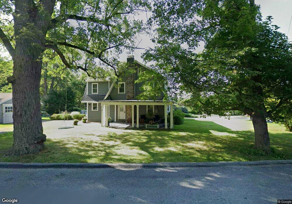
72 Maple Ave Millbrook, NY 12545
Estimated Value: $479,459 - $682,000
3
Beds
1
Bath
1,509
Sq Ft
$389/Sq Ft
Est. Value
About This Home
This home is located at 72 Maple Ave, Millbrook, NY 12545 and is currently estimated at $586,615, approximately $388 per square foot. 72 Maple Ave is a home located in Dutchess County with nearby schools including Elm Drive Elementary School, Alden Place Elementary School, and Millbrook Middle School.
Ownership History
Date
Name
Owned For
Owner Type
Purchase Details
Closed on
May 30, 2008
Sold by
Sorrentino Justine
Bought by
Lavarnway Heather
Current Estimated Value
Purchase Details
Closed on
Mar 26, 2007
Sold by
Sorrentino Justine
Bought by
Sorrentino Justine
Home Financials for this Owner
Home Financials are based on the most recent Mortgage that was taken out on this home.
Original Mortgage
$160,000
Interest Rate
6%
Mortgage Type
Purchase Money Mortgage
Purchase Details
Closed on
Jul 16, 1996
Create a Home Valuation Report for This Property
The Home Valuation Report is an in-depth analysis detailing your home's value as well as a comparison with similar homes in the area
Home Values in the Area
Average Home Value in this Area
Purchase History
| Date | Buyer | Sale Price | Title Company |
|---|---|---|---|
| Lavarnway Heather | $365,000 | -- | |
| Sorrentino Justine | -- | -- | |
| -- | -- | -- |
Source: Public Records
Mortgage History
| Date | Status | Borrower | Loan Amount |
|---|---|---|---|
| Previous Owner | Sorrentino Justine | $160,000 |
Source: Public Records
Tax History
| Year | Tax Paid | Tax Assessment Tax Assessment Total Assessment is a certain percentage of the fair market value that is determined by local assessors to be the total taxable value of land and additions on the property. | Land | Improvement |
|---|---|---|---|---|
| 2024 | $8,552 | $265,900 | $63,200 | $202,700 |
| 2023 | $6,555 | $265,900 | $63,200 | $202,700 |
| 2019 | $6,021 | $265,900 | $63,200 | $202,700 |
Source: Public Records
Map
Nearby Homes
- 44 Merrit Ave
- 3311 Franklin Ave
- 188 Nine Partners Ln
- 97 Valley Farm Rd
- TBD Stanford Rd
- 121 Stanford Rd
- 20 Orchard Hill Dr
- 45 Hitchcock Ln
- 121 Valley Farm Rd
- 121-125 Butts Hollow Rd
- 66 County House Rd
- 37 Maple Hill Dr
- 3985 Route 82
- 43 Maple Hill Dr
- 45 Maple Hill Dr
- 477 Canoe Hill Rd
- 568 Oak Summit Rd
- 508 Woodstock Rd
- 3893 Route 82
- 4388 Route 82
Your Personal Tour Guide
Ask me questions while you tour the home.