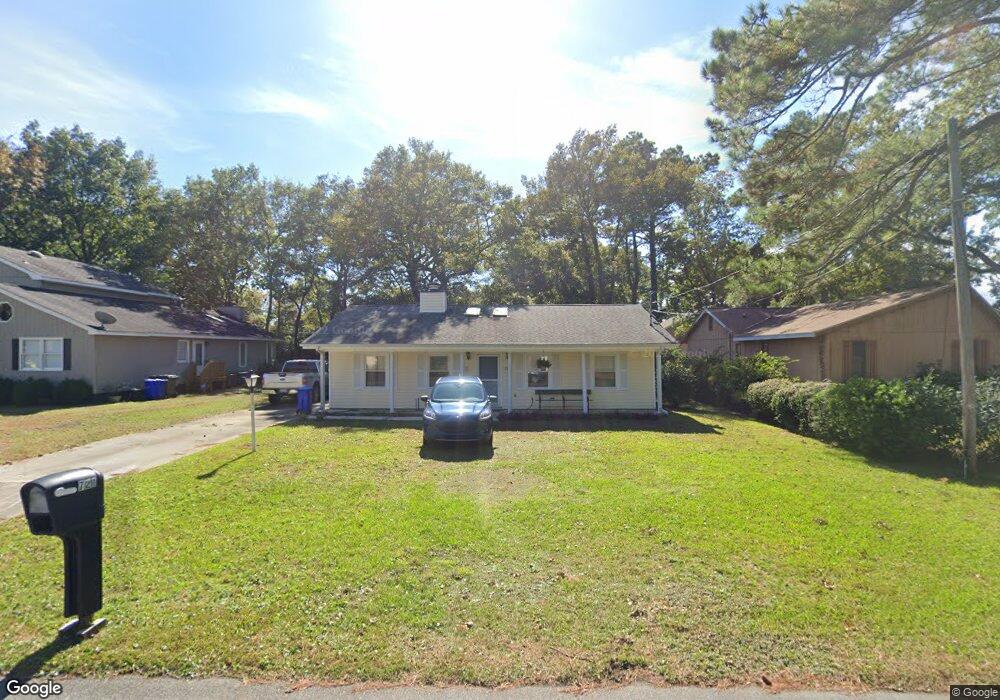
721 9th Ave S Surfside Beach, SC 29575
Estimated Value: $433,000 - $511,599
3
Beds
2
Baths
1,650
Sq Ft
$289/Sq Ft
Est. Value
About This Home
This home is located at 721 9th Ave S, Surfside Beach, SC 29575 and is currently estimated at $477,650, approximately $289 per square foot. 721 9th Ave S is a home located in Horry County with nearby schools including Seaside Elementary, St. James Intermediate, and St. James High School.
Ownership History
Date
Name
Owned For
Owner Type
Purchase Details
Closed on
Jul 26, 2013
Sold by
Bauknight Barbara H
Bought by
Bauknight Barbara Hartley
Current Estimated Value
Purchase Details
Closed on
May 26, 2009
Sold by
Bauknight Terry M
Bought by
Bauknight Barbara H
Purchase Details
Closed on
Feb 27, 2009
Sold by
Poirier Karen M
Bought by
Bauknight Terry M
Create a Home Valuation Report for This Property
The Home Valuation Report is an in-depth analysis detailing your home's value as well as a comparison with similar homes in the area
Home Values in the Area
Average Home Value in this Area
Purchase History
We collect this data history from publicly available records. To have your information removed, we recommend requesting removal directly through your county’s website.
| Date | Buyer | Sale Price | Title Company |
|---|---|---|---|
| Bauknight Barbara Hartley | -- | -- | |
| Bauknight Barbara H | -- | -- | |
| Bauknight Terry M | $198,000 | -- | |
| Poirier Karen M | -- | -- |
Source: Public Records
Tax History
| Year | Tax Paid | Tax Assessment Tax Assessment Total Assessment is a certain percentage of the fair market value that is determined by local assessors to be the total taxable value of land and additions on the property. | Land | Improvement |
|---|---|---|---|---|
| 2025 | -- | $0 | $0 | $0 |
| 2024 | -- | $16,909 | $11,530 | $5,379 |
| 2023 | $830 | $8,850 | $4,864 | $3,986 |
| 2021 | $809 | $10,733 | $6,721 | $4,012 |
| 2020 | $792 | $10,733 | $6,721 | $4,012 |
| 2019 | $792 | $10,733 | $6,721 | $4,012 |
| 2018 | $0 | $7,695 | $3,151 | $4,544 |
| 2017 | $619 | $7,695 | $3,151 | $4,544 |
| 2016 | $0 | $7,695 | $3,151 | $4,544 |
| 2015 | -- | $7,696 | $3,152 | $4,544 |
| 2014 | $578 | $7,696 | $3,152 | $4,544 |
Source: Public Records
Map
Nearby Homes
- 1010 Moss Dr
- 1014 Bay Dr
- 1014 Cedar Dr S
- 728 7th Ave S Unit SB
- 1027 Hickory Dr Unit 1027 Hickory Drive
- 715 Cypress Dr
- 910 U S 17 Business Unit Lot 1
- 910 U S 17 Business Unit Lots 8 & 9
- 910 U S 17 Business Unit Lot 4
- 510 9th Ave S
- 616 Maple Dr
- 726 Juniper Dr
- 1025 S Myrtle Dr
- 514 Cypress Dr
- 815 S Willow Dr
- 1406 Winddrift Ct
- 120-A 16th Ave S
- 1432 Seahouse Ct
- 619 S Palmetto Way
- 318 15th Ave S
- 723 9th Ave S Unit SB
- 719 9th Ave S Unit East of 17
- 719 9th Ave S Unit Ocean Terrace
- 719 9th Ave S
- 717 9th Ave S
- 911 S Poplar Dr
- 717 9th Ave S
- 720 10th Ave S
- 720 10th Ave S Unit WALK TO THE BEACH
- 720 10th Ave S Unit Walking Distance to
- 718 10th Ave S
- 722 10th Ave S
- 720 9th Ave S
- 716 10th Ave S Unit SB
- 722 9th Ave S
- 718 9th Ave S
- 913 S Poplar Dr
- 724 9th Ave S
- 714 10th Ave S
- 713 9th Ave S
Your Personal Tour Guide
Ask me questions while you tour the home.