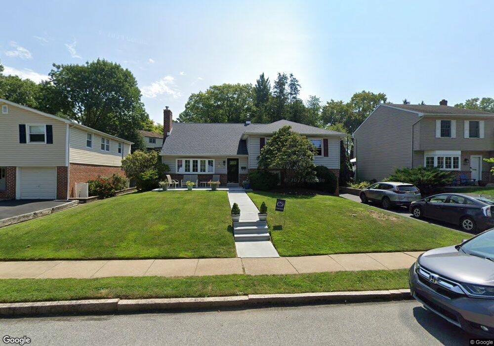
721 Evans Rd Springfield, PA 19064
Estimated Value: $526,841 - $686,000
4
Beds
4
Baths
2,370
Sq Ft
$261/Sq Ft
Est. Value
About This Home
This home is located at 721 Evans Rd, Springfield, PA 19064 and is currently estimated at $617,710, approximately $260 per square foot. 721 Evans Rd is a home located in Delaware County with nearby schools including Springfield High School, St Francis Of Assisi School, and Holy Cross School.
Ownership History
Date
Name
Owned For
Owner Type
Purchase Details
Closed on
Nov 30, 1994
Sold by
Williamson Rosalie
Bought by
Mccloskey Michael and Mcclosky Theresa
Current Estimated Value
Home Financials for this Owner
Home Financials are based on the most recent Mortgage that was taken out on this home.
Original Mortgage
$168,300
Interest Rate
8.81%
Create a Home Valuation Report for This Property
The Home Valuation Report is an in-depth analysis detailing your home's value as well as a comparison with similar homes in the area
Home Values in the Area
Average Home Value in this Area
Purchase History
| Date | Buyer | Sale Price | Title Company |
|---|---|---|---|
| Mccloskey Michael | $187,000 | Commonwealth Land Title Ins |
Source: Public Records
Mortgage History
| Date | Status | Borrower | Loan Amount |
|---|---|---|---|
| Closed | Mccloskey Michael | $168,300 |
Source: Public Records
Tax History
| Year | Tax Paid | Tax Assessment Tax Assessment Total Assessment is a certain percentage of the fair market value that is determined by local assessors to be the total taxable value of land and additions on the property. | Land | Improvement |
|---|---|---|---|---|
| 2025 | $8,387 | $298,400 | $96,130 | $202,270 |
| 2024 | $8,387 | $298,400 | $96,130 | $202,270 |
| 2023 | $8,076 | $298,400 | $96,130 | $202,270 |
| 2022 | $7,901 | $298,400 | $96,130 | $202,270 |
| 2021 | $12,236 | $298,400 | $96,130 | $202,270 |
| 2020 | $7,599 | $167,690 | $46,210 | $121,480 |
| 2019 | $7,420 | $167,690 | $46,210 | $121,480 |
| 2018 | $7,314 | $167,690 | $0 | $0 |
| 2017 | $7,145 | $167,690 | $0 | $0 |
| 2016 | $920 | $167,690 | $0 | $0 |
| 2015 | $920 | $167,690 | $0 | $0 |
| 2014 | $920 | $167,690 | $0 | $0 |
Source: Public Records
Map
Nearby Homes
- 720 Evans Rd
- 658 E Leamy Ave
- 253 Saxer Ave
- 264 Pancoast Ave
- 334 Parham Rd
- 231 E Woodland Ave
- 341 Harwicke Rd
- 114 Providence Rd
- 933 Greenbriar Ln
- 225 Lynbrooke Rd
- 364 S Rolling Rd
- 238 Alliston Rd
- 493 Wheatsheaf Rd
- 507 School St
- 354 E Springfield Rd
- 359 Spring Valley Rd
- 249 Gleaves Rd
- 120 W Springfield Rd
- 1022 Crozer Ln
- 514 Springview Ln
Your Personal Tour Guide
Ask me questions while you tour the home.