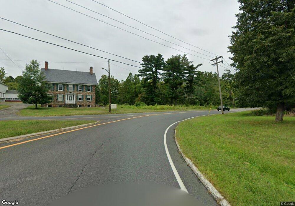
721 Highway 12 Flemington, NJ 08822
Franklin NeighborhoodEstimated Value: $511,000 - $802,000
Studio
--
Bath
1,890
Sq Ft
$312/Sq Ft
Est. Value
About This Home
This home is located at 721 Highway 12, Flemington, NJ 08822 and is currently estimated at $589,001, approximately $311 per square foot. 721 Highway 12 is a home located in Hunterdon County with nearby schools including Franklin Township School and North Hunterdon High School.
Ownership History
Date
Name
Owned For
Owner Type
Purchase Details
Closed on
Apr 17, 2008
Sold by
Gallo Lois F and The James J Gallo Jr & Lois F
Bought by
Pfenninger Realty Llc
Current Estimated Value
Home Financials for this Owner
Home Financials are based on the most recent Mortgage that was taken out on this home.
Original Mortgage
$300,000
Outstanding Balance
$186,224
Interest Rate
5.93%
Mortgage Type
Commercial
Estimated Equity
$402,777
Purchase Details
Closed on
Nov 8, 2005
Sold by
Gallo James J and Gallo Lois F
Bought by
Gallo James J and Gallo Lois F
Create a Home Valuation Report for This Property
The Home Valuation Report is an in-depth analysis detailing your home's value as well as a comparison with similar homes in the area
Home Values in the Area
Average Home Value in this Area
Purchase History
We collect this data history from publicly available records. To have your information removed, we recommend requesting removal directly through your county’s website.
| Date | Buyer | Sale Price | Title Company |
|---|---|---|---|
| Pfenninger Realty Llc | -- | None Available | |
| Pfenninger Realty Llc | $372,000 | First American Title Ins Co | |
| Gallo James J | -- | None Available |
Source: Public Records
Mortgage History
We collect this data history from publicly available records. To have your information removed, we recommend requesting removal directly through your county’s website.
| Date | Status | Borrower | Loan Amount |
|---|---|---|---|
| Open | Pfenninger Realty Llc | $300,000 |
Source: Public Records
Tax History
| Year | Tax Paid | Tax Assessment Tax Assessment Total Assessment is a certain percentage of the fair market value that is determined by local assessors to be the total taxable value of land and additions on the property. | Land | Improvement |
|---|---|---|---|---|
| 2025 | $9,667 | $321,600 | $201,200 | $120,400 |
| 2024 | $9,140 | $321,600 | $201,200 | $120,400 |
| 2023 | $9,140 | $321,600 | $201,200 | $120,400 |
| 2022 | $9,082 | $321,600 | $201,200 | $120,400 |
| 2021 | $8,744 | $321,600 | $201,200 | $120,400 |
| 2020 | $8,799 | $321,600 | $201,200 | $120,400 |
| 2019 | $8,886 | $321,600 | $201,200 | $120,400 |
| 2018 | $8,244 | $316,000 | $201,200 | $114,800 |
| 2017 | $8,086 | $316,000 | $201,200 | $114,800 |
| 2016 | $7,856 | $316,000 | $201,200 | $114,800 |
| 2015 | $7,834 | $316,000 | $201,200 | $114,800 |
| 2014 | $7,995 | $316,000 | $201,200 | $114,800 |
Source: Public Records
Map
Nearby Homes
- 719 Pittstown Rd
- 550 Barbertown Point Breeze Rd
- 911 County Road 579
- 271 Old Croton Rd
- 12 Locktown School Rd
- 77 Plum Brook Rd
- 240 Oak Grove Rd
- 221 Old Croton Rd
- 4 Michele Crossing
- 26 Old Route12
- 194 Locktown Flemington Rd
- 56 Old Route12
- 722 County Road 579
- 130 Fitzer Rd
- 37 Barbertown Point Breeze Rd Unit 3 LOT
- 181 Old Croton Rd
- 168 Locktown Sergeantsville Rd
- 107 Oak Grove Rd
- 2 Shrope Ln
- 180 Locktown Sergeantsville Rd
- 721 State Route 12
- 674 State Route 12
- 676 State Route 12
- 676 State Route 12
- 728 State Route 12
- 670 State Route 12
- 678 New Jersey 12 Unit 3
- 685 Highway 12 Unit 2
- 729 State Route 12
- 662 New Jersey 12
- 662 State Route 12
- 683 State Route 12
- 683 Highway 12
- 656 New Jersey 12 Unit 4
- 656 New Jersey 12 Unit 5
- 679 State Route 12
- 681 State Route 12
- 681 New Jersey 12
- 725 State Route 12
- 673 State Route 12
Your Personal Tour Guide
Ask me questions while you tour the home.