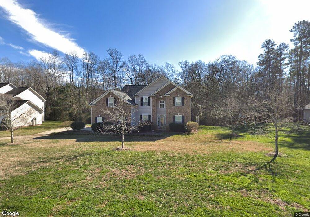
7236 Forrest Rader Dr Mint Hill, NC 28227
Estimated Value: $577,578 - $650,000
About This Home
This home is located at 7236 Forrest Rader Dr, Mint Hill, NC 28227 and is currently estimated at $619,645, approximately $196 per square foot. 7236 Forrest Rader Dr is a home located in Mecklenburg County with nearby schools including Bain Elementary, Mint Hill Middle School, and Independence High.
Ownership History
We collect this data history from publicly available records. To have your information removed, we recommend requesting removal directly through your county’s website.
Purchase Details
Home Financials for this Owner
Home Financials are based on the most recent Mortgage that was taken out on this home.Purchase Details
Home Financials for this Owner
Home Financials are based on the most recent Mortgage that was taken out on this home.Purchase Details
Home Financials for this Owner
Home Financials are based on the most recent Mortgage that was taken out on this home.Home Values in the Area
Average Home Value in this Area
Purchase History
We collect this data history from publicly available records. To have your information removed, we recommend requesting removal directly through your county’s website.
| Date | Buyer | Sale Price | Title Company |
|---|---|---|---|
| $223,000 | None Available | ||
| $235,500 | -- | ||
| $229,000 | -- |
Mortgage History
We collect this data history from publicly available records. To have your information removed, we recommend requesting removal directly through your county’s website.
| Date | Status | Borrower | Loan Amount |
|---|---|---|---|
| Open | $211,300 | ||
| Previous Owner | $188,000 | ||
| Closed | $23,527 |
Tax History
We collect this data history from publicly available records. To have your information removed, we recommend requesting removal directly through your county’s website.
| Year | Tax Paid | Tax Assessment Tax Assessment Total Assessment is a certain percentage of the fair market value that is determined by local assessors to be the total taxable value of land and additions on the property. | Land | Improvement |
|---|---|---|---|---|
| 2025 | $3,576 | $498,000 | $104,500 | $393,500 |
| 2024 | $3,576 | $498,000 | $104,500 | $393,500 |
| 2023 | $3,521 | $498,000 | $104,500 | $393,500 |
| 2022 | $2,767 | $312,800 | $76,000 | $236,800 |
| 2021 | $2,709 | $306,200 | $76,000 | $230,200 |
| 2020 | $2,709 | $306,200 | $76,000 | $230,200 |
| 2019 | $2,703 | $306,200 | $76,000 | $230,200 |
| 2018 | $2,557 | $231,400 | $45,000 | $186,400 |
| 2017 | $2,536 | $231,400 | $45,000 | $186,400 |
| 2016 | $2,533 | $231,400 | $45,000 | $186,400 |
| 2015 | $2,529 | $231,400 | $45,000 | $186,400 |
| 2014 | $2,527 | $231,400 | $45,000 | $186,400 |
Map
- 9134 Ramsford Ct
- 5500 Kinsbridge Dr
- 7536 Hannah Alexander Ln
- 8004 Whitegrove Rd
- 10122 Hemingway Place
- 3231 Lisburn St
- 5502 Chicopee Dr
- 6804 Cinnamon Cir
- 1221 Colgher St
- 5109 Kinsbridge Dr
- 6446 Hove Rd
- 5108 Kinsbridge Dr
- 7304 River Valley Ct
- 3147 Coventry Commons Dr
- 4217 Patriots Hill Rd
- 7302 Snowbird Ct
- 4514 Wilgrove Mint Hill Rd
- 7139 Brighton Park Dr
- 4317 Wilgrove Mint Hill Rd
- 7311 Snowbird Ct
- 7226 Forrest Rader Dr
- 7226 Forrest Rader Dr Unit 59
- 7244 Forrest Rader Dr
- 10912 Despa Dr
- 7245 Forrest Rader Dr
- 7235 Forrest Rader Dr
- 7216 Forrest Rader Dr
- 7223 Forrest Rader Dr
- 7307 Forrest Rader Dr
- 10926 Despa Dr
- 10905 Despa Dr
- 5211 Harris Trace Ct
- 7206 Forrest Rader Dr
- 5221 Harris Trace Ct
- 7302 Forrest Rader Dr
- 10930 Despa Dr
- 7304 Hannah Alexander Ln
- 10917 Despa Dr
- 7314 Hannah Alexander Ln
- 10931 Despa Dr
Ask me questions while you tour the home.