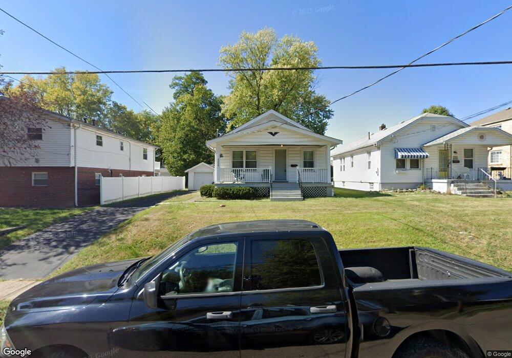
7239 Brookline Ave Cincinnati, OH 45236
Estimated Value: $177,000 - $224,000
2
Beds
1
Bath
875
Sq Ft
$230/Sq Ft
Est. Value
About This Home
This home is located at 7239 Brookline Ave, Cincinnati, OH 45236 and is currently estimated at $201,652, approximately $230 per square foot. 7239 Brookline Ave is a home located in Hamilton County with nearby schools including Amity Elementary School, Deer Park Jr/Sr High School, and Ohr Torah Cincinnati.
Ownership History
Date
Name
Owned For
Owner Type
Purchase Details
Closed on
May 1, 2017
Sold by
Elsen Kathleen W
Bought by
Paytes Sean and Paytes Lisa A
Current Estimated Value
Home Financials for this Owner
Home Financials are based on the most recent Mortgage that was taken out on this home.
Original Mortgage
$63,750
Outstanding Balance
$31,882
Interest Rate
4.23%
Mortgage Type
Future Advance Clause Open End Mortgage
Estimated Equity
$169,770
Purchase Details
Closed on
Dec 28, 1999
Sold by
Kathleen Elsen
Bought by
Elsen Kathleen W and The Kathleen W Elsen Revocable Trust
Create a Home Valuation Report for This Property
The Home Valuation Report is an in-depth analysis detailing your home's value as well as a comparison with similar homes in the area
Home Values in the Area
Average Home Value in this Area
Purchase History
| Date | Buyer | Sale Price | Title Company |
|---|---|---|---|
| Paytes Sean | $85,000 | Priority National Title | |
| Elsen Kathleen W | -- | -- | |
| Elsen Kathleen W | -- | -- |
Source: Public Records
Mortgage History
| Date | Status | Borrower | Loan Amount |
|---|---|---|---|
| Open | Paytes Sean | $63,750 |
Source: Public Records
Tax History
| Year | Tax Paid | Tax Assessment Tax Assessment Total Assessment is a certain percentage of the fair market value that is determined by local assessors to be the total taxable value of land and additions on the property. | Land | Improvement |
|---|---|---|---|---|
| 2025 | $3,170 | $42,476 | $13,111 | $29,365 |
| 2023 | $2,735 | $42,476 | $13,111 | $29,365 |
| 2022 | $2,826 | $33,919 | $11,074 | $22,845 |
| 2021 | $2,813 | $33,919 | $11,074 | $22,845 |
| 2020 | $2,554 | $33,919 | $11,074 | $22,845 |
| 2019 | $2,502 | $29,751 | $9,713 | $20,038 |
| 2018 | $2,501 | $29,751 | $9,713 | $20,038 |
| 2017 | $2,409 | $29,751 | $9,713 | $20,038 |
| 2016 | $2,278 | $27,517 | $10,101 | $17,416 |
| 2015 | $2,063 | $27,517 | $10,101 | $17,416 |
| 2014 | $2,060 | $27,517 | $10,101 | $17,416 |
| 2013 | $2,004 | $26,461 | $9,713 | $16,748 |
Source: Public Records
Map
Nearby Homes
- 4300 Hegner Ave
- 4224 North Ave
- 4267 Clifford Rd
- 4390 Yakima Ct
- 4248 South Ave
- 4223 South Ave
- 7211 Maryland Ave
- 4025 Deer Park Ave
- 4155 Home St
- 4009 Saint Johns Terrace
- 3982 Superior Ave
- 4120 Hoffman Ave
- 3911 E Gatewood Ln
- 3827 Thornton Dr
- 7905 Plainfield Rd
- 6826 Sampson Ln
- 7938 Queens Ave
- 7837 Moss Ct
- 3814 N Broadlawn Cir
- 6829 Alpine Ave
- 7241 Brookline Ave
- 7235 Brookline Ave
- 7233 Brookline Ave
- 7245 Brookline Ave
- 4207 Hegner Ave
- 4231 Hegner Ave
- 7236 Lafayette Ave
- 4205 Hegner Ave
- 7229 Brookline Ave
- 4230 Glenway Ave
- 7232 Lafayette Ave
- 4235 Hegner Ave
- 7225 Brookline Ave
- 7230 Lafayette Ave
- 4201 Hegner Ave
- 4236 Glenway Ave
- 4220 Hegner Ave
- 4216 Hegner Ave
- 4243 Hegner Ave
- 4226 Hegner Ave
Your Personal Tour Guide
Ask me questions while you tour the home.