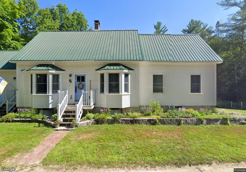
725 Redding Rd Sumner, ME 04292
Estimated Value: $142,000 - $405,000
Studio
--
Bath
1,160
Sq Ft
$262/Sq Ft
Est. Value
About This Home
This home is located at 725 Redding Rd, Sumner, ME 04292 and is currently estimated at $304,166, approximately $262 per square foot. 725 Redding Rd is a home located in Oxford County with nearby schools including Hartford-Sumner Elementary School and Buckfield Junior/Senior High School.
Create a Home Valuation Report for This Property
The Home Valuation Report is an in-depth analysis detailing your home's value as well as a comparison with similar homes in the area
Tax History
| Year | Tax Paid | Tax Assessment Tax Assessment Total Assessment is a certain percentage of the fair market value that is determined by local assessors to be the total taxable value of land and additions on the property. | Land | Improvement |
|---|---|---|---|---|
| 2025 | $5,028 | $322,311 | $51,775 | $270,536 |
| 2024 | $4,190 | $322,311 | $51,775 | $270,536 |
| 2023 | $4,206 | $199,342 | $27,275 | $172,067 |
| 2022 | $4,116 | $199,342 | $27,275 | $172,067 |
| 2021 | $4,116 | $199,342 | $27,275 | $172,067 |
| 2020 | $4,116 | $199,342 | $27,275 | $172,067 |
| 2019 | $4,057 | $199,342 | $27,275 | $172,067 |
| 2018 | $3,847 | $199,342 | $27,275 | $172,067 |
| 2017 | $3,648 | $199,342 | $27,275 | $172,067 |
| 2016 | $3,379 | $199,342 | $27,275 | $172,067 |
| 2015 | $3,269 | $199,342 | $27,275 | $172,067 |
| 2014 | $3,189 | $199,342 | $27,275 | $172,067 |
| 2013 | $3,130 | $199,342 | $27,275 | $172,067 |
Source: Public Records
Map
Nearby Homes
- M13L18A-1 Redding Rd
- M19 L6-6 Tuell Hill Rd
- L14 Concord Pond Rd
- 1443 Main St
- 15 Front St
- 20 Front St
- 42 Front St
- 309 Cushman Rd
- 0 Andrews Rd
- R12-010 Main St
- 729 Main St
- Lot 56 S Main St
- 20 Kittridge Brook Rd
- Lot#32 Beech Ridge Ln
- 585 Main St
- 83 Outlook Rd
- Lot# 55 Arline's Way
- 219 Outlook Rd
- 67 Fields Hill Rd
- 20 Maine 232
Your Personal Tour Guide
Ask me questions while you tour the home.