Estimated Value: $241,250 - $286,000
3
Beds
2
Baths
1,871
Sq Ft
$141/Sq Ft
Est. Value
About This Home
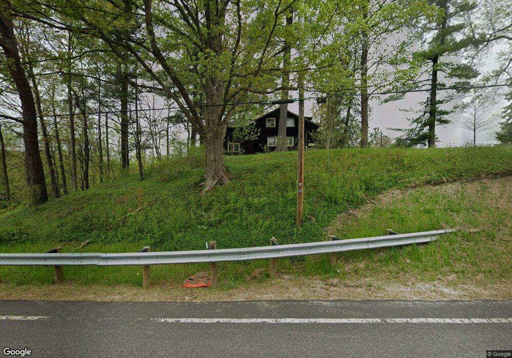
This home is located at 7253 State Route 305, Hiram, OH 44234 and is currently estimated at $264,063, approximately $141 per square foot. 7253 State Route 305 is a home located in Portage County with nearby schools including Crestwood Primary School, Crestwood Intermediate School, and Crestwood Middle School.
Ownership History
Date
Name
Owned For
Owner Type
Purchase Details
Closed on
Oct 22, 2021
Sold by
Estate Of Phyllis Irene Ellenberger
Bought by
Vanmetre Leta S and Flower Jennifer L
Current Estimated Value
Purchase Details
Closed on
Aug 6, 2021
Sold by
Estate Of Kenneth Ronald Ellenberger
Bought by
Ellenberger Joanne M
Purchase Details
Closed on
Jan 1, 1990
Sold by
Ellenberger Ronald
Bought by
Ellenberger Wallace H
Create a Home Valuation Report for This Property
The Home Valuation Report is an in-depth analysis detailing your home's value as well as a comparison with similar homes in the area
Purchase History
| Date | Buyer | Sale Price | Title Company |
|---|---|---|---|
| Vanmetre Leta S | -- | None Available | |
| Ellenberger Joanne M | -- | None Available | |
| Ellenberger Wallace H | -- | -- |
Source: Public Records
Tax History
| Year | Tax Paid | Tax Assessment Tax Assessment Total Assessment is a certain percentage of the fair market value that is determined by local assessors to be the total taxable value of land and additions on the property. | Land | Improvement |
|---|---|---|---|---|
| 2025 | $2,092 | $49,740 | $14,040 | $35,700 |
| 2024 | $1,997 | $49,740 | $14,040 | $35,700 |
| 2023 | $2,113 | $47,400 | $11,240 | $36,160 |
| 2022 | $2,137 | $47,400 | $11,240 | $36,160 |
| 2021 | $2,209 | $47,400 | $11,240 | $36,160 |
| 2020 | $2,009 | $41,130 | $11,240 | $29,890 |
| 2019 | $1,990 | $41,130 | $11,240 | $29,890 |
| 2018 | $1,798 | $36,510 | $11,240 | $25,270 |
| 2017 | $1,798 | $36,510 | $11,240 | $25,270 |
| 2016 | $1,793 | $36,510 | $11,240 | $25,270 |
| 2015 | $1,797 | $36,510 | $11,240 | $25,270 |
| 2014 | $1,831 | $36,510 | $11,240 | $25,270 |
| 2013 | $1,770 | $36,510 | $11,240 | $25,270 |
Source: Public Records
Map
Nearby Homes
- 11383 Rolling Meadows Dr
- 11606 Garfield Rd
- 0 Garfield Rd
- 6846 Wakefield Rd
- 7760 State Route 305
- 11861 Garfield Rd
- 6792 Bancroft St
- 11744 Peckham Ave
- 7076 Village Way Dr
- 11538 Wheeler Rd
- 7000 Village Way Dr
- 11801 Kenyon Dr
- Lot 7 Wheeler Rd
- Lot 14 Wheeler Rd
- 11685 Mills Rd
- 7695 Norton Rd
- 10977 Fox Hollow Dr
- 0 Mills Rd
- 10971 Fox Hollow Dr
- 10937 Fox Den Cir
- 7266 State Route 305
- 7161 State Route 305
- 7161 Wakefield Rd
- 7129 State Route 305
- 7116 Wakefield Rd
- 7191 Sr 305
- 7108 Wakefield Rd
- 7108 Wakefield Rd
- 7096 Wakefield Rd
- 7096 Wakefield Rd
- 7070 Wakefield Rd
- 11707 Udall Rd
- 11729 Udall Rd
- 7050 Wakefield Rd
- 11434 Rolling Meadows Dr
- 11734 Udall Rd
- 11424 Rolling Meadows Dr
- 7021 Wakefield Rd
- 11754 Udall Rd
- 7023 Wakefield Rd
Your Personal Tour Guide
Ask me questions while you tour the home.