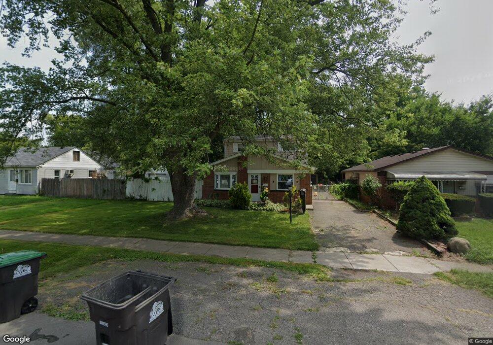
7255 Michael St Unit Bldg-Unit Taylor, MI 48180
Estimated Value: $171,000 - $204,000
About This Home
This home is located at 7255 Michael St Unit Bldg-Unit, Taylor, MI 48180 and is currently estimated at $181,679, approximately $125 per square foot. 7255 Michael St Unit Bldg-Unit is a home located in Wayne County with nearby schools including Taylor Parks Elementary School, Hoover Middle School, and Taylor High School.
Ownership History
We collect this data history from publicly available records. To have your information removed, we recommend requesting removal directly through your county’s website.
Purchase Details
Home Financials for this Owner
Home Financials are based on the most recent Mortgage that was taken out on this home.Purchase Details
Purchase Details
Purchase Details
Purchase Details
Home Values in the Area
Average Home Value in this Area
Purchase History
We collect this data history from publicly available records. To have your information removed, we recommend requesting removal directly through your county’s website.
| Date | Buyer | Sale Price | Title Company |
|---|---|---|---|
| $105,000 | Stewart Title | ||
| $37,000 | None Available | ||
| -- | None Available | ||
| -- | First American Title | ||
| $75,000 | -- |
Mortgage History
We collect this data history from publicly available records. To have your information removed, we recommend requesting removal directly through your county’s website.
| Date | Status | Borrower | Loan Amount |
|---|---|---|---|
| Open | $103,098 |
Tax History
We collect this data history from publicly available records. To have your information removed, we recommend requesting removal directly through your county’s website.
| Year | Tax Paid | Tax Assessment Tax Assessment Total Assessment is a certain percentage of the fair market value that is determined by local assessors to be the total taxable value of land and additions on the property. | Land | Improvement |
|---|---|---|---|---|
| 2025 | $2,320 | $74,600 | $0 | $0 |
| 2024 | $2,246 | $68,700 | $0 | $0 |
| 2023 | $2,680 | $63,800 | $0 | $0 |
| 2022 | $2,144 | $56,400 | $0 | $0 |
| 2021 | $2,358 | $53,700 | $0 | $0 |
| 2020 | $2,334 | $48,500 | $0 | $0 |
| 2019 | $233,336 | $44,000 | $0 | $0 |
| 2018 | $1,462 | $34,100 | $0 | $0 |
| 2017 | $1,425 | $34,800 | $0 | $0 |
| 2016 | $2,409 | $33,800 | $0 | $0 |
| 2015 | $3,450 | $34,500 | $0 | $0 |
| 2013 | $3,480 | $36,100 | $0 | $0 |
| 2012 | $1,561 | $35,200 | $10,600 | $24,600 |
Map
- 7128 Cherokee St
- 7148 Gulley St
- 7550 Wilkie St
- 25621 Ecorse Rd
- 26019 3rd St
- 8214 Gulley St
- 0000 Ecorse Rd
- 8145 Bailey St
- 25444 Filmore St
- 6784 Cooper St
- 6550 Buck St
- 8070 Westpoint St
- 6363 Mcguire St
- 6430 Banner St
- 6305 Beech Daly Rd
- 6657 Westpoint St
- 6562 Westpoint St
- 6717 Cornell St
- 8235 Cornell St
- 6024 Wilkie St
- 7237 Michael St
- 7255 Michael St
- 7275 Michael St
- 7229 Michael St
- 7301 Michael St
- 7221 Michael St
- 7270 Vivian St
- 7304 Vivian St
- 7220 Vivian St
- 7197 Michael St
- 7325 Michael St
- 7204 Vivian St
- 7240 Michael St
- 7189 Michael St
- 7326 Vivian St
- 7196 Vivian St
- 7270 Michael St
- 7234 Michael St
- 7188 Vivian St
- 7177 Michael St
Ask me questions while you tour the home.