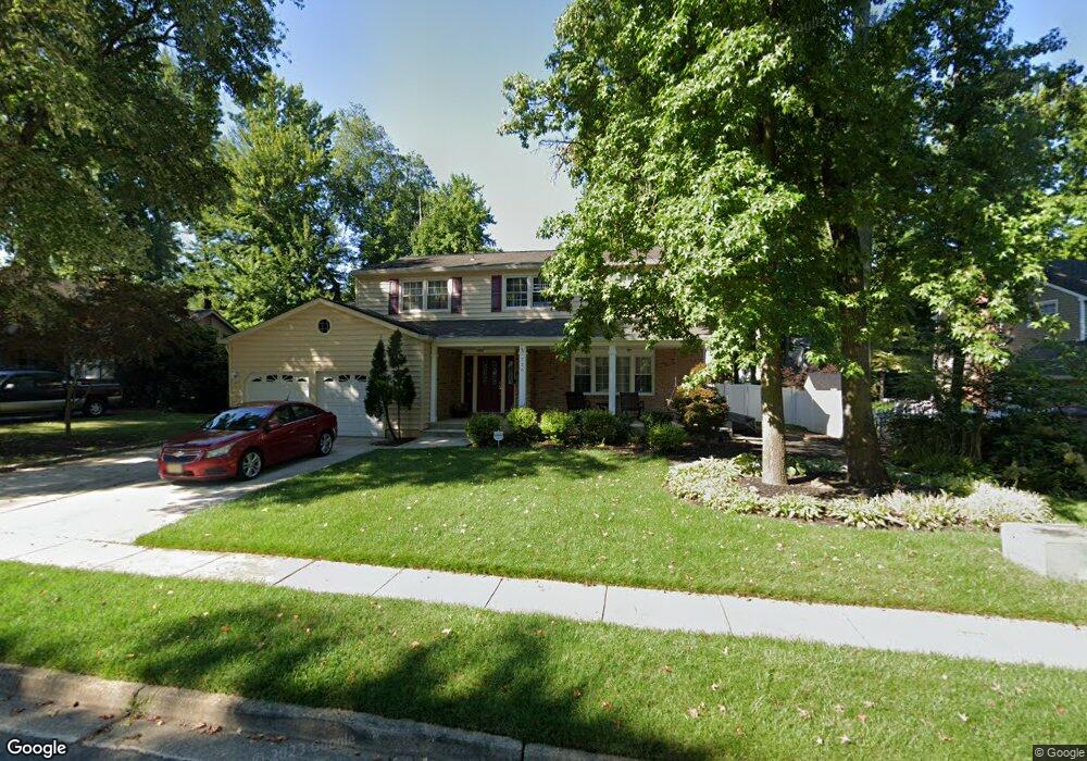
726 Decatur Dr Mount Laurel, NJ 08054
Estimated Value: $586,981 - $658,000
Studio
--
Bath
2,443
Sq Ft
$257/Sq Ft
Est. Value
About This Home
This home is located at 726 Decatur Dr, Mount Laurel, NJ 08054 and is currently estimated at $627,995, approximately $257 per square foot. 726 Decatur Dr is a home located in Burlington County with nearby schools including Hillside Elementary School, T.E. Harrington Middle School, and Mount Laurel Hartford School.
Ownership History
Date
Name
Owned For
Owner Type
Purchase Details
Closed on
May 3, 2019
Sold by
Bruno Daniel J
Bought by
Bruno Bambi
Current Estimated Value
Purchase Details
Closed on
Feb 3, 2003
Sold by
Navarra Lawrence S
Bought by
Bruno Daniel J and Bruno Bambi
Home Financials for this Owner
Home Financials are based on the most recent Mortgage that was taken out on this home.
Original Mortgage
$215,000
Outstanding Balance
$92,280
Interest Rate
5.98%
Estimated Equity
$535,715
Create a Home Valuation Report for This Property
The Home Valuation Report is an in-depth analysis detailing your home's value as well as a comparison with similar homes in the area
Home Values in the Area
Average Home Value in this Area
Purchase History
| Date | Buyer | Sale Price | Title Company |
|---|---|---|---|
| Bruno Bambi | -- | None Available | |
| Bruno Daniel J | $269,900 | Couch/Braumsdarf Title Agenc |
Source: Public Records
Mortgage History
| Date | Status | Borrower | Loan Amount |
|---|---|---|---|
| Open | Bruno Daniel J | $215,000 |
Source: Public Records
Tax History
| Year | Tax Paid | Tax Assessment Tax Assessment Total Assessment is a certain percentage of the fair market value that is determined by local assessors to be the total taxable value of land and additions on the property. | Land | Improvement |
|---|---|---|---|---|
| 2025 | $9,203 | $291,500 | $87,500 | $204,000 |
| 2024 | $8,856 | $291,500 | $87,500 | $204,000 |
| 2023 | $8,856 | $291,500 | $87,500 | $204,000 |
| 2022 | $8,827 | $291,500 | $87,500 | $204,000 |
| 2021 | $8,660 | $291,500 | $87,500 | $204,000 |
| 2020 | $8,491 | $291,500 | $87,500 | $204,000 |
| 2019 | $8,404 | $291,500 | $87,500 | $204,000 |
| 2018 | $8,340 | $291,500 | $87,500 | $204,000 |
| 2017 | $8,124 | $291,500 | $87,500 | $204,000 |
| 2016 | $8,002 | $291,500 | $87,500 | $204,000 |
| 2015 | $7,908 | $291,500 | $87,500 | $204,000 |
| 2014 | $7,830 | $291,500 | $87,500 | $204,000 |
Source: Public Records
Map
Nearby Homes
- 745 Cornwallis Dr
- 725 Cornwallis Dr
- 42 Falmouth Dr
- 704 Cornwallis Dr
- 107 Bastian Dr
- 3 Newtown Ct
- 12 Taconia Ct
- 1583 Hainesport Mount Laurel Rd
- 790 Carteret Ct
- 511 Perry Dr
- 238 Saint David Dr
- 49 Farnwood Rd
- 83 Eddystone Way
- 23 E Oleander Dr
- 73 Hearthstone Ln
- 98B Red Cedar Ct
- 4873 Church Rd
- 88B Red Cedar Ct
- 91 Center Ln Unit 91
- 32 Hearthstone Ln
- 724 Decatur Dr
- 728 Decatur Dr
- 729 Liberty Rd
- 733 Liberty Rd
- 722 Decatur Dr
- 727 Decatur Dr
- 725 Decatur Dr
- 729 Decatur Dr
- 727 Liberty Rd
- 723 Decatur Dr
- 720 Decatur Dr
- 725 Liberty Rd
- 741 Cornwallis Dr
- 747 Cornwallis Dr
- 721 Decatur Dr
- 724 Lincoln Dr
- 734 Cornwallis Dr
- 732 Liberty Rd
- 739 Cornwallis Dr
- 726 Lincoln Dr
Your Personal Tour Guide
Ask me questions while you tour the home.