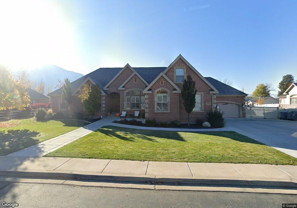
727 W 250 S Mapleton, UT 84664
Estimated Value: $1,360,000 - $1,572,000
5
Beds
5
Baths
5,812
Sq Ft
$255/Sq Ft
Est. Value
About This Home
This home is located at 727 W 250 S, Mapleton, UT 84664 and is currently estimated at $1,480,895, approximately $254 per square foot. 727 W 250 S is a home located in Utah County with nearby schools including Mapleton School, Mapleton Junior High School, and Maple Mountain High School.
Ownership History
Date
Name
Owned For
Owner Type
Purchase Details
Closed on
Nov 11, 2019
Sold by
Hunsaker Emily A
Bought by
Hunsaker Thomas Shayne and The We Care Trust
Current Estimated Value
Purchase Details
Closed on
Apr 28, 2015
Sold by
Livingston John Allan and Livingston Deborah V
Bought by
Livingston John Allan and Livingston Deborah
Purchase Details
Closed on
Aug 25, 2005
Sold by
Thayne Douglas S and Thayne Sheree J
Bought by
Livingston John Allan and Livingston Deborah
Purchase Details
Closed on
Jan 18, 2000
Sold by
Wing Pointe Estates Lc
Bought by
Thayne Douglas S and Thayne Sheree J
Create a Home Valuation Report for This Property
The Home Valuation Report is an in-depth analysis detailing your home's value as well as a comparison with similar homes in the area
Home Values in the Area
Average Home Value in this Area
Purchase History
| Date | Buyer | Sale Price | Title Company |
|---|---|---|---|
| Hunsaker Thomas Shayne | -- | None Available | |
| Livingston John Allan | -- | None Available | |
| Livingston John Allan | -- | First American Title Agency | |
| Thayne Douglas S | -- | Pro Title & Escrow Inc |
Source: Public Records
Tax History
| Year | Tax Paid | Tax Assessment Tax Assessment Total Assessment is a certain percentage of the fair market value that is determined by local assessors to be the total taxable value of land and additions on the property. | Land | Improvement |
|---|---|---|---|---|
| 2025 | $6,563 | $748,330 | -- | -- |
| 2024 | $6,563 | $642,950 | $0 | $0 |
| 2023 | $6,689 | $659,450 | $0 | $0 |
| 2022 | $6,435 | $627,220 | $0 | $0 |
| 2021 | $5,577 | $834,700 | $221,300 | $613,400 |
| 2020 | $5,427 | $785,600 | $195,800 | $589,800 |
| 2019 | $5,317 | $785,600 | $195,800 | $589,800 |
| 2018 | $5,124 | $720,700 | $167,200 | $553,500 |
| 2017 | $5,220 | $389,675 | $0 | $0 |
| 2016 | $4,565 | $338,745 | $0 | $0 |
| 2015 | $4,003 | $295,240 | $0 | $0 |
| 2014 | $3,599 | $260,700 | $0 | $0 |
Source: Public Records
Map
Nearby Homes
- 4664 S 680 W Unit S204
- 4664 S 680 W Unit S203
- 4664 S 680 W Unit S302
- 4664 S 680 W Unit S303
- 4664 S 680 W Unit S201
- 4664 S 680 W Unit S202
- 4664 S 680 W Unit S304
- 4664 S 680 W Unit S301
- 4664 S 680 W Unit S102
- 4664 S 680 W Unit S101
- 509 W 350 S Unit 30
- 126 N 800 W
- 896 W 675 S
- 415 S 1200 W
- 1142 W 220 N
- 1222 W 190 N
- 754 W 400 N Unit 29
- 648 W 400 N
- 1272 W 220 N
- 572 W 500 N
Your Personal Tour Guide
Ask me questions while you tour the home.