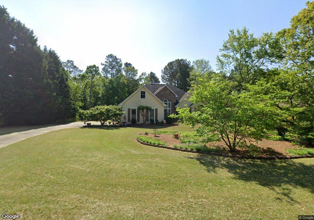
729 Michael Dr Unit 1 Winder, GA 30680
Estimated Value: $343,473 - $383,000
3
Beds
2
Baths
2,016
Sq Ft
$181/Sq Ft
Est. Value
About This Home
This home is located at 729 Michael Dr Unit 1, Winder, GA 30680 and is currently estimated at $364,618, approximately $180 per square foot. 729 Michael Dr Unit 1 is a home located in Barrow County with nearby schools including County Line Elementary School, Russell Middle School, and Winder-Barrow High School.
Ownership History
Date
Name
Owned For
Owner Type
Purchase Details
Closed on
Feb 18, 2019
Sold by
Fore Edna E
Bought by
Dagenhart Michael Patrick and Dagenhart Carey France
Current Estimated Value
Purchase Details
Closed on
Feb 14, 2006
Sold by
Fore Darryl Bruce An
Bought by
Fore Darryl Bruce And
Purchase Details
Closed on
Aug 28, 1998
Sold by
New South Home Builders
Bought by
Fore Darryl B
Home Financials for this Owner
Home Financials are based on the most recent Mortgage that was taken out on this home.
Original Mortgage
$125,400
Interest Rate
6.92%
Mortgage Type
FHA
Purchase Details
Closed on
Sep 3, 1997
Sold by
D & R Devel
Bought by
New South Bldrs
Home Financials for this Owner
Home Financials are based on the most recent Mortgage that was taken out on this home.
Original Mortgage
$104,400
Interest Rate
9.5%
Mortgage Type
New Conventional
Purchase Details
Closed on
Jul 16, 1996
Bought by
D & R Development In
Create a Home Valuation Report for This Property
The Home Valuation Report is an in-depth analysis detailing your home's value as well as a comparison with similar homes in the area
Home Values in the Area
Average Home Value in this Area
Purchase History
| Date | Buyer | Sale Price | Title Company |
|---|---|---|---|
| Dagenhart Michael Patrick | -- | -- | |
| Fore Darryl Bruce And | -- | -- | |
| Fore Darryl B | $126,000 | -- | |
| New South Bldrs | $20,000 | -- | |
| New South Home Build | $20,000 | -- | |
| D & R Development In | -- | -- |
Source: Public Records
Mortgage History
| Date | Status | Borrower | Loan Amount |
|---|---|---|---|
| Previous Owner | Fore Darryl B | $125,400 | |
| Previous Owner | New South Home Build | $104,400 |
Source: Public Records
Tax History
| Year | Tax Paid | Tax Assessment Tax Assessment Total Assessment is a certain percentage of the fair market value that is determined by local assessors to be the total taxable value of land and additions on the property. | Land | Improvement |
|---|---|---|---|---|
| 2025 | $2,859 | $118,582 | $27,200 | $91,382 |
| 2024 | $2,919 | $115,919 | $27,200 | $88,719 |
| 2023 | $2,924 | $116,519 | $27,200 | $89,319 |
| 2022 | $2,678 | $91,617 | $20,000 | $71,617 |
| 2021 | $2,262 | $72,482 | $16,400 | $56,082 |
| 2020 | $2,117 | $67,463 | $13,600 | $53,863 |
| 2019 | $611 | $65,359 | $13,600 | $51,759 |
| 2018 | $558 | $60,911 | $13,600 | $47,311 |
| 2017 | $1,564 | $53,714 | $13,600 | $40,114 |
| 2016 | $478 | $50,376 | $13,600 | $36,776 |
| 2015 | $486 | $50,802 | $13,600 | $37,202 |
| 2014 | $1,327 | $45,075 | $7,448 | $37,627 |
| 2013 | -- | $42,346 | $7,448 | $34,898 |
Source: Public Records
Map
Nearby Homes
- 716 Michael Dr
- 615 Wellington Dr
- 311 Rockwell Church Rd NW
- 879 Hawk Creek Trail
- 569 Maddox Rd
- 854 Hawk Creek Trail
- 932 Century Oak Dr
- 857 Laurel Ln
- 909 Century Oak Dr Unit 2
- 139 Ashwood Ct
- 536 Valley View Dr
- 403 Ryan Cir
- 2050 Whispering Way
- 845 Idlewood Rd
- 0 Gainesville Hwy Unit 10712053
- 236 Hidden Ct
- 0 E Northcrest Dr Unit 10648147
- 553 Rockwell Church Rd NW
- 469 Plantation Dr
- 326 Fayette Dr
- 725 Michael Dr Unit 1
- 233 Alanna Ave
- 721 Michael Dr Unit 1
- 728 Michael Dr
- 801 Carmon Ct
- 724 Michael Dr
- 724 Michael Dr
- 807 Carmon Ct
- 730 Michael Dr Unit 1
- 719 Michael Dr
- 726 Michael Dr Unit 1
- 232 Alanna Ave Unit 1
- 732 Michael Dr Unit 1
- 732 Michael Dr Unit 1/15
- 732 Michael Dr
- 722 Michael Dr
- 234 Alanna Ave
- 734 Michael Dr
- 715 Michael Dr Unit 1
- 236 Alanna Ave
Your Personal Tour Guide
Ask me questions while you tour the home.