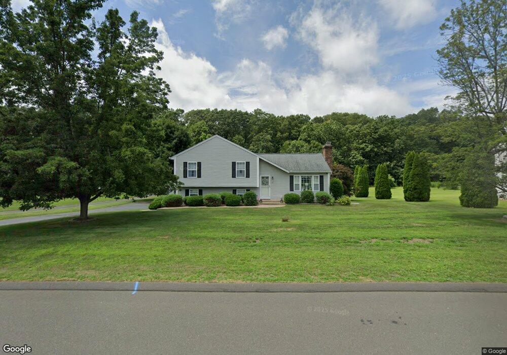
73 Broadleaf Cir West Suffield, CT 06093
Estimated Value: $406,000 - $519,000
3
Beds
2
Baths
1,256
Sq Ft
$364/Sq Ft
Est. Value
About This Home
This home is located at 73 Broadleaf Cir, West Suffield, CT 06093 and is currently estimated at $457,811, approximately $364 per square foot. 73 Broadleaf Cir is a home located in Hartford County with nearby schools including A. Ward Spaulding School, Mcalister Intermediate School, and Suffield Middle School.
Ownership History
Date
Name
Owned For
Owner Type
Purchase Details
Closed on
Sep 4, 2001
Sold by
Stevens Daniel and Stevens Elizabeth
Bought by
Duffy Christopher and Duffy Ann
Current Estimated Value
Home Financials for this Owner
Home Financials are based on the most recent Mortgage that was taken out on this home.
Original Mortgage
$138,600
Interest Rate
7.06%
Purchase Details
Closed on
Dec 31, 1998
Sold by
Resel Steven and Resel Kimberly
Bought by
Stevens Daniel
Home Financials for this Owner
Home Financials are based on the most recent Mortgage that was taken out on this home.
Original Mortgage
$152,095
Interest Rate
6.84%
Create a Home Valuation Report for This Property
The Home Valuation Report is an in-depth analysis detailing your home's value as well as a comparison with similar homes in the area
Home Values in the Area
Average Home Value in this Area
Purchase History
We collect this data history from publicly available records. To have your information removed, we recommend requesting removal directly through your county’s website.
| Date | Buyer | Sale Price | Title Company |
|---|---|---|---|
| Duffy Christopher | $198,000 | -- | |
| Stevens Daniel | $160,100 | -- |
Source: Public Records
Mortgage History
We collect this data history from publicly available records. To have your information removed, we recommend requesting removal directly through your county’s website.
| Date | Status | Borrower | Loan Amount |
|---|---|---|---|
| Open | Stevens Daniel | $123,000 | |
| Closed | Stevens Daniel | $138,600 | |
| Previous Owner | Stevens Daniel | $152,095 |
Source: Public Records
Tax History
| Year | Tax Paid | Tax Assessment Tax Assessment Total Assessment is a certain percentage of the fair market value that is determined by local assessors to be the total taxable value of land and additions on the property. | Land | Improvement |
|---|---|---|---|---|
| 2025 | $5,785 | $247,100 | $57,960 | $189,140 |
| 2024 | $5,592 | $247,100 | $57,960 | $189,140 |
| 2023 | $4,732 | $165,410 | $57,890 | $107,520 |
| 2022 | $4,732 | $165,410 | $57,890 | $107,520 |
| 2021 | $4,737 | $165,410 | $57,890 | $107,520 |
| 2020 | $4,737 | $165,410 | $57,890 | $107,520 |
| 2019 | $4,751 | $165,410 | $57,890 | $107,520 |
| 2018 | $4,856 | $165,620 | $55,580 | $110,040 |
| 2017 | $4,785 | $165,620 | $55,580 | $110,040 |
| 2016 | $4,670 | $165,620 | $55,580 | $110,040 |
| 2015 | $4,601 | $165,620 | $55,580 | $110,040 |
| 2014 | $4,492 | $165,620 | $55,580 | $110,040 |
Source: Public Records
Map
Nearby Homes
- 1 Echo Rd
- 1 Brayton Dr
- 5 Pauline Cir
- 141 Point Grove Rd
- 12 Knollwood Rd
- 218 Griffin Rd
- 24 Shore Rd
- 245 Birch Rd
- 2 Stratton Farms Rd
- 80 Bungalow St
- 150 S Longyard Rd
- 216 College Hwy
- 7 Rising Corner Rd
- 17 Depot St
- 434 College Hwy
- 20 Depot St
- 877 Newgate Rd
- Lot 28F Oak St
- 4 Pearl Brook Rd
- 14 Lexington Cir
- 59 Broadleaf Cir
- 87 Broadleaf Cir
- 68 Broadleaf Cir
- 101 Broadleaf Cir
- 45 Broadleaf Cir
- 98 Broadleaf Cir
- 36 Broadleaf Cir
- 84 Broadleaf Cir
- 79 Broadleaf Cir
- 51 Broadleaf Cir
- 107 Broadleaf Cir
- 4 Broadleaf Cir
- 115 Broadleaf Cir
- 249 Babbs Rd
- 235 Babbs Rd
- 114 Broadleaf Cir
- 31 Broadleaf Cir
- 280 Halladay Dr
- 284 Halladay Dr
- 221 Babbs Rd
Your Personal Tour Guide
Ask me questions while you tour the home.