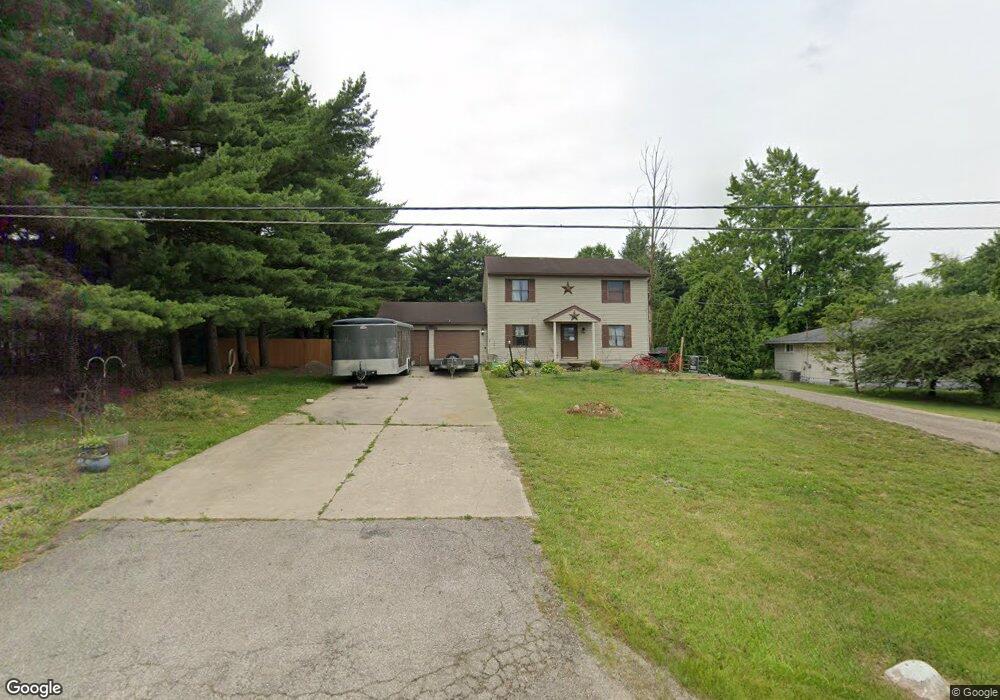
730 Piper Rd Mansfield, OH 44905
Estimated Value: $238,000 - $292,000
3
Beds
3
Baths
2,304
Sq Ft
$114/Sq Ft
Est. Value
About This Home
This home is located at 730 Piper Rd, Mansfield, OH 44905 and is currently estimated at $263,342, approximately $114 per square foot. 730 Piper Rd is a home located in Richland County with nearby schools including Madison High School, Temple-Christian School, and St. Mary Catholic School.
Ownership History
Date
Name
Owned For
Owner Type
Purchase Details
Closed on
Sep 10, 1996
Sold by
Hancock Richard
Bought by
Smith Dairl E and Smith Blanche
Current Estimated Value
Home Financials for this Owner
Home Financials are based on the most recent Mortgage that was taken out on this home.
Original Mortgage
$113,050
Outstanding Balance
$4,101
Interest Rate
6.25%
Mortgage Type
New Conventional
Estimated Equity
$259,241
Purchase Details
Closed on
Sep 29, 1992
Bought by
Hancock Richard Lee
Purchase Details
Closed on
Jul 1, 1987
Purchase Details
Closed on
Aug 1, 1986
Create a Home Valuation Report for This Property
The Home Valuation Report is an in-depth analysis detailing your home's value as well as a comparison with similar homes in the area
Home Values in the Area
Average Home Value in this Area
Purchase History
| Date | Buyer | Sale Price | Title Company |
|---|---|---|---|
| Smith Dairl E | $119,000 | -- | |
| Hancock Richard Lee | -- | -- | |
| -- | $75,000 | -- | |
| -- | $13,000 | -- |
Source: Public Records
Mortgage History
| Date | Status | Borrower | Loan Amount |
|---|---|---|---|
| Open | Smith Dairl E | $113,050 |
Source: Public Records
Tax History
| Year | Tax Paid | Tax Assessment Tax Assessment Total Assessment is a certain percentage of the fair market value that is determined by local assessors to be the total taxable value of land and additions on the property. | Land | Improvement |
|---|---|---|---|---|
| 2025 | $2,197 | $66,750 | $8,330 | $58,420 |
| 2024 | $2,197 | $66,750 | $8,330 | $58,420 |
| 2023 | $2,294 | $66,750 | $8,330 | $58,420 |
| 2022 | $2,248 | $58,490 | $7,440 | $51,050 |
| 2021 | $2,248 | $58,490 | $7,440 | $51,050 |
| 2020 | $2,265 | $58,490 | $7,440 | $51,050 |
| 2019 | $2,072 | $50,800 | $6,310 | $44,490 |
| 2018 | $1,938 | $50,800 | $6,310 | $44,490 |
| 2017 | $1,940 | $50,800 | $6,310 | $44,490 |
| 2016 | $2,495 | $51,120 | $5,990 | $45,130 |
| 2015 | $2,380 | $51,120 | $5,990 | $45,130 |
| 2014 | $2,371 | $51,120 | $5,990 | $45,130 |
| 2012 | $1,191 | $53,820 | $6,310 | $47,510 |
Source: Public Records
Map
Nearby Homes
- 961 Neil Cir N
- 698 Hoover Rd
- 573 Caldwell Ave
- 0 Wesley
- 943 Yale Ave
- 888 Beal Rd
- 1168 ConcheMcO St
- 1217 Evergreen Ave W
- 683 Coachman Rd
- 646 Fleetwood Rd
- 644 Skyline Rd
- 1226 Evergreen Ave W
- 690 Ashland Rd
- 672 Coachman Rd
- 607 Skyline Rd
- 489 Boals Ave
- 602 Champion Rd
- 632 Coachman Rd
- 615 Champion Rd
- 684 N Mcelroy Rd
Your Personal Tour Guide
Ask me questions while you tour the home.