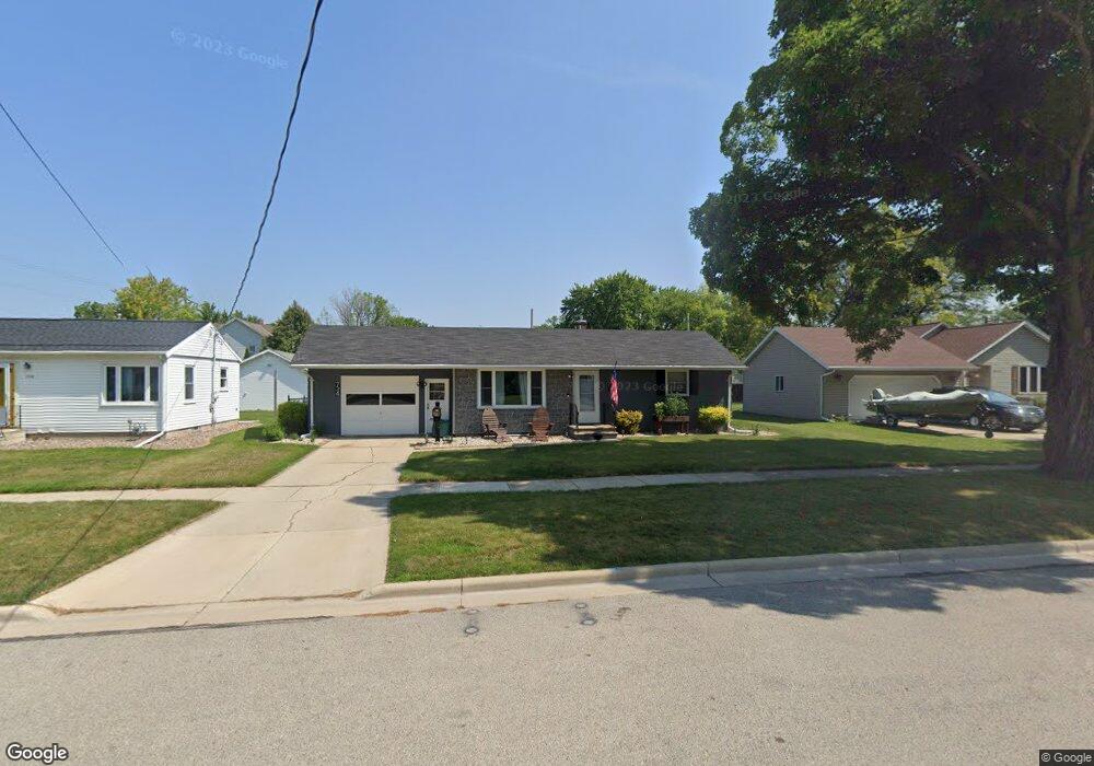
734 Pine St de Pere, WI 54115
Estimated Value: $203,000 - $244,000
4
Beds
2
Baths
1,728
Sq Ft
$128/Sq Ft
Est. Value
About This Home
This home is located at 734 Pine St, de Pere, WI 54115 and is currently estimated at $221,507, approximately $128 per square foot. 734 Pine St is a home located in Brown County with nearby schools including Westwood Elementary School, West De Pere Middle School, and West De Pere High School.
Ownership History
Date
Name
Owned For
Owner Type
Purchase Details
Closed on
Oct 1, 2004
Sold by
Cady Mary and Enderby Marshall W
Bought by
Roffers Patrick James
Current Estimated Value
Home Financials for this Owner
Home Financials are based on the most recent Mortgage that was taken out on this home.
Original Mortgage
$90,250
Outstanding Balance
$43,269
Interest Rate
5.93%
Mortgage Type
Purchase Money Mortgage
Estimated Equity
$178,238
Purchase Details
Closed on
Oct 15, 2003
Sold by
Enderby Ralph L
Bought by
Enderby Ralph L and Enderby Laverne M
Create a Home Valuation Report for This Property
The Home Valuation Report is an in-depth analysis detailing your home's value as well as a comparison with similar homes in the area
Home Values in the Area
Average Home Value in this Area
Purchase History
We collect this data history from publicly available records. To have your information removed, we recommend requesting removal directly through your county’s website.
| Date | Buyer | Sale Price | Title Company |
|---|---|---|---|
| Roffers Patrick James | $79,200 | Evans Title | |
| Roffers Patrick James | $15,800 | Evans Title | |
| Enderby Ralph L | -- | -- |
Source: Public Records
Mortgage History
We collect this data history from publicly available records. To have your information removed, we recommend requesting removal directly through your county’s website.
| Date | Status | Borrower | Loan Amount |
|---|---|---|---|
| Open | Roffers Patrick James | $90,250 |
Source: Public Records
Tax History
| Year | Tax Paid | Tax Assessment Tax Assessment Total Assessment is a certain percentage of the fair market value that is determined by local assessors to be the total taxable value of land and additions on the property. | Land | Improvement |
|---|---|---|---|---|
| 2025 | $2,931 | $197,000 | $33,100 | $163,900 |
| 2024 | $2,897 | $191,700 | $31,500 | $160,200 |
| 2023 | $2,692 | $171,600 | $31,500 | $140,100 |
| 2022 | $2,637 | $151,100 | $31,500 | $119,600 |
| 2021 | $2,546 | $133,300 | $26,200 | $107,100 |
| 2020 | $2,528 | $124,800 | $26,200 | $98,600 |
| 2019 | $2,372 | $117,600 | $26,200 | $91,400 |
| 2018 | $2,251 | $108,400 | $26,200 | $82,200 |
| 2017 | $2,071 | $97,800 | $26,200 | $71,600 |
| 2016 | $2,081 | $97,800 | $26,200 | $71,600 |
| 2015 | $2,033 | $93,700 | $26,300 | $67,400 |
| 2014 | $2,070 | $93,700 | $26,300 | $67,400 |
| 2013 | $2,070 | $93,700 | $26,300 | $67,400 |
Source: Public Records
Map
Nearby Homes
- 817 Elm St
- 117 Fort Howard Ave
- 616 Reid St
- 915 Twilight Dr
- 382 S 9th St
- 703 Helena St Unit 705
- 802 Suburban Dr
- 920 Lee Ave
- 2380 Scheuring Rd
- 2374 Scheuring Rd
- 2386 Scheuring Rd
- 2392 Scheuring Rd
- 3166 Trinity Ct
- 1041 S 6th St
- 305 Battery Ave
- 400 Battery Ave
- 960 Springfield Dr
- 1105 Fay Ct
- 976 Springfield Dr
- 755 William St Unit 4
Your Personal Tour Guide
Ask me questions while you tour the home.